Do you want to know the best tools to plan your next hikes and accompany you on your walks? Here is our top 5 of the best hiking apps!
The hike is the ideal activity to combine the pleasures of the walk to those of the sporting activity. In this way, hundreds of thousands of itineraries are available that allow you to relax your mind, enjoy magnificent landscapes and enjoy yourself.
From high majestic mountains to the sweet Mediterranean coast, to the rich valleys or the oceanic lands... It is sometimes difficult to find the closest, the simplest and the one that best matches our desires!
But with the rise of mobile applications, you can now be guided and accompanied during your next trips by applications dedicated to hiking. To help you find yourself there, we have selected our 5 best hiking apps for you!
1. Alltrails

[
Photo credit: App Store
](link_id:33278)
Our top/flop :
- ✱ The multitude of trails offered and the many free features
- ASSISTANCE Offline mode is only available in pro version
The first application we recommend is Alltrails, it is undoubtedly THE best hiking application on the market! Elle propose more than 200,000 hiking tours and mountain bike routes – in the world, including over 20,000 in France – thanks to carefully selected trail maps, as well as magazines, reviews and photos provided by millions of community hikers.
With Alltrails, you can select the hike that matches your desires but also your physical shape! Indeed, the application allows you to filter your searches to find the path suitable for your needs (number of km, denived, duration). To put you in the best conditions before departure, Alltrails provides you with GPS cards as well as topo-guides. You also have access to other features such as the GPS Activity Tracker (necessary to not lose you), your hiking statistics, detailed GPS routes to access directly from the trail, the recording of your adventures and the backup of your favourite hikes.
Price side: all features presented above are available in the free version . There is also one pro version which allows access to other features such as offline mode or real-time maps (with details on air quality, satellite weather or pollen rate in the area). To do that, you will have to pay 29,99 € / year , or 59,99 € / 3 years .
📌 L’avis de la rédaction : according to us, Alltrails is THE best hiking app on the market. With its many free features and ease of use, it will be an ideal companion for your next hiking trips.
- Start using Alltrails
2. Visorando
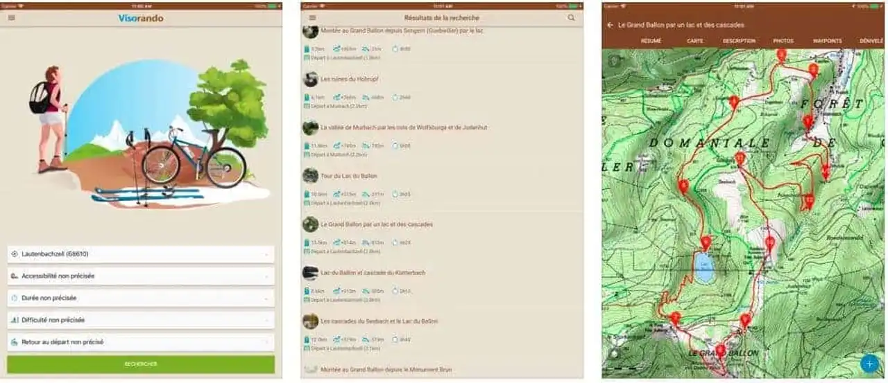
Photo credit: App Store
Our top/flop :
- ✱ Its database and its numerous routes in France
- ASSISTANCE ING cards are only available in the paid version
Visorando is also one of the best hiking apps in the French market. With an important database, you have access to more than 20,000 hiking routes varied and of quality, everywhere in France but also abroad. In addition, the application also supports other activities such as mountain biking or skiing.
Thus, by choosing a route, you can get several information such as the duration of the hike, the number of kilometers or the denial. Hiking sheets are often very detailed as each circuit is checked by a team of moderators before being published, community members can also provide details by adding photos or reviews for example. The Visorando app also allows you to access features such as knowing its location, to check your exact location on the type of card you have chosen (map IGN or OpenStreetMap).
Price side: one free version is available. However, ING cards are only available for free for a period of 3 days. Beyond that, you must subscribe to a quarterly subscription ( 11.99€ ) or annual ( 18.99€ ).
3. Whympr
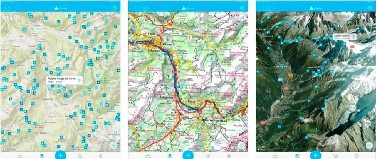
Photo credit: App Store
Our top/flop :
- ✱ The active community and ease of use
- ASSISTANCE The search function is not yet optimized
Whympr is a community application for hiking, climbing, hiking and mountaineering practitioners. It is a very complete application that allows you to find everything you need to enjoy the pleasures of the mountain. You will find topographical maps and descriptions for more than 60,000 routes in the world.
You also have access to the management of your shopping notebook or community returns to prepare your next outings. But that’s not all, the app also allows you to keep your outputs in memory and to locate you on the map, to easily spot you in the mountains. All these elements make Whympr one of the best hiking apps on the market!
Price: The majority of the above items are available in the free version . There is also a paid version that gives access to the entire application with features such as offline mode, peak weather or GPS tracker. To do that, you will have to pay 19,99€ / 3 months or 29,99€ / year .
4. Wikiloc
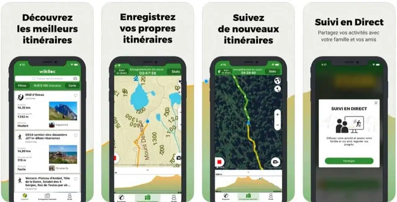
Photo credit: App Store
Our top/flop :
- ✱ It is the community that proposes routes
- ASSISTANCE The cards are not complete enough
Using the Wikiloc application, you can discover millions of itineraries worldwide! Indeed, unlike the above applications, here it is the users who offer the routes. You therefore have the opportunity to create a route by adding photos and information, which you then share with the rest of the community.
The number of itineraries therefore increases as the community grows, which makes it one of the best hiking applications on the market. You also have the opportunity to access other data such as the length of the hike, the denial or the time taken by the person who created the itinerary.
Price side: the above features are available in the free version . There is also a premium version that gives access to other features such as GPS browser, position sharing, weather forecasts or search filters. You can try the premium version for 14 days, then you will have to pay 9€ / year .
5. Outdooractive
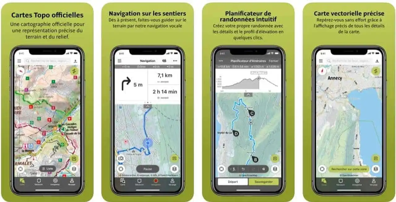
Photo credit: App Store
Our top/flop :
- ✱ Maps that are complete, accurate and practical
- ASSISTANCE The number of courses offered in France
Outdooractive is an application dedicated to outdoor activities and hiking. Elle propose thousands of hiking routes worldwide. It also offers hiking, skiing or cycling routes, which makes it one of the best applications for outdoor activities!
Thanks to a large bookseller of itineraries, you can find the ideal trail for your next walks. Itineraries are provided with complete details (on the number of km, duration, denial...), photos and points of interest nearby. You also have the opportunity to plan your itineraries by creating your own circuit, depending on your criteria, that you can share with the rest of the community. But the real plus of this application lies in its maps, which are very precise and of quality.
Price side: the above features are present in the free version . There is also one pro version which allows you to use the application in offline mode, access satellite images or the Outdooractive map with all trail networks. But there is also one pro version + which allows to have official cards of Alpine clubs, premium cards of KOMPASS or hiking guides. You can try these features for free for 30 days, then you will have to pay 29,99 € / year for the pro version and 59,99 € / year for the pro + version.



Loading comments ...