
The hike in the Alpilles allows you to discover this beautiful limestone massif under all its seams: it is on foot that you can enjoy the best Provencal charms of the Alpilles.
In this small massif mainly composed of white limestone, where the thyme, the pines of Aleppo and the olive trees, the decoration is resolutely provencal. A real pleasure for the walker, both for the decor and for the scents. The Alpilles form an East-West horizontal strip of 25km long and 6km to 8km wide, composed of mountains of low altitude, culminating at the top of the Opies, at 498 meters.
Due to their orientation, the Alpilles are particularly exposed to Mistral from the North. Be warned, especially in winter! From spring and back season, the climate of the South, soft and pleasant, is ideal for hiking in the Alpilles. In the middle of the summer, under the sun, beware of hot shots, recharge the water supply and protect yourself well.
Good news, the Alpilles are completely strewn with many hiking trails, offering the possibility to browse the entire mountain range and compose multiple walking routes, from the small one- or two-hour exit to the great hiking day. To help you choose, we have only kept the most beautiful hikes in the Alpilles. Here we go!
1. Le Rocher des Deux Trous from Saint-Rémy-de-Provence
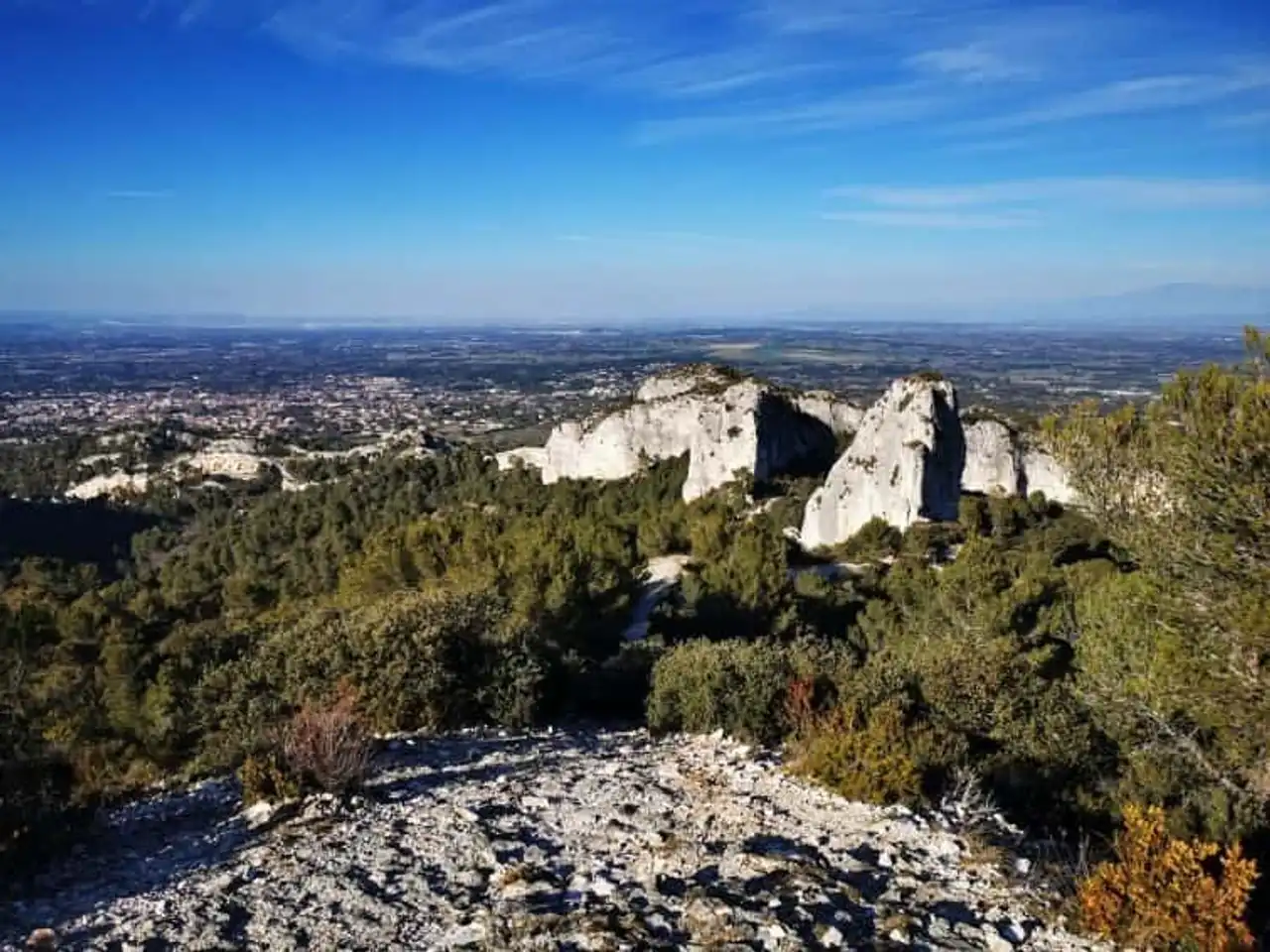
Photo credit: Alltrails
- Duration : about 2h20
- Distance 6.9 km
- Denivelé 253 m
- Difficulty Average
- See the hiking trail
Just next to Saint-Rémy-de-Provence, this hike in the Alpilles begins at the level of the Roman archaeological site of Glanum. Allow a little time for this interesting visit, at the start or at the finish.
Then, go to the monastery of Saint-Paul-de-Mausole for this outing which, without being frankly difficult, still requires a small physical effort (especially in hot weather). The goal is to reach the Rocher des Deux Trous, a limestone wall drilled in two places, painted in its time by Van Gogh In person. We understand the artist’s inspiration. Enjoy the 360° panorama on the Alpilles, before closing the loop to the starting point.
2. The village of Baux-de-Provence and its orientation table
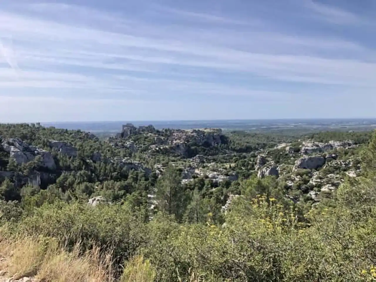
Photo credit: Alltrails
- Duration : about 2 hours
- Distance 5.8 km
- Denivelé 193 m
- Difficulty : easy
- See the hiking trail
♪ Baux-de-Provence There are certainly some of the most beautiful villages in Provence, and even in France. From the orientation table where there is a superb view of the massif and the surrounding area ( guaranteed effect at the end of the day), this hike in the Alpilles gradually leads you, sometimes crossing the road, to the medieval village walls.
Follow the route for a complete visit of the Baux (recommended spa, take your time!), before leaving the village to reach your starting point, making a loop. Itinerary nice, this itinerary doesn’t count a few more technical passages, go with good shoes and sticks. To avoid the crowd in the village, choose your walking hours (or your season).
3. The Ascension of the Opies, the summit of the Alpilles
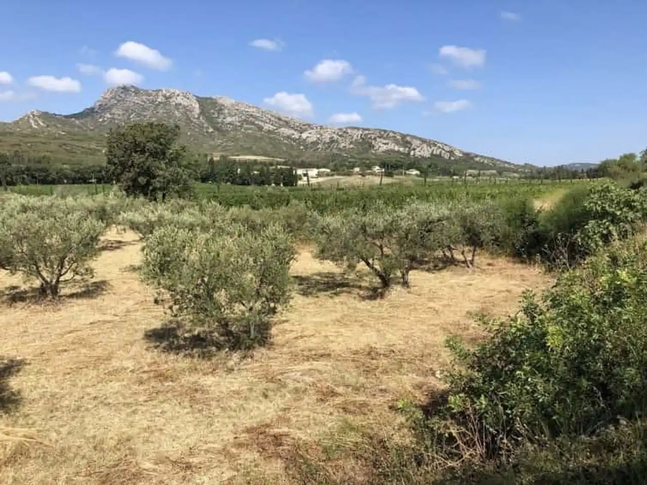
Photo credit: Alltrails
- Duration : about 4h
- Distance 11.3 km
- Denivelé 436 m
- Difficulty Average
- See the hiking trail
At 498 meters above sea level, Les Opies, the highest point of the Alpilles, have nothing of a giant. It is already well enough to enjoy a splendid and panoramic view that carries far: the Ventoux , Alps , the Rhone Valley, the Mediterranean on the horizon... a show that is worth a visit!
This beautiful hike in the Alpilles begins in the village of Eyguières, with the typical Provencal atmosphere. From the Arènes, the path gradually climbs and then more steeply up to the Tower of the Opies that strikes the summit. The descent is carried out by the other side, to reach the village, where to mark a pleasant and well-deserved break.
4. Walking around Fontvieille
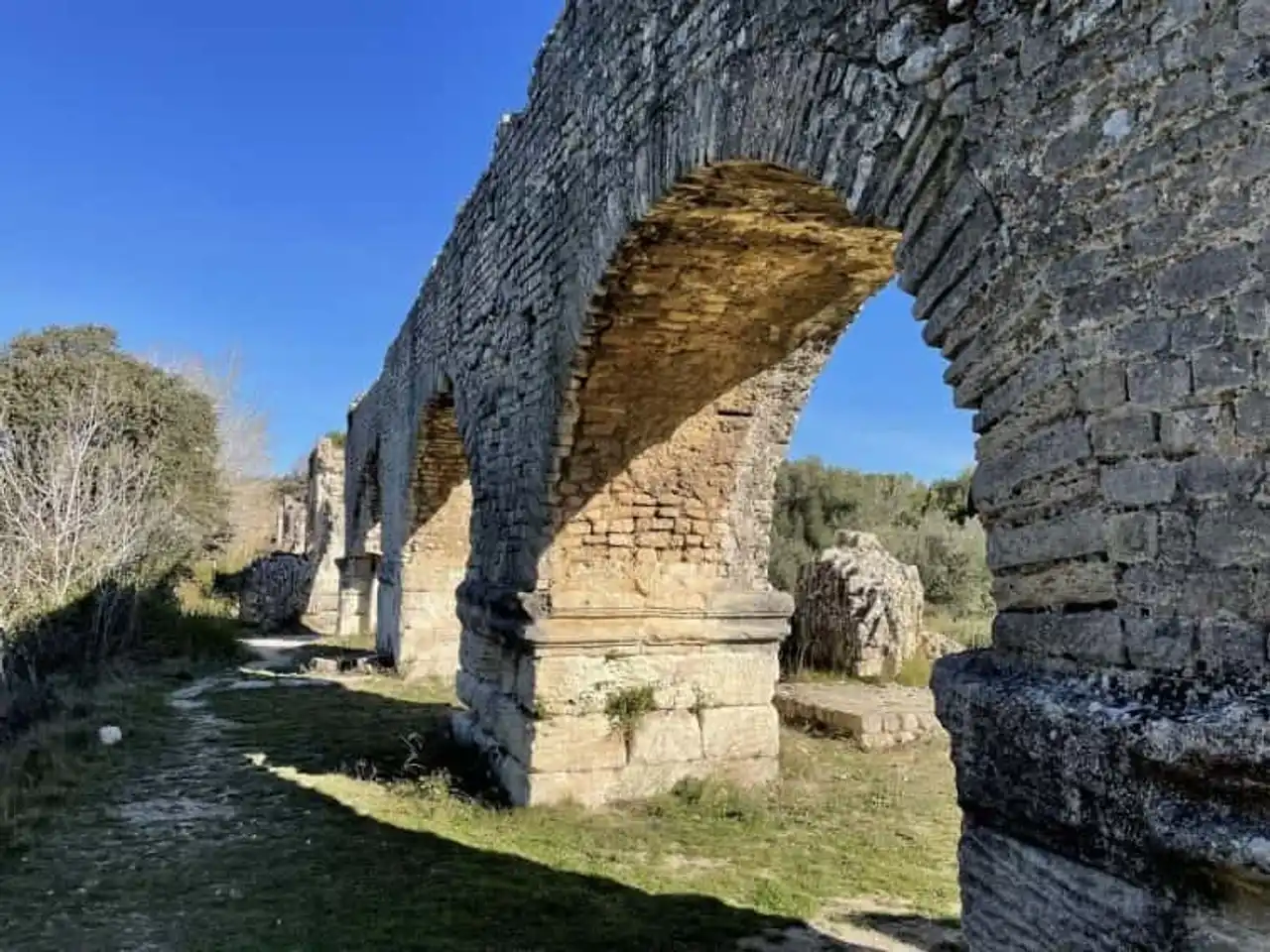
Photo credit: Alltrails
- Duration : about 2h15
- Distance 7.9 km
- Denivelé 113 m
- Difficulty : easy
- See the hiking trail
Fontvieille is a village full of pills, the ideal place to start and finish a hike in the Alpilles. Here we start from the heart of Fontvieille to explore the first foothills of the massif, and the cultural heritage of the corner by the same occasion. We make a stop at the Moulin d’Alphonse Daudet, before continuing to the Roman aqueduct of Barbegal. The return is made rude by the same path.
This family-run “walking” itinerary is ideal to unravel the legs and offer a pleasant walk, without notorious difficulty.
5. Hiking on the Alpilles ridge

Photo credit: Alltrails
- Duration : about 5h30
- Distance 16.4 km
- Denivelé 599 m
- Difficulty difficult:
- See the hiking trail
The difficulty increases more seriously, however, with this hike in the Alpilles by the peak, much higher. It will be necessary to be able to hold remotely and the important denial. Go well equipped, and early in the morning!
The departure in Saint-Rémy is from the Glanum site. The climb begins to reach Mont Gaussier, then the iconic Rocher des Deux Trous, before joining the Plateau de la Caume and going through the ridge line of the massif. The magnificent viewpoint parade is impressive throughout the course! The way back passes below the Alpilles to form a loop.
6. Nice loop in the Alpilles since Maussane
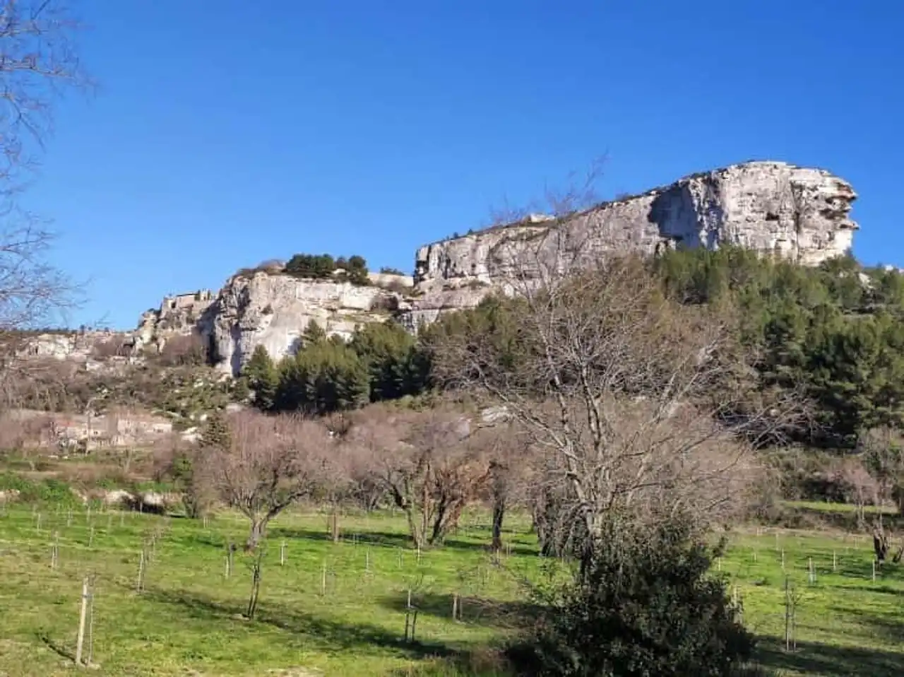
Photo credit: Alltrails
- Duration : about 3h20
- Distance 11.4 km
- Denivelé 205 m
- Difficulty : easy
- See the hiking trail
From the peaceful village of Maussane-les-Alpilles, this beautiful walk offers a nice condensed of what makes the reputation and beauty of the massif. From the olive groves, to the fragrant scrubland, to the Provencal mas and the rocky spoon of the Baux-de-Provence, this hike offers breathtaking Provencal landscapes.
Indeed, this hike in the Alpilles, from an easy level and with little denimation, will satisfy the walkers looking for a nice ride rather than a big physical effort.
7. The heart of the Alpilles massif from Eygalières
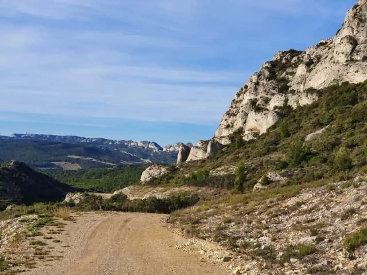
Photo credit: Alltrails
- Duration : about 4h20
- Distance 14 km
- Denivelé : 316 m
- Difficulty Average
- See the hiking trail
Back to Eygalières, for another loop trail at the start of the village: a hike in the Alpilles that plunges you into the heart of the massif, without too much force on the distance and the denivelé. We treat ourselves for a beautiful half-day walk, through the garrigue and pines, accessible at all levels.
On the way, we cross the Arboretum of Badon, Pas de la Figuière at 247 meters above sea level, Gaudre de Vallonguette (a gaudre being a small river in Provençal) as well as the old fort of Ancise, before returning to Eygalières, where to lay at the bistro to cool down and redo a health.
8. The tower of Mont Menu in Eyguières
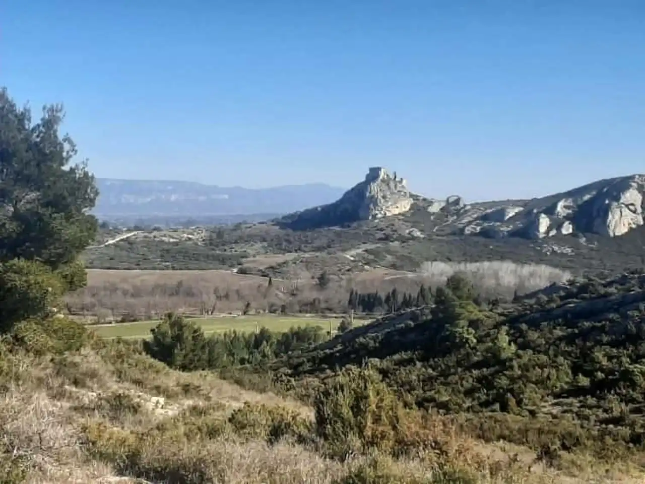
Photo credit: Alltrails
- Duration : about 2h30
- Distance 8.4 km
- Denivelé 214 m
- Difficulty Average
- See the hiking trail
Variant of the trail beginning at the Arènes d’Eyguières, this route is the complete tour of the Mont Menu (306 meters) which dominates the village, but without climbing. A hike in the Alpilles that runs at the foot of the Opies, the top of the massif, and gives a beautiful view of the beauty of the corner.
Not very long, nor very difficult, this route is widely appreciated for its nice, easy-to-do ride side, even with young walkers.
9. refreshing hike to Lake Peiroou
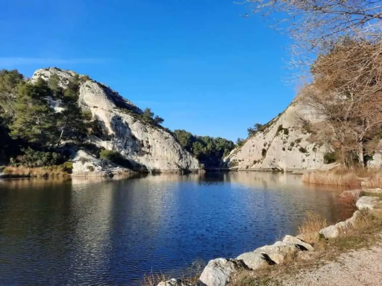
Photo credit: Alltrails
- Duration : about 1h45
- Distance 5 km
- Denivelé 201 m
- Difficulty Average
- See the hiking trail
Next to Saint-Rémy, the ancient Roman city of Glanum is the starting point for several beautiful hikes in the Alpilles. The road leaves the road and goes up to the Baldoin Cave, before joining the shores of Peiroou Lake. In Provencal, peiroou means a natural cavity, dug by erosion in the rock, as is the case here.
The path leads to this beautiful artificial lake with shaded and pleasant shores where it is allowed to fish but not to swim, unfortunately, the temptation is strong when it is hot! The end of the course forms a loop and descends on the road, at the archaeological site of Glanum.
10. The Trincades Tower in the Alpilles Regional Natural Park
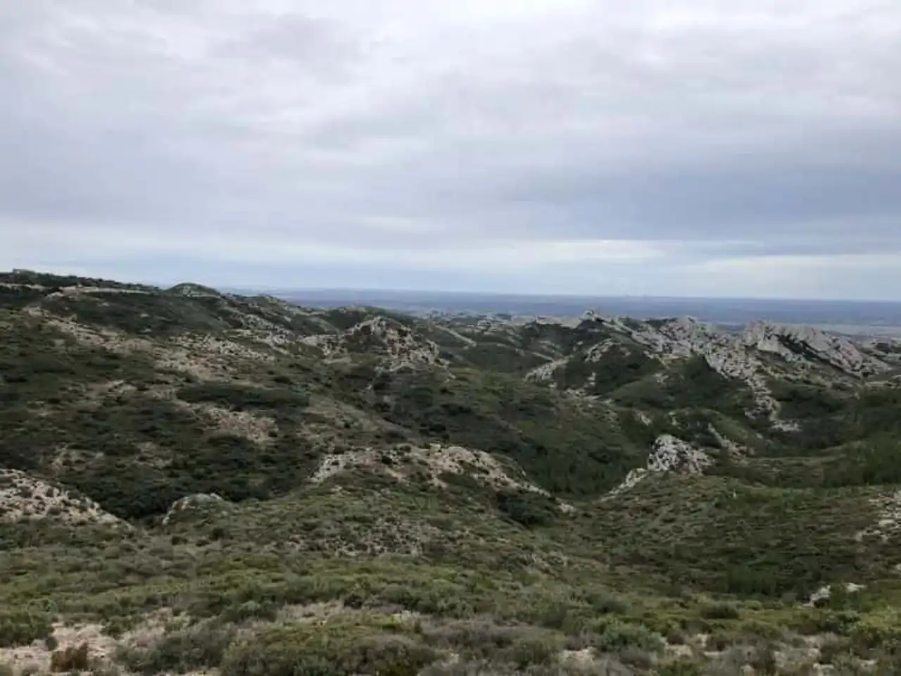
Photo credit: Alltrails
- Duration : about 3h30
- Distance 9.5 km
- Denivelé : 321 m
- Difficulty Average
- See the hiking trail
A hike in the Alpilles to explore a beautiful corner of the massif, east of Maussane and the Bals. The ride is well hilly, but the progressive denial does not represent a big difficulty. The hikers will be pleased because the trail offers varied terrain, and many very beautiful views of the mountains and surrounding areas.
A recommended exit to fill a beautiful half-day, exercise and enjoy the landscapes without providing too much physical effort.


Loading comments ...