Did you plan a fantastic road trip in the French Alps? Here is our guide to visit the Grandes Alpes road by bike or by car!
Among the magical routes of France, visiting the Route des Grandes Alpes is probably unmatched. This road stretches over 700 kilometres, passing through the French Alps from the north to the south through 17 mountain passes. Along the way, you will admire fantastic landscapes, from the shores of Lake Geneva to the shores of the Mediterranean, through the alpine peaks.
This exceptional road is ideally shortened by motorcycle or car, even if some passes can be climbed by bike by the most expensive. Would you like to visit the Grandes Alpes road? So this is our tour guide!
The Route des Grandes Alpes in a few words
It was in 1909 that the Route des Grandes Alpes project began at the start of the Touring Club de France. The titanium works started in 1911 to finish only in 1937, with the opening of the Iseran Pass, the highest of the road (2700 meters). The aim of this tourist itinerary was then to connect all the great passes, and thus the existing valley roads.
The Route des Grandes Alpes starts in Thonon-les-Bains, on Lake Geneva, to reach Menton, by the Mediterranean Sea. The course of 700 kilometers and a few will take a small or even big week to most of the travelers. This time obviously depends on the many stops and detours on the way.
Once taken by coaches, the motorcycle and the car are today the best means of transport to visit the Grandes Alpes Route. The itinerary can be divided into 5 parts, from large collar to large collar. On the way, you will have the opportunity to admire many wonders: monuments, landscapes, cities and villages of character.
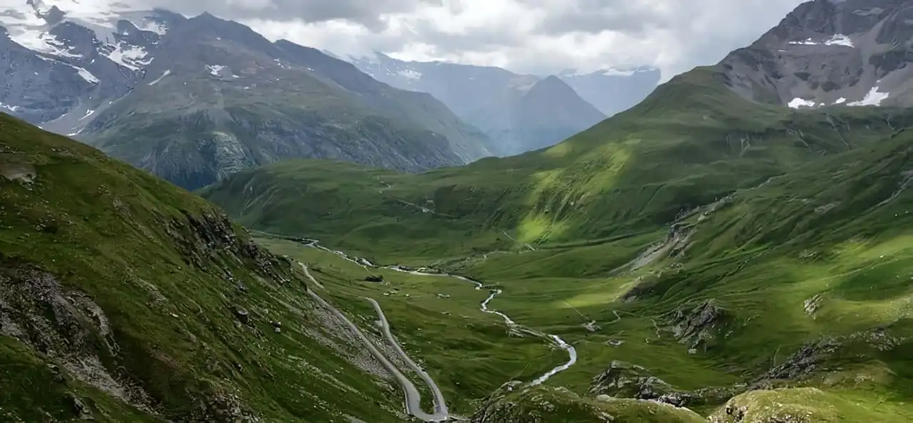
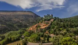
1. From the shores of Lake Geneva to the Col des Aravis
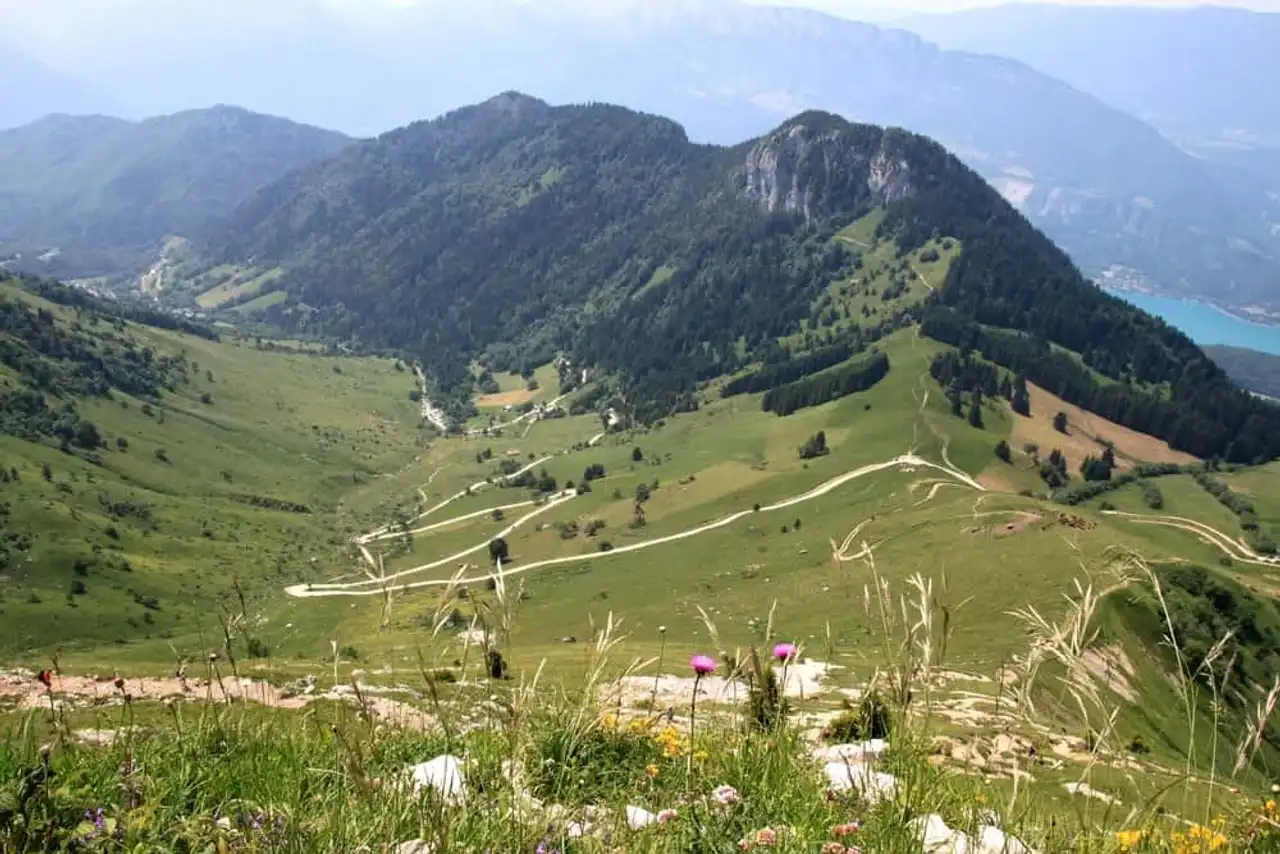
Photo credit: Shutterstock – vouvraysan
Uncontournable: Thonon-les-Bains, Gorges du Pont du Diable, Le Grand-Bornand, col des Gets, col de la Colombière, col des Aravis
Distance: 100 kilometres
Cities steps: Thonon-les-Bains, Morzine, La Clusaz
The first part of the journey already has a variety of spectacular scenery that you will see during this visit to the Grandes Alpes Route! The departure is, as mentioned above, to Thonon-les-Bains . Before leaving on the way, take the time to enjoy this beautiful spa town on the edge of the Lake Geneva . You can enjoy its beach, its charming port and even its flowered parks around its castle.
It will then be time to join the Grandes Alpes Route. On this section, you'll go all the department of Haute-Savoie. By leaving Thonon-les-Bains, you will arrive in the spectacular gorges of the Pont du Diable .
You will then climb into the authentic Alps of Haute-Savoie, punctuated with flowery chalets. These ancient terroirs are the territory of famous dairy cows, which give two famous cheeses: abundance and reblochon. You can discover local traditions and products winter sports stations that you will cross: Morzine, the Grand-Bornand and its market in the reblochon or the Clusaz.
Arrived at Aravis , you will also enjoy a superb panorama on the massif of Mont-Blanc .
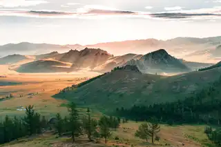
2. From the Col des Aravis to the col de l’Iseran
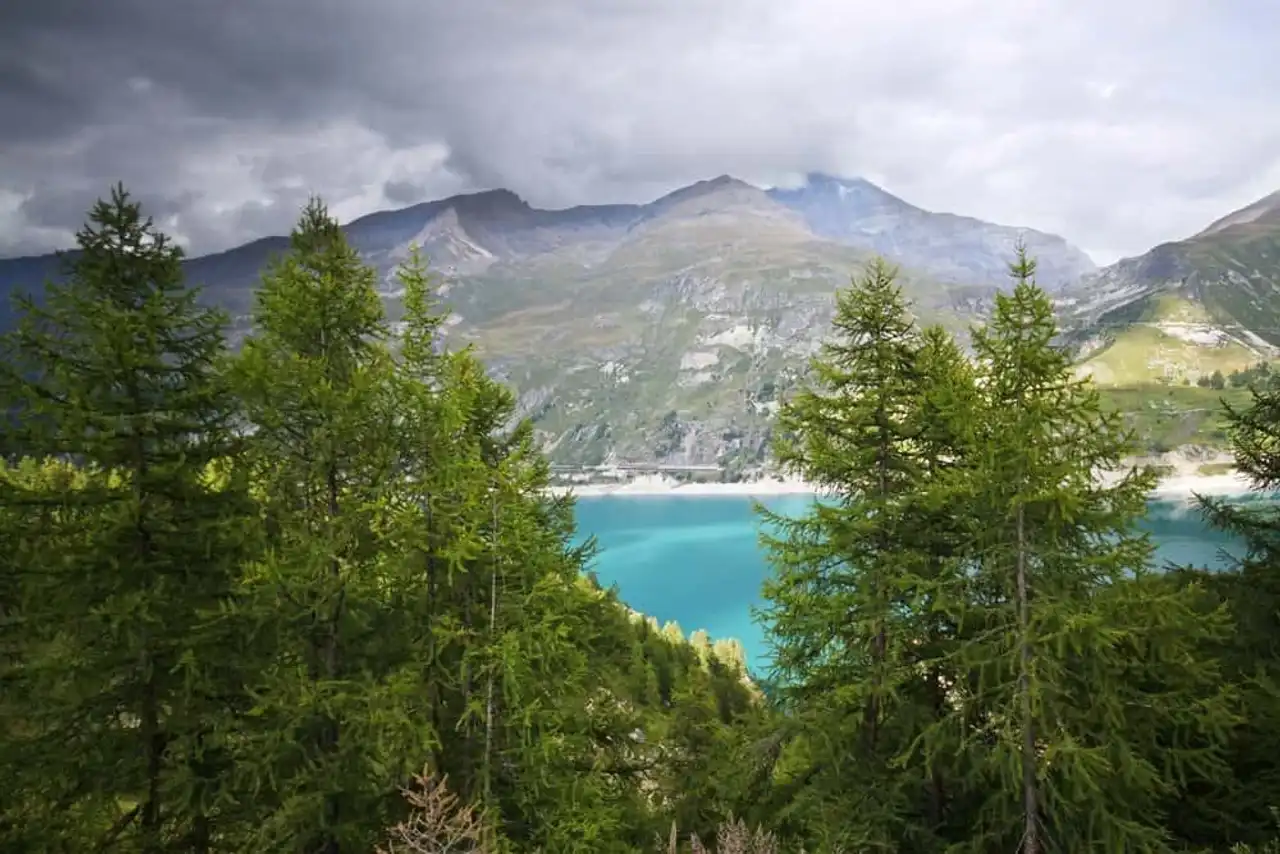
Photo credit: Shutterstock – Mircea Costina
Uncontournable: Saisies Pass, Beaufort, Roselend Lake, Tignes Barrage, Olympique Cableway, Tarentaise Belvedere
Distance: 130 kilometres
Cities steps: Les Saisies, Bourg-Saint-Maurice, Tignes, Val-d’Isère
The pass of the Aravis crossed, you leave the Haute-Savoie for the Savoie. With the massifs of Beaufortain, Tarentaise and Vanoise, you then enter the countries of the high mountain! The region is known for its large winter high-altitude sports stations: Les Saisies, Courchevel, Méribel, Les Menuires, Val Thorens, Les Arcs and La Plagne.
On the way, you will thus reach the Col des Saisies . With an altitude of 1,633 m, it allows the passage between the Beaufortain valley and the Arly val. This region is known for its cheese: the beaufort, which you can buy in the resort.
By continuing the road, you will then arrive at Bourg-Saint-Maurice and thus to the Vanoise National Park . You can then admire the titanesque dam of Tignes, the highest in France!
In Val-d’Isère, you will also enjoy an incredible view from the Olympique cable car to the Bellevarde Rock (2689 metres). You will then arrive at the Belvedere de la Tarentaise where you will admire all the summits of the Vanoise. One more round of corners, and you're here at col de l’Iseran at an altitude of 2,770 metres. Once at the top, you will understand why visiting the Great Alps Route is exceptional.
3. From the Iseran Pass to the Lautaret Pass
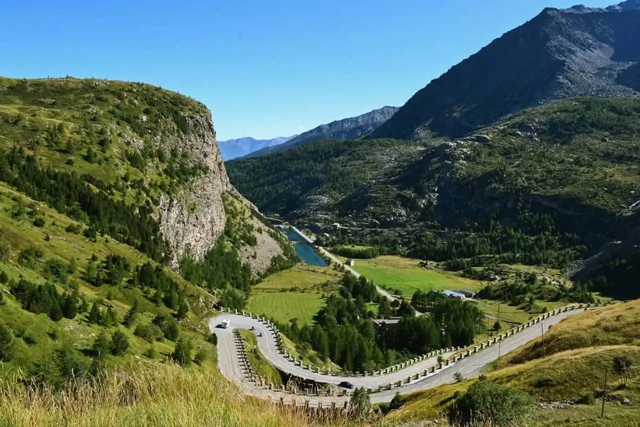
Photo credit: Shutterstock – worldroadtrip
Uncontournable: Bonneval-sur-Arc, Vanoise National Park, Mont-Cenis Lake, Telegraph Pass, Galibier Pass
Distance: 120 kilometres
Cities steps: Val-Cenis, Modane, Valloire , Le Bourg-d’Oisans
By crossing the Iseran pass, you left to visit the third stage of the Route des Grandes Alpes: the Maurienne valley. Make a stop at Bonneval-sur-Arc: this village has kept its authenticity. If the Route des Grandes Alpes then runs along the Parc de la Vanoise by the south, make a detour to Lac du Mont-Cenis.
In the summer you can cross the Franco-French border Italian To this place and join Suse! The road then joined Modane, then Saint-Michel-de-Maurienne. You can then join the Col du Télégraphe at 1,566 metres above sea level. In this place you can visit the Fort du Télégraph, an impressive fortress.
Between Saint-Michel-de-Maurienne (650 metres) and Valloire, the descents and slopes are also impressive. After all the denial is quite substantial. After Valloire, you will finally arrive at the col du Galibier at an altitude of 2,645 metres. Stop and enjoy the view before joining the Lautaret Pass, at 2,058 metres.
Alternative route : Bourg-d’Oisans
Between Modane and the Lautaret pass, you can also choose to go through Le Bourg-d’Oisans, via a 100-kilometre easterly detour. You can admire the Lac de Lauvitel, enjoy a little more of the Écrins National Park, or even climb to the Alpe d’Huez.
4. From the Lautaret pass to the Vars pass
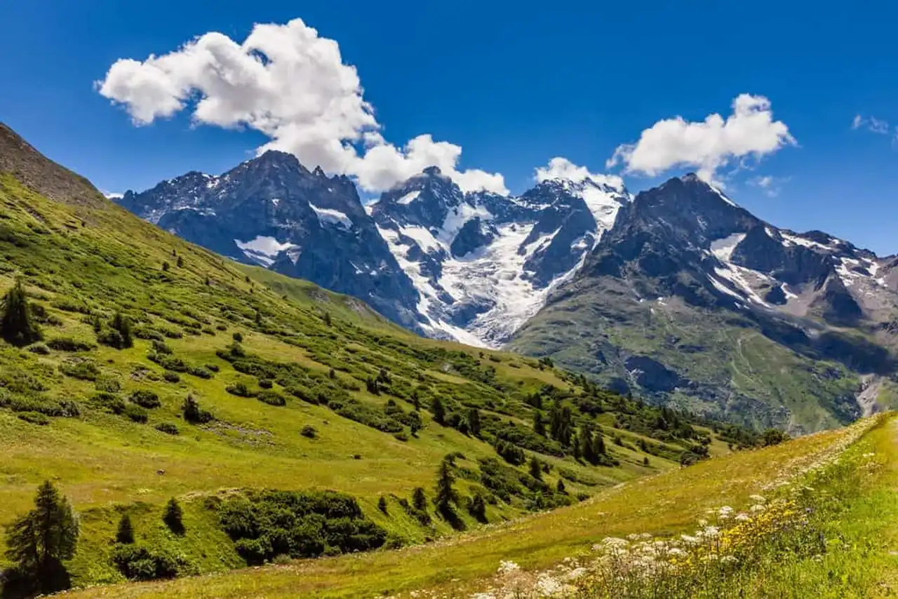
Photo credit: Shutterstock – Francois Roux
Uncontournable: Alpine garden of Lautaret, Parc national des Écrins, Briançon, pas d’Izoard, Parc naturel régional du Queyras, Saint-Véran, Mont-Dauphin
Distance: 80 kilometres
Cities steps: Serre-Chevalier, Briançon, Guillestre, Vars
The Lautaret crossed, from the Savoie to the Hautes-Alpes department. If you want to visit the Route des Grandes Alpes, plan a long stop at the pass. The latter houses a beautiful alpine garden, rich in about 2,000 altitude plants from the world’s massifs. You will also enjoy beautiful views of the Massif de la Meije and its majestic peaks. It should also be noted that you arrive in the National Park of the Writers, known for its wild and steep landscapes.
The road thus descends into the Briançonnais, you will then pass at the foot of the Barre des Écrins and the Pelvoux. You'll then get to Briançon , which also deserves a stop. Take the time to visit its ramparts and citadel. From the Porte de la Durance, you will also enjoy a fabulous viewpoint on the valleys.
By continuing your route, you will arrive at collar of Izoard in the Queyras. The Route des Grandes Alpes route is just passing along the Queyras Regional Natural Park. We therefore recommend that you make a detour by Saint-Véran, one of the most beautiful villages in all the Alps.
The road then continues in the gorges of the Combe du Queyras to Guillestre. There you can admire the Pétrifiant Fountain of Réotier or visit the Place forte de Mont-Dauphin. This building is one of the most beautiful achievements of Vauban ! After these visits, the road finally goes back to Vars and towards the Vars pass. On the way, you will enjoy an incredible view of the remarkable fortress below.
Alternative route : Lac de Serre-Ponçon
If you plan to visit the Route des Grandes Alpes, know that you don’t have to borrow the pass from Vars. You can also make a detour by the famous Lake of Serre-Ponçon . For this, fork before Guillestre towards the southeast. After taking advantage of the lake, you will only have to reach Barcelonnette to continue the route and visit the Grandes Alpes Route.
5. From Vars Pass to the shores of the Mediterranean
Uncontournable: Parc national du Mercantour, Lac d’Allos, col de la Cayolle, col de la Couillole, Saint-Martin-Vésubie
Distance: 230 kilometres
Cities steps: Barcelonnette, Allos, Valberg, Sospel, Menton
It's done! You crossed the Vars Pass, at 2018 meters above sea level. You are now in the Alpes-de-Haute-Provence. Three routes are available to you.
The Mercantour National Park
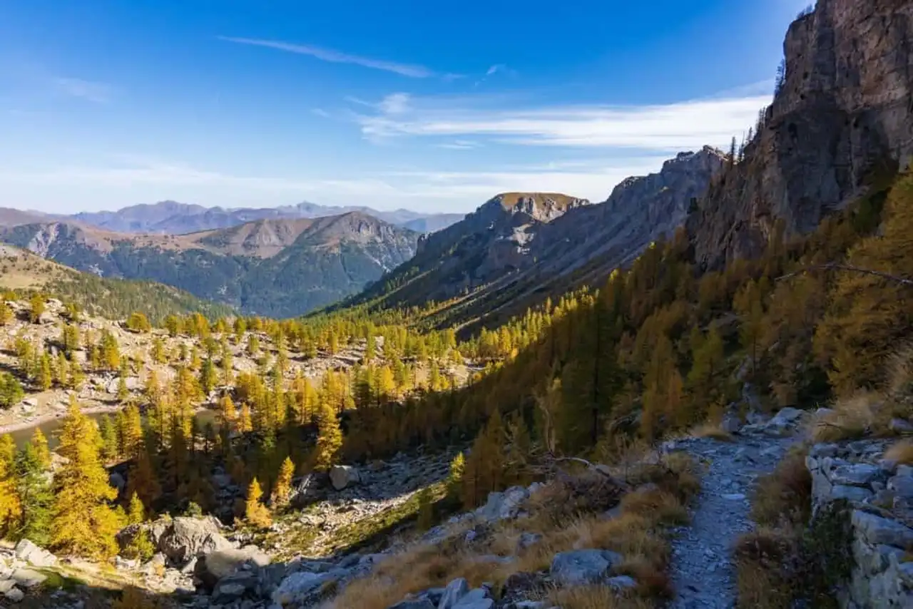
Photo credit: Shutterstock – Anthony Caretto
Before Barcelonnette, you can choose to borrow the collar then the road to the Bonnette , known as the highest in France, narrow and winding. The latter will take you through the Mercantour National Park.
On the way, you can stop in the villages of Saint-Dalmas-le-Selvage, Saint-Étienne-de-Tinée or Auron. These are ideal starting points to visit the natural and wild sanctuaries of the Park. On the way, you can also discover the gorges of Valabres and then reach Saint-Martin-de-Vésubie .
The traditional route or the Val d’Allos
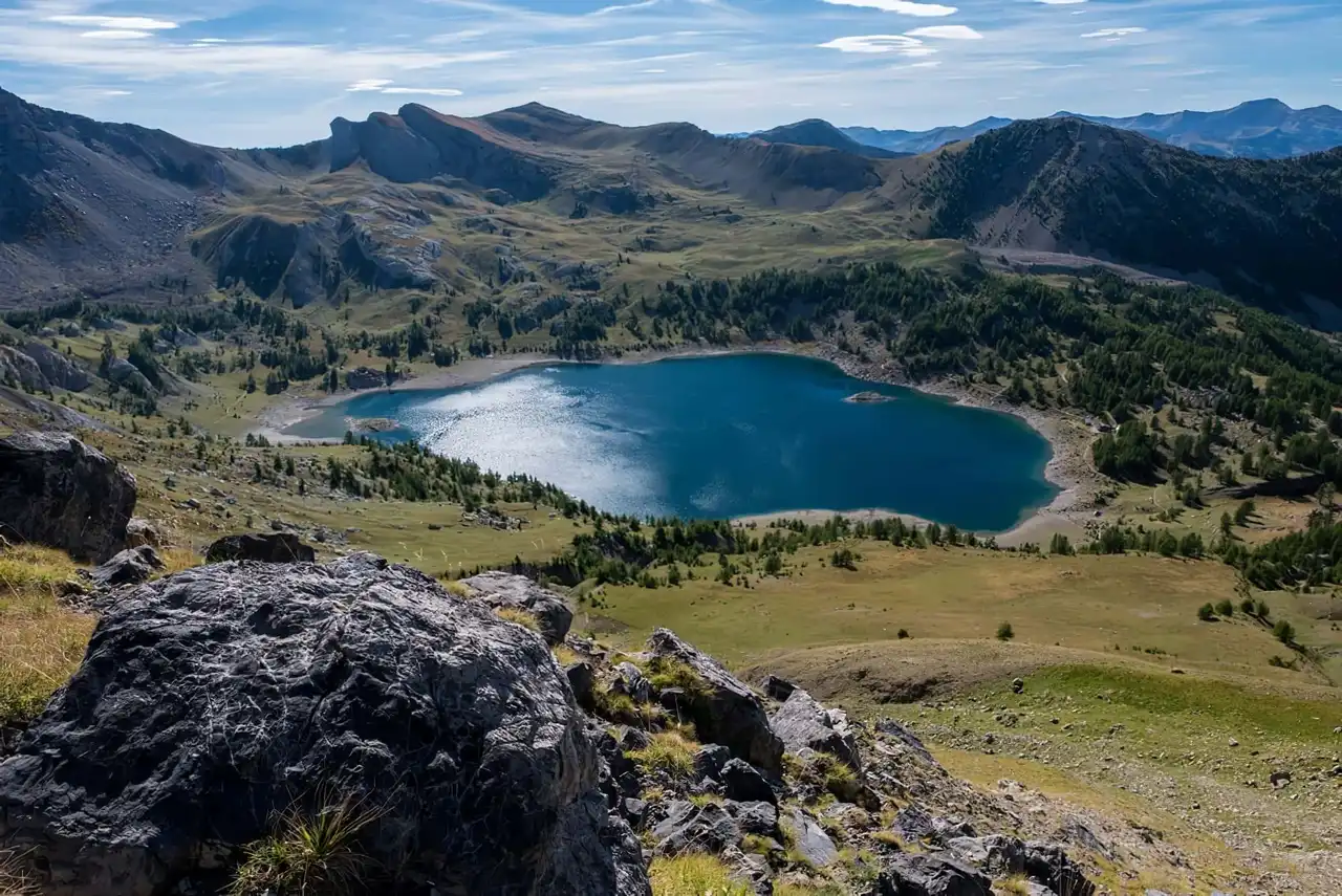
Photo credit: Shutterstock – NDani
If you are planning to visit the Grandes Alpes Route, you should know that the traditional route will normally pass through Barcelonnette and the Cayolle pass before you reach Valberg. This part is known for its breathtaking landscapes. You can however make a detour by Allos located at the bottom of the valley Verdon . You can then admire its lake, the largest altitude lake in Europe, or dive into the Gorges du Verdon .
Regardless of the route, you will reach Saint-Martin-Vésubie, a village to visit absolutely. Further south, the road will lead you to the pass of Turini, the last true mountain pass of this great journey. You can then visit the picturesque city of Sospel before joining the Castillon Pass. The road then plunges to the sea and you will soon arrive Menton .
Your great adventure is then over: enjoy it to relax and refresh yourself in the sea!


Loading comments ...