Are you going to visit Brussels? To locate you on site, use and download Brussels maps and plans!
Brussels is a human-sized city, but if you just spend a short or prolonged weekend there, it will be useful to spot you in advance with Brussels maps and plans, in order to save time on site.
Below you will find detailed maps and plans of Brussels to help you when you arrive at the airport, at the central station or in the centre if you arrive by car. For each of the cards, you have the possibility to enlarge it. To download maps & plans, right click and "Save as".
Are you going to Brussels? Use our guides:
- Visit Brussels
- Where to stay in Brussels
- Find a flight to Brussels
- Activities in Brussels
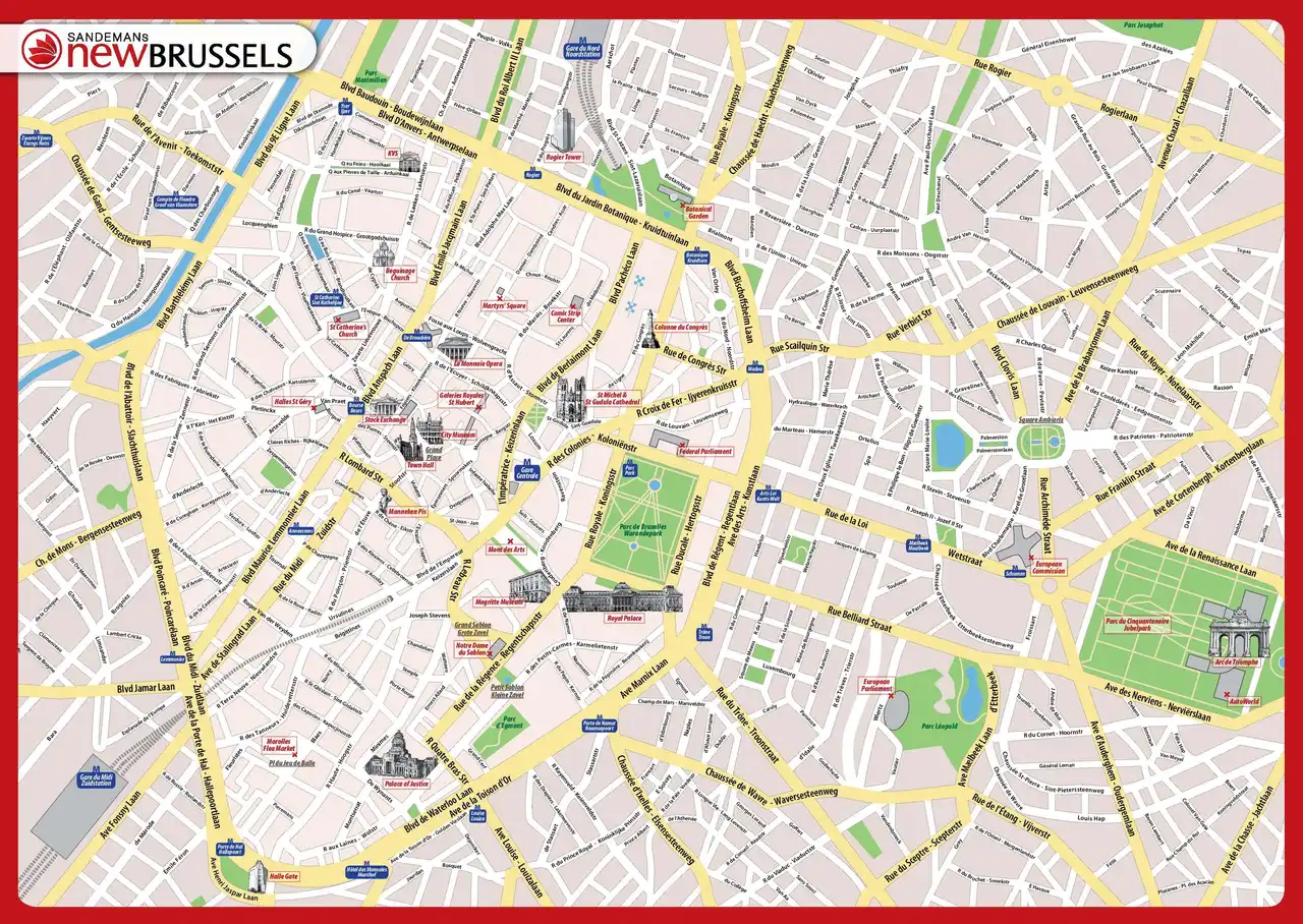
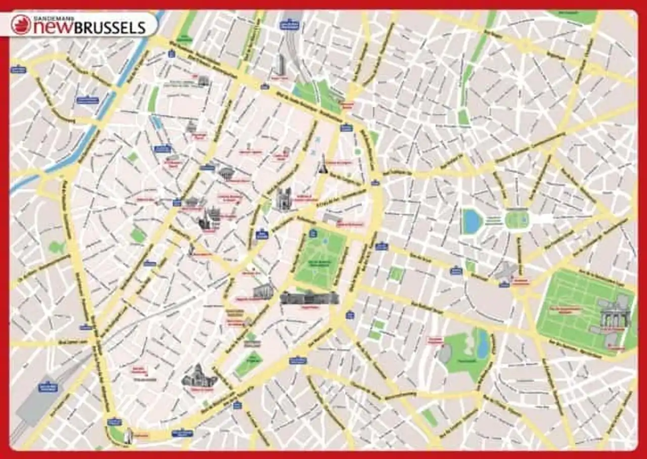
Detailed map of Brussels
This map of Brussels allows you to have an overview of the geography of the city:
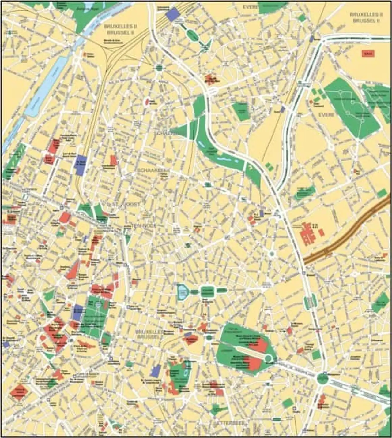
Detailed map of the historic centre of Brussels
Here is a detailed map of the historic centre of Brussels, the busiest and tourist area:
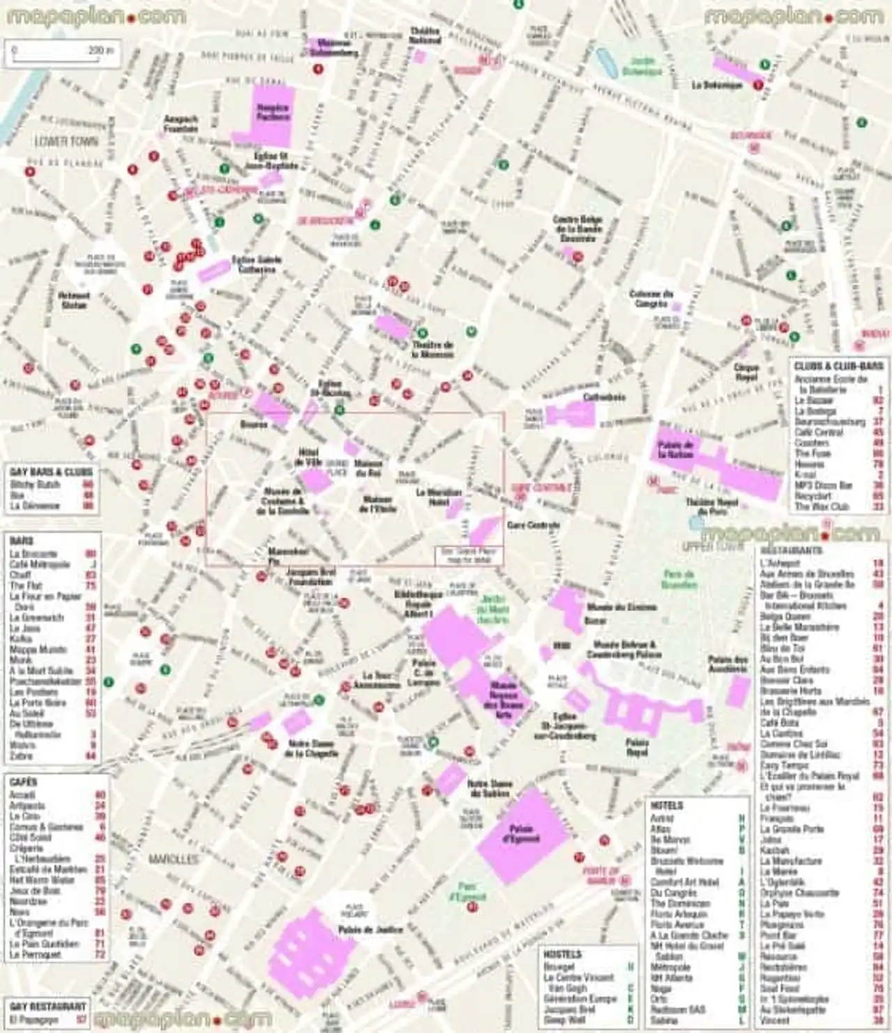
Map of places of interest in Brussels
Find all the monuments and places of interest in Brussels on this map: Monuments, museums, parks, tourist attractions...
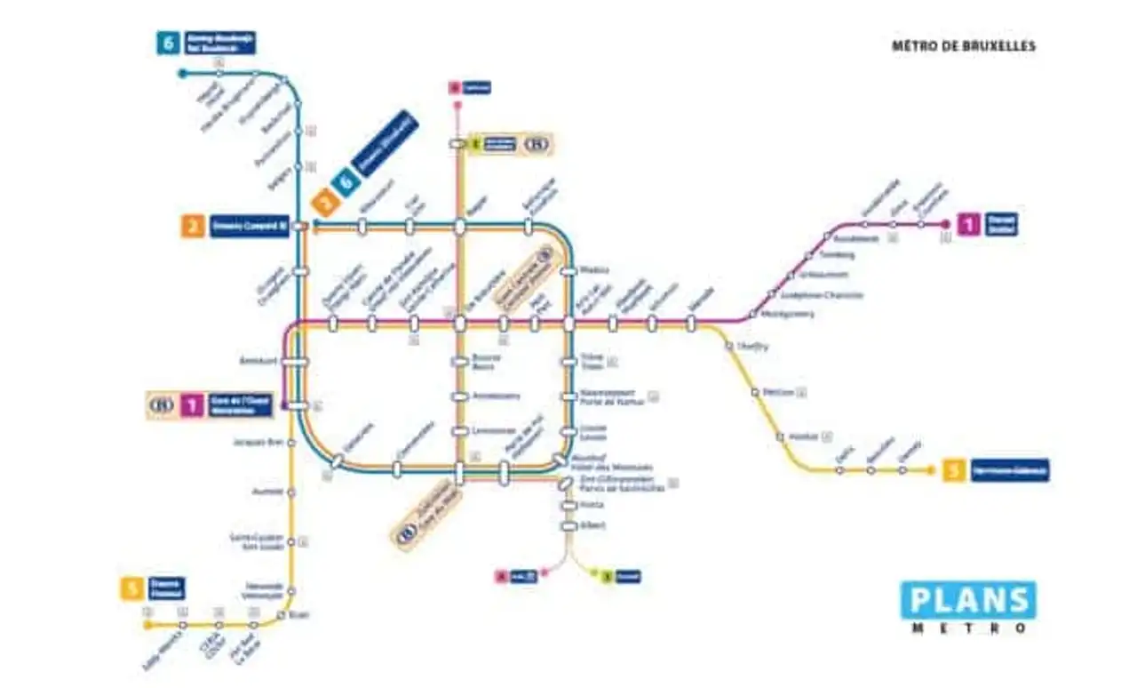
Brussels Metro Line Plan
The Brussels Metro Plan tells you the stations and routes of the lines to move more easily on site:
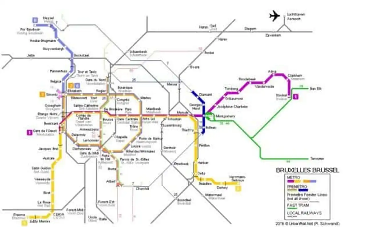
Brussels Transport Line Plan
Bus, metro, trams... here are all Brussels public transport lines:


Loading comments ...