These 40 maps of the world highlight the unusual and revealing facts of the world in which we live. To share without moderation!
If you imagine our planet Earth as in a planisphere, then these 40 maps of the world will radically change your vision of our society. Figures from the world population to unusual data, as well as instructive information, you may have answers to the questions you've been asking for ever! The world maps presented in this article may raise questions with you. One thing is certain, these cards teach us more about the world we live in.
Knowledge, culture and social facts are elements that must be taken into account when traveling, our writing has chosen to make you discover 40 maps of the world that come out of the usual patterns.
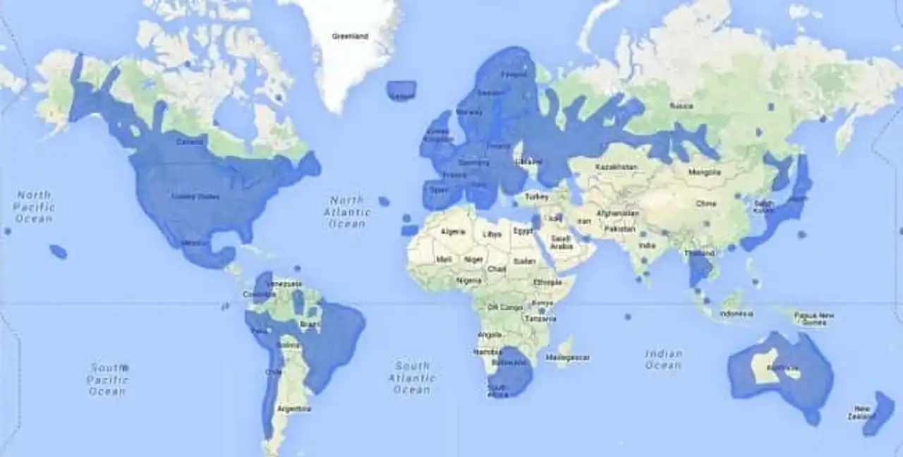
1. Map of countries with access to Google Street View (2014)
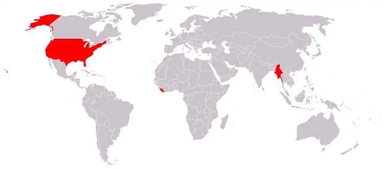
2. Map of countries that have not formally adopted the metric system (red)
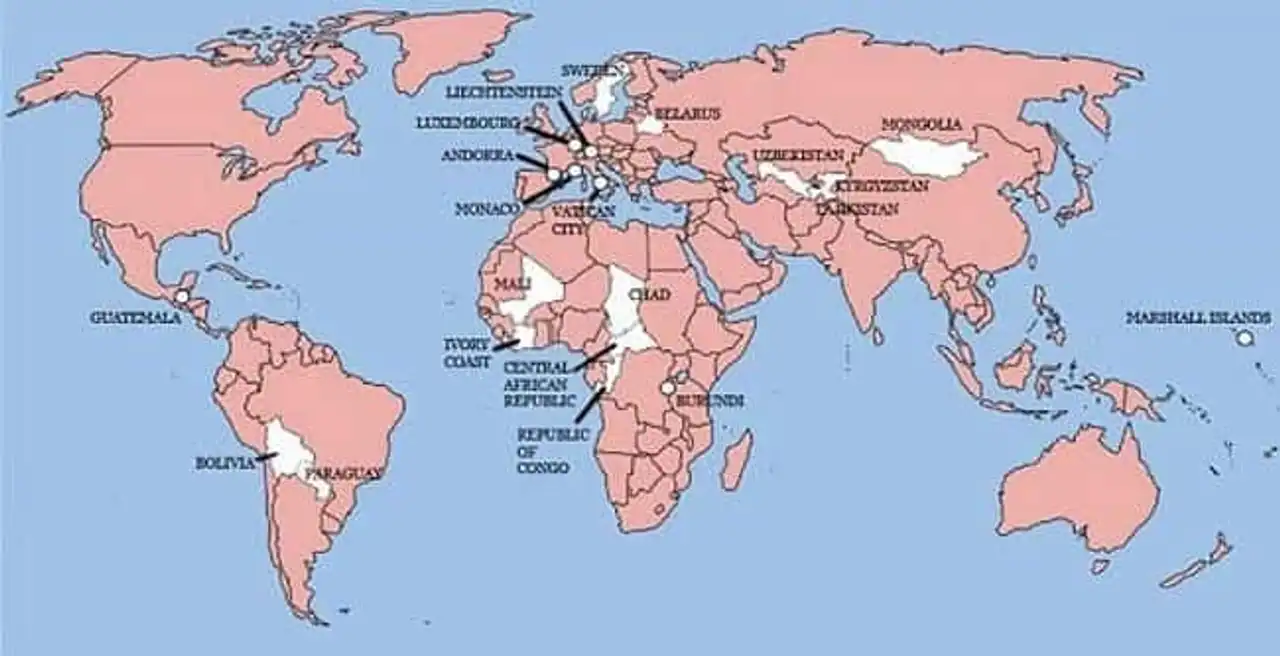
3. The only 22 countries in the world have never invaded England (white)
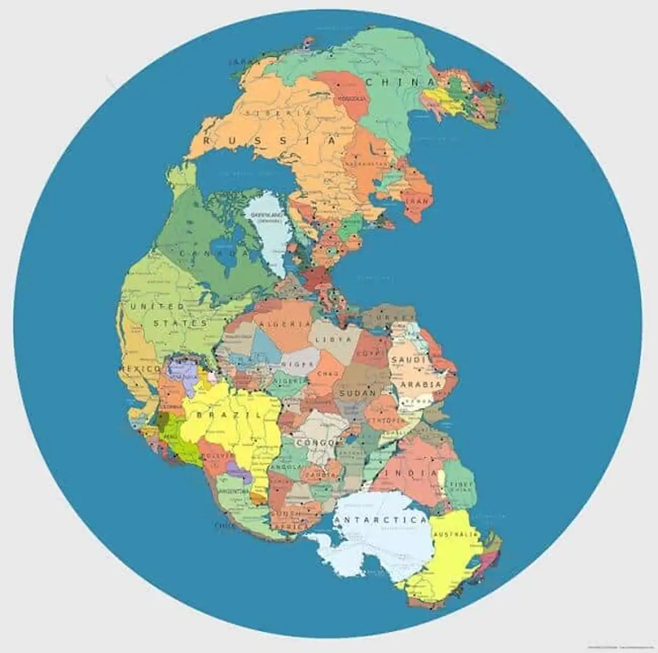
4. Map of the Pangean with current borders
5. Map where McDonald’s is located in the world
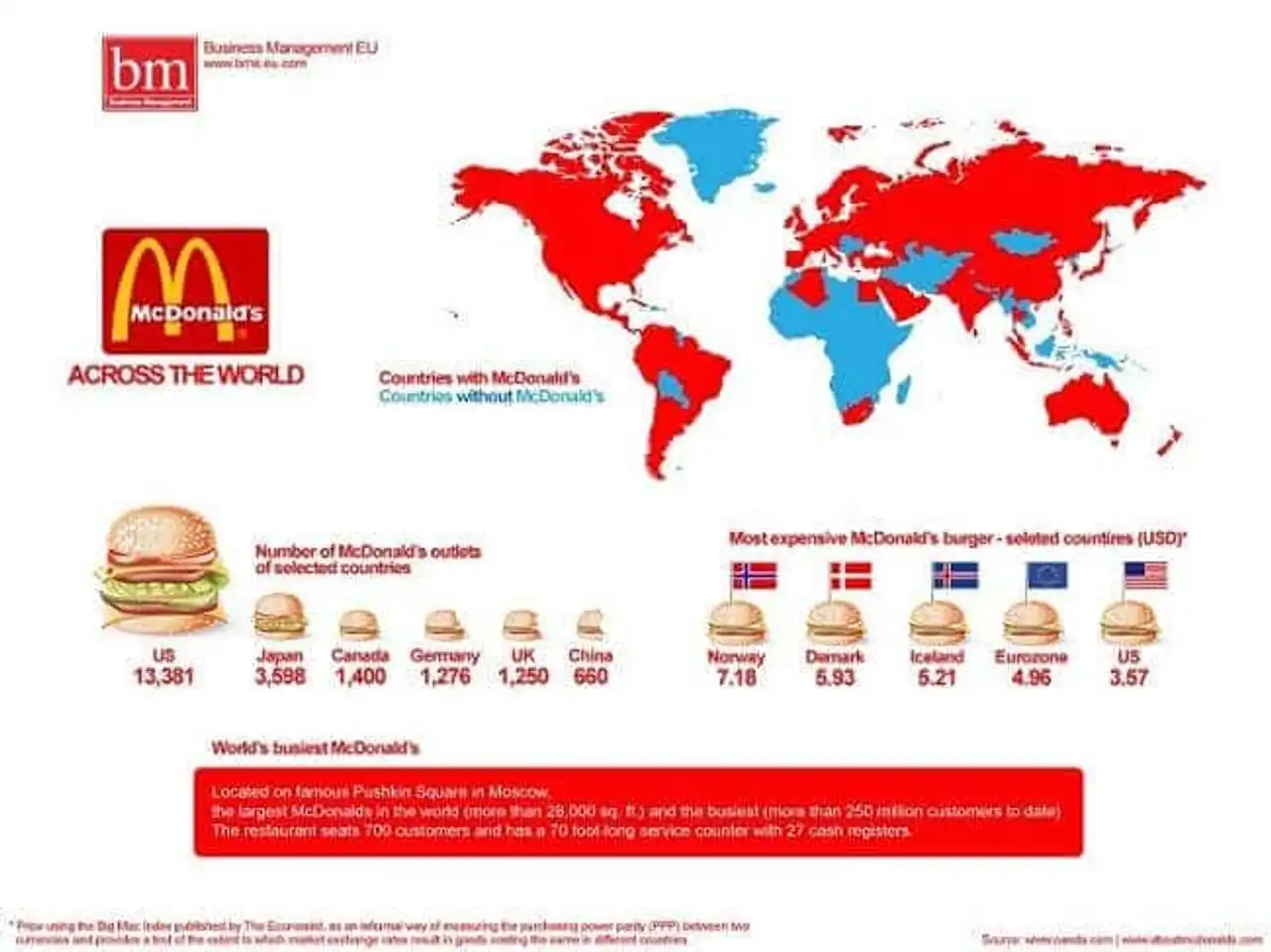 The map represents the countries where there is a McDonald’s restaurant (red). In blue where the American firm is not there. The number of McDonald restaurants per country and the highest prices for a McDonald’s burger is then at the bottom left.
In the red box, it is written: “The largest (more than 28,000 m2) and the most frequented (more than 250 million customers since the opening) McDonald’s restaurant in the world is located on the famous Pushkin Square in Moscow. The restaurant has 700 seating places and has a 22-metre long counter and is equipped with 27 boxes. »
6. Map of paid maternity leave worldwide
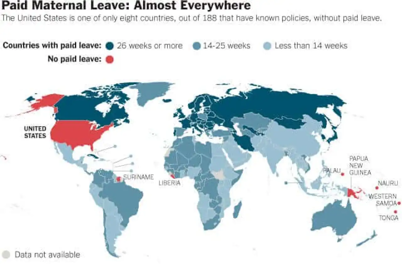 Dark blue: 26 weeks and more, blue/grey: 14-25 weeks, light blue: less than 14 weeks. Red: not paid
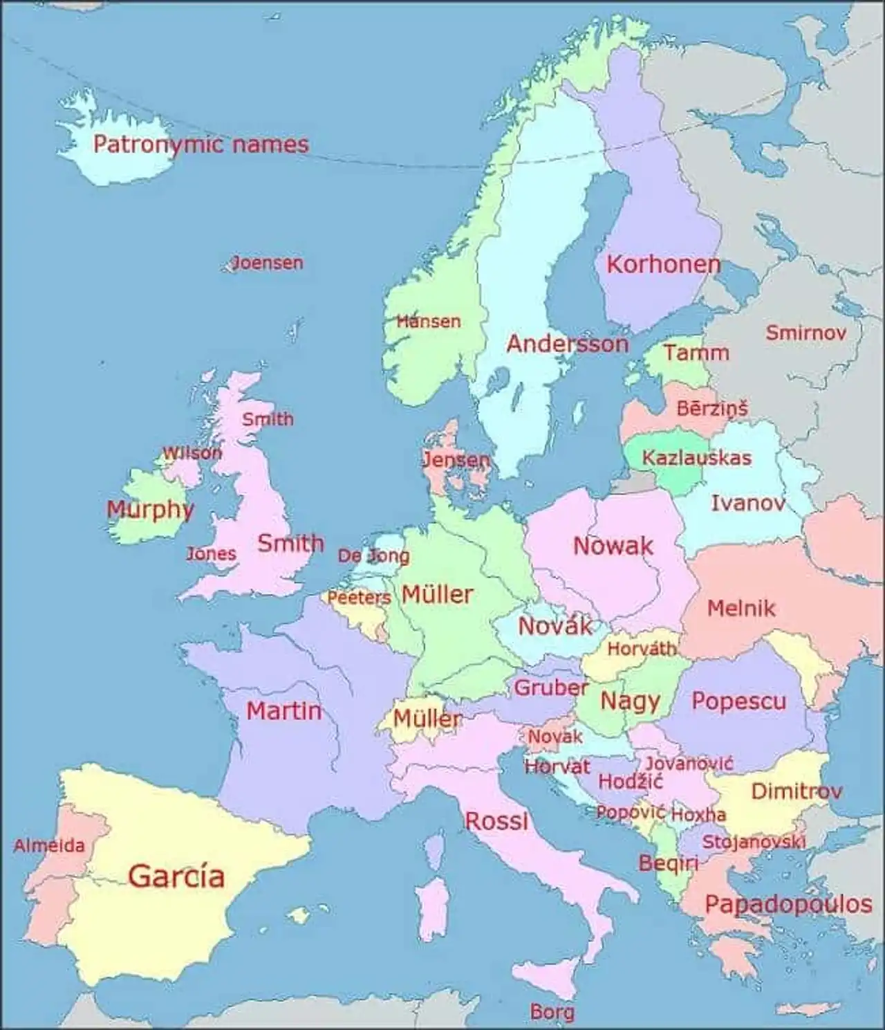
7. Map of the most common family names in each European country
8. Map of the direction of traffic in the world (blue : left, red : right)

9. Map of time zones in Antarctica

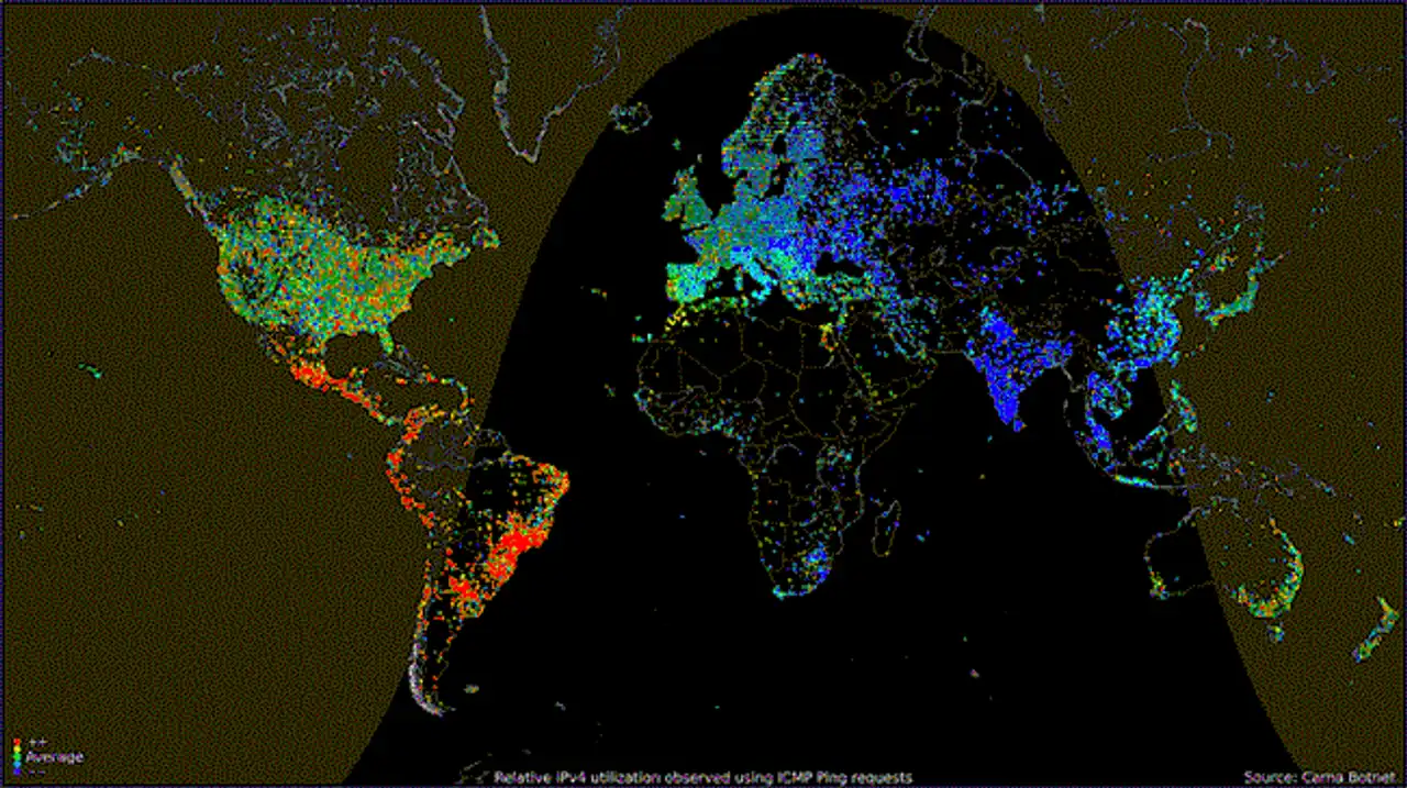
10. World Internet usage map according to the time of day
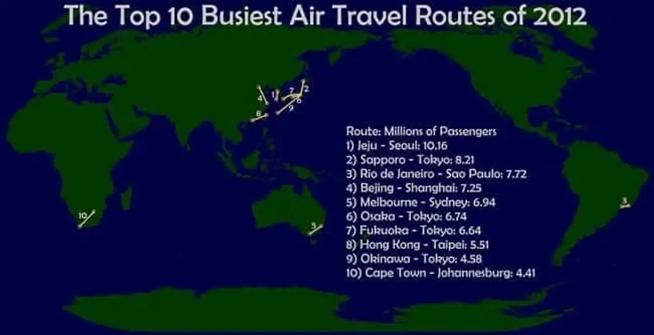
11. Map of the 10 most frequent air corridors in 2012
12. Map analysing population density worldwide
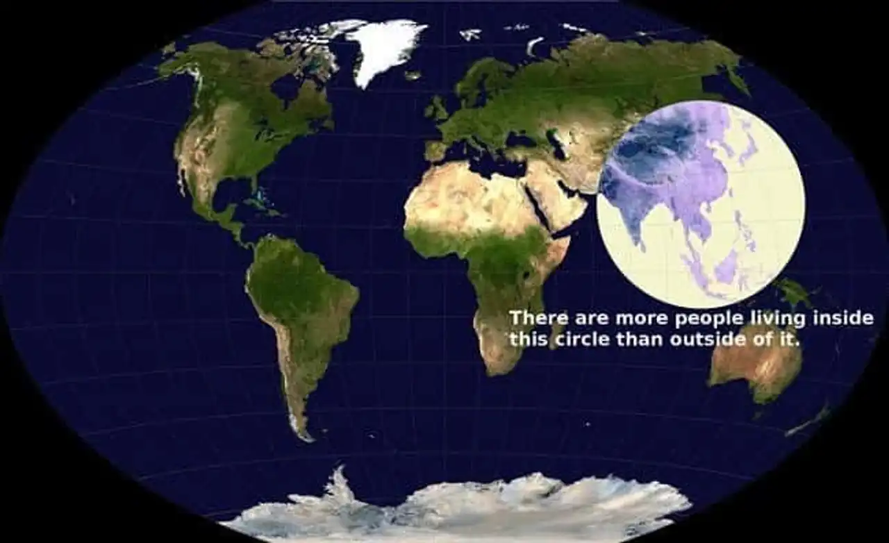 “There are more people living inside this circle than outside”
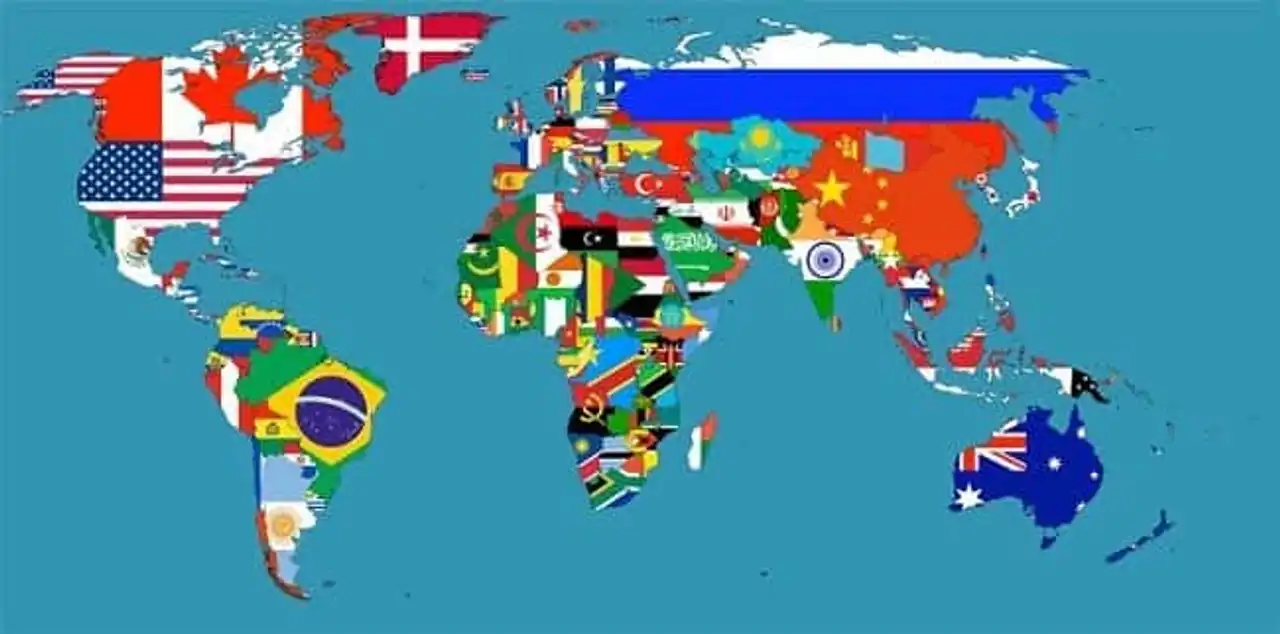
13. World Flags Map
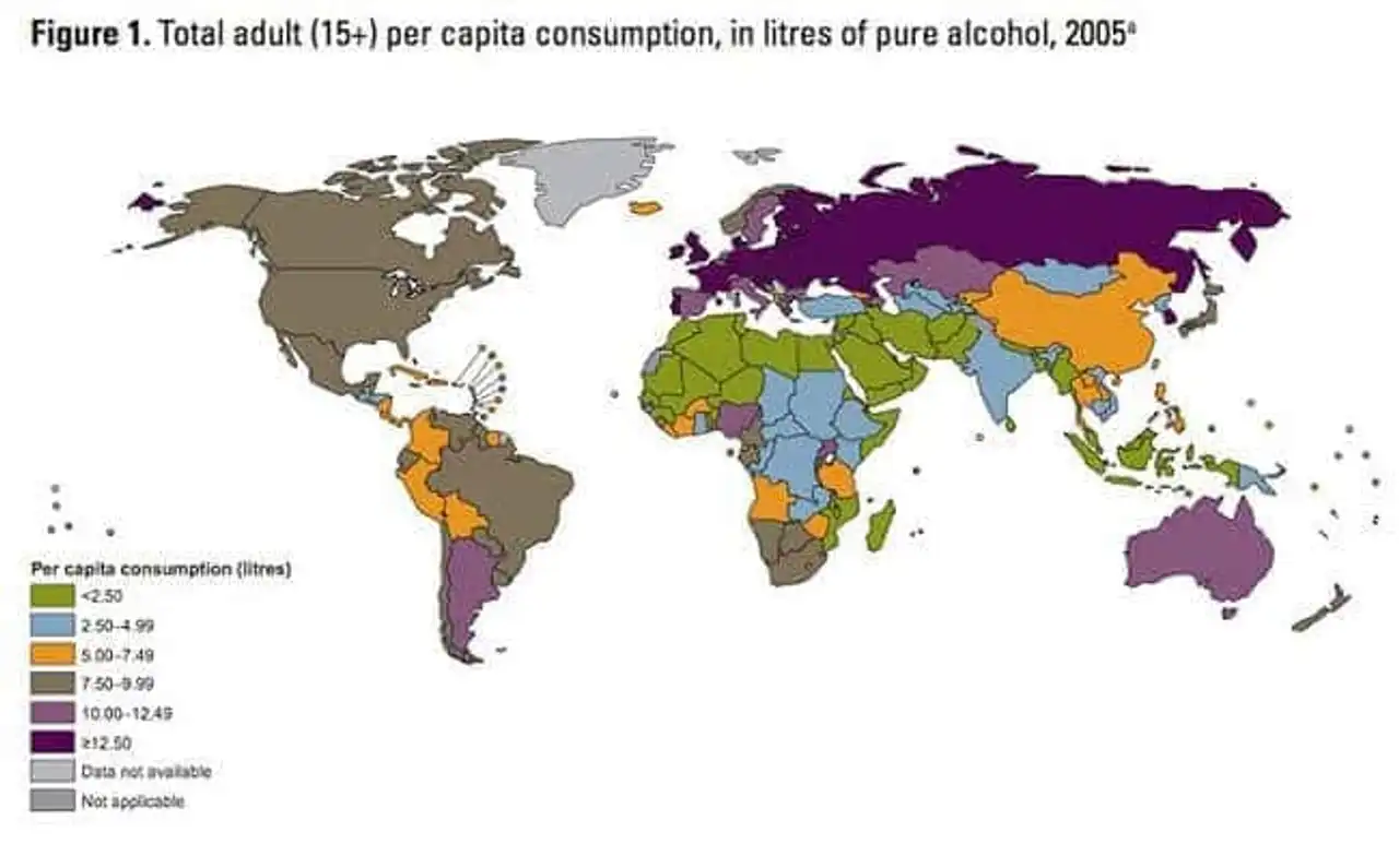
14. Map of World Alcohol Consumption in Liter
15. Most popular alcoholic beverages by country
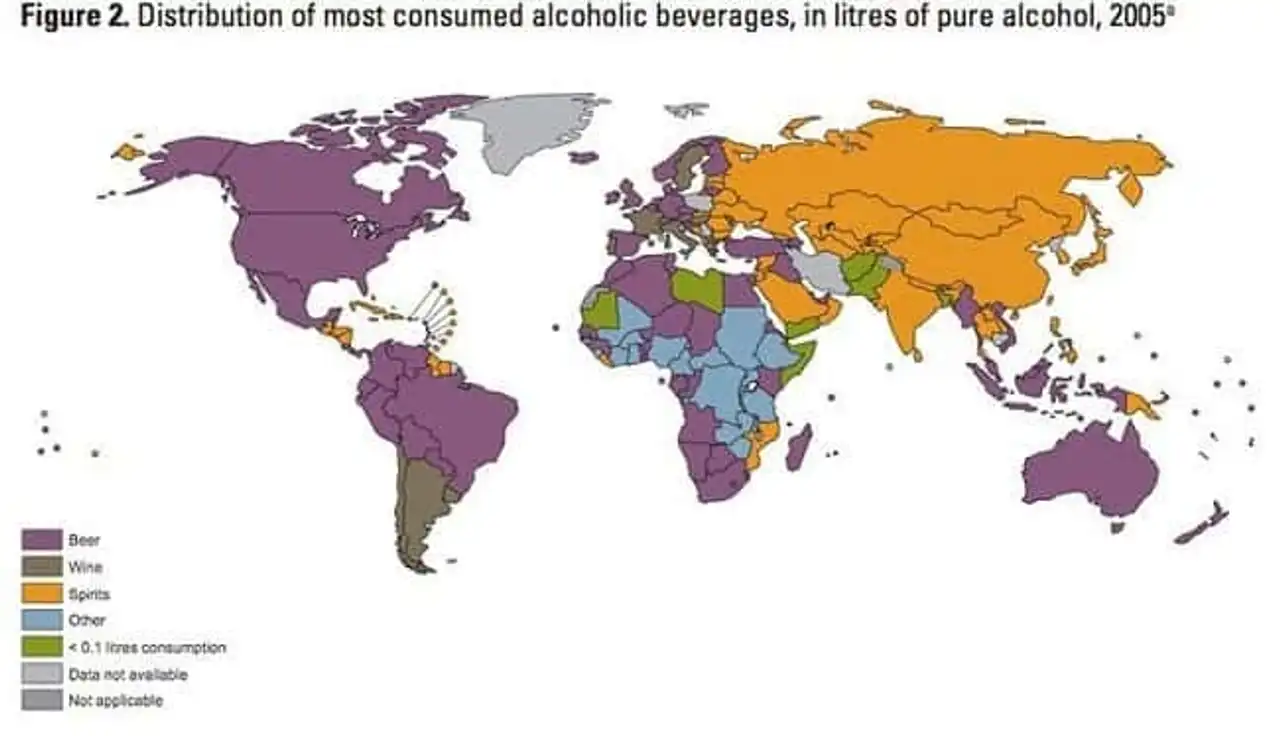 The most consumed alcoholic beverages, in liter of pure alcohol for the year 2005 (beer, wine, spirits, other)
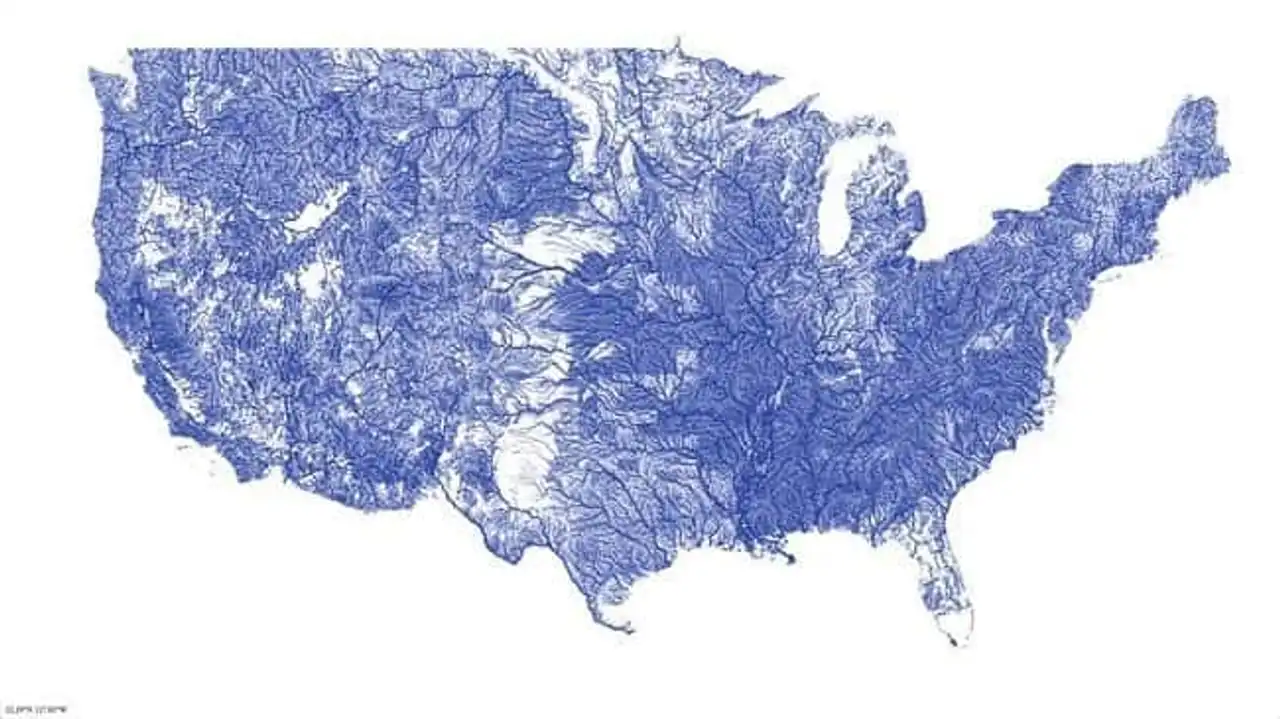
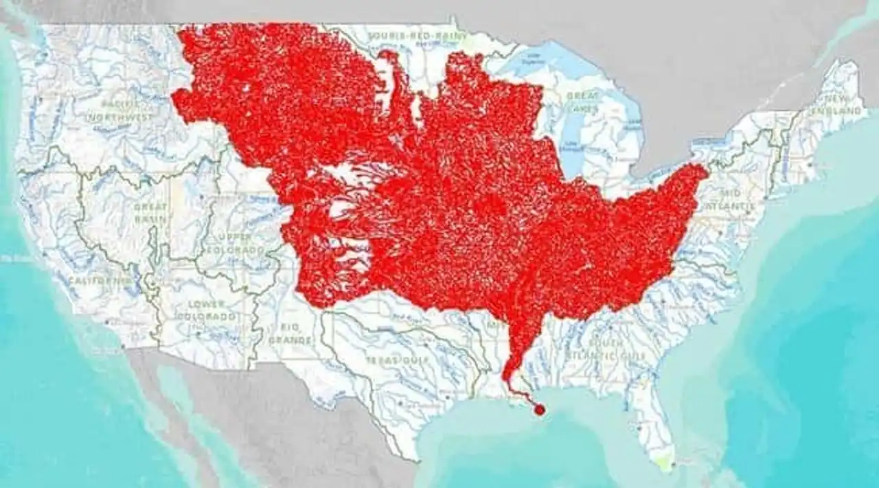
16. Map of rivers in the United States
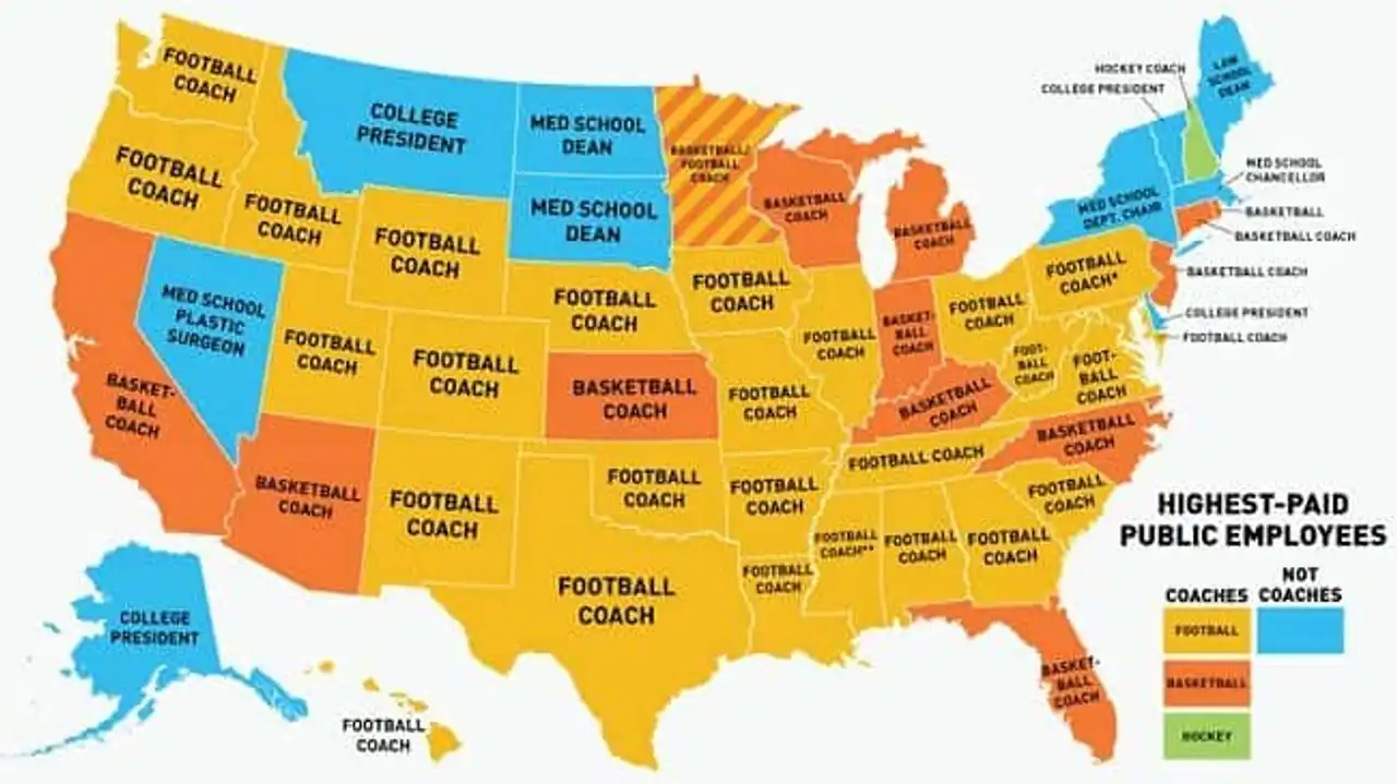
17. Best paid employee map of U.S. public service, by state
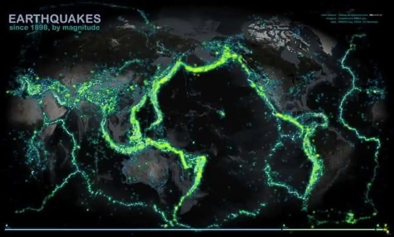
18. Map of earthquakes in the world since 1898
19. Map of corruption in the world
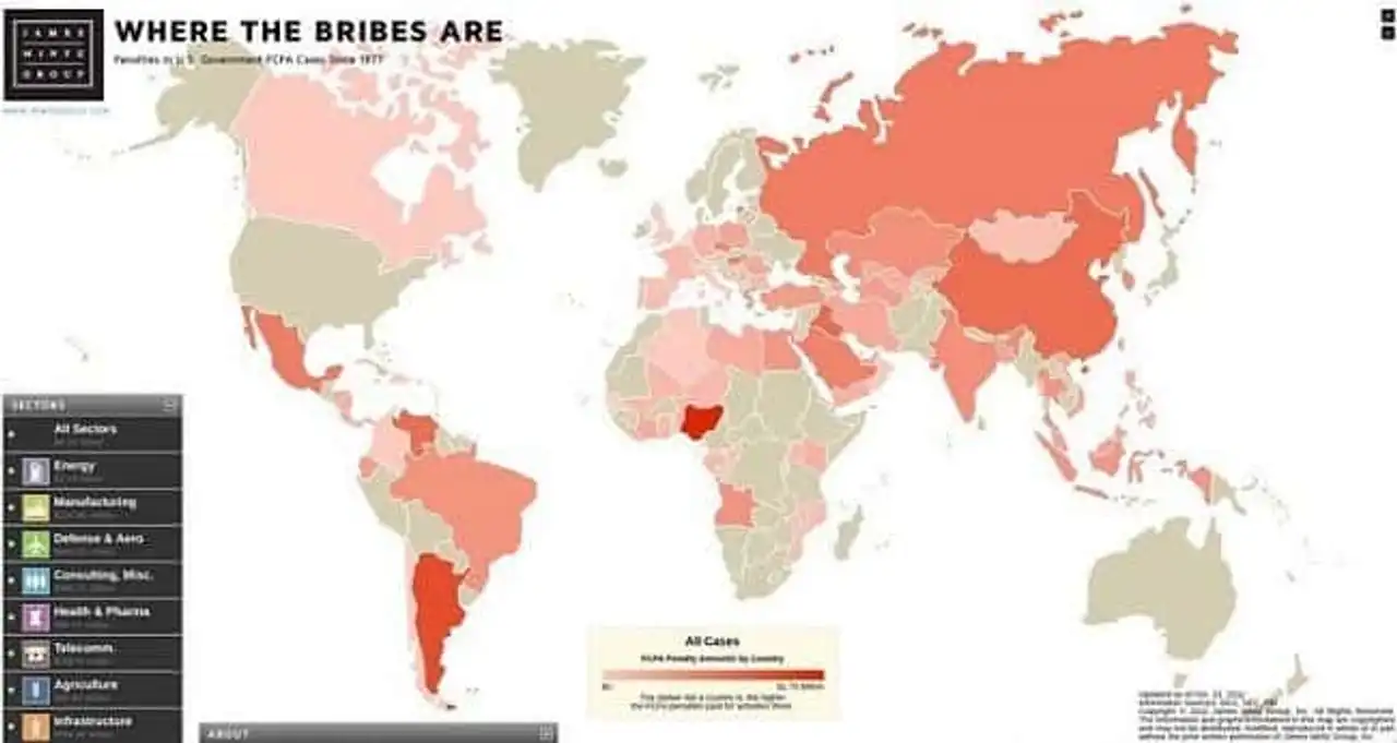
James Mintz Group
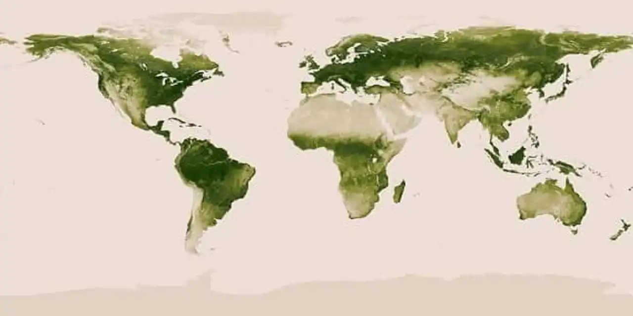
20. Map of vegetation on Earth
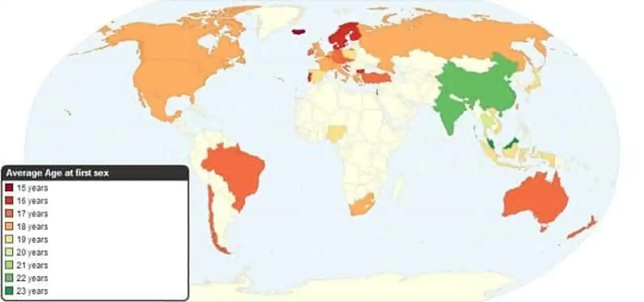
21. Age map of the first sexual intercourse in the world (from 15 to 23 years old)
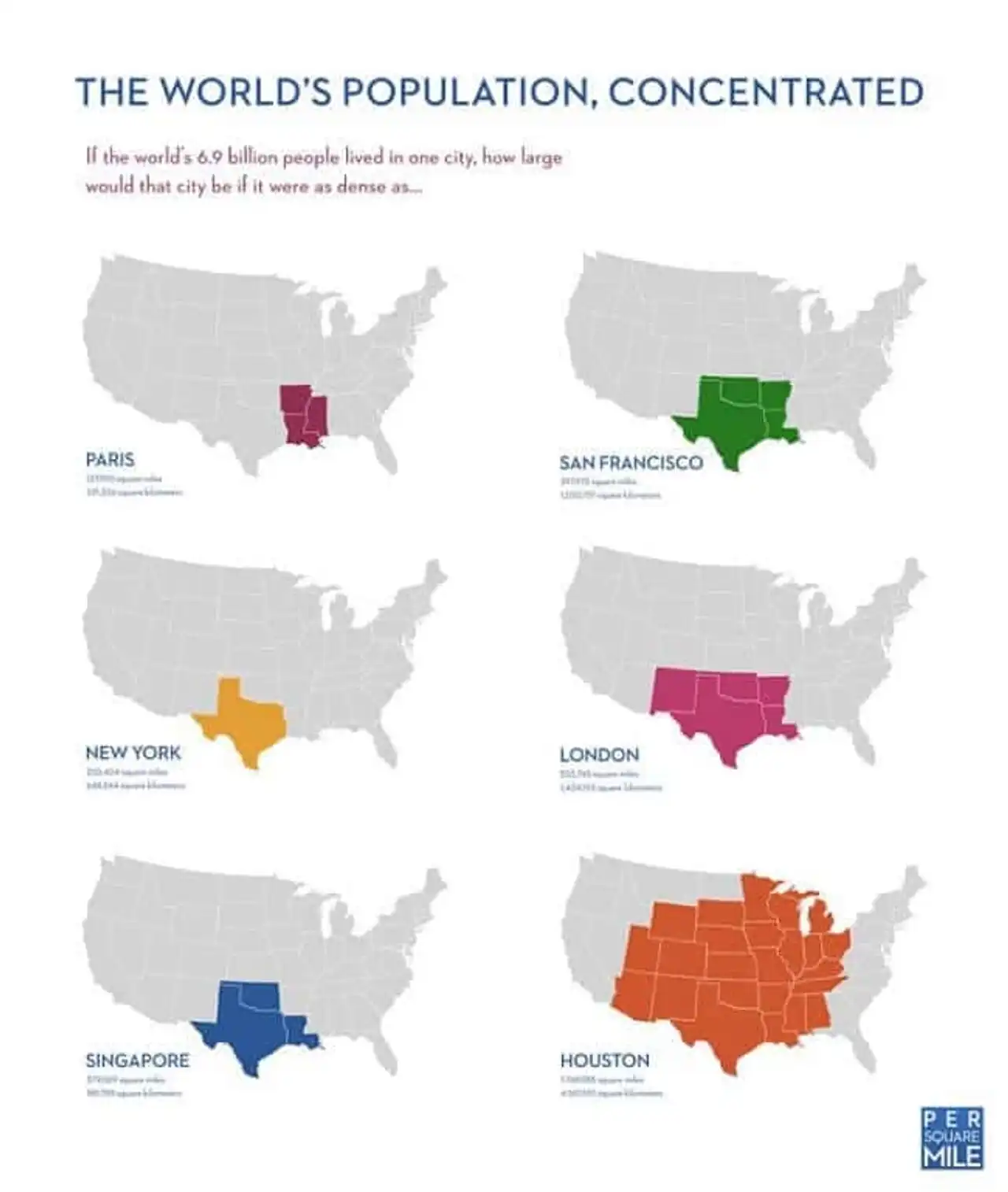
22. If the world population lived according to the density of one city...
23. Map of the number of researchers per million inhabitants worldwide
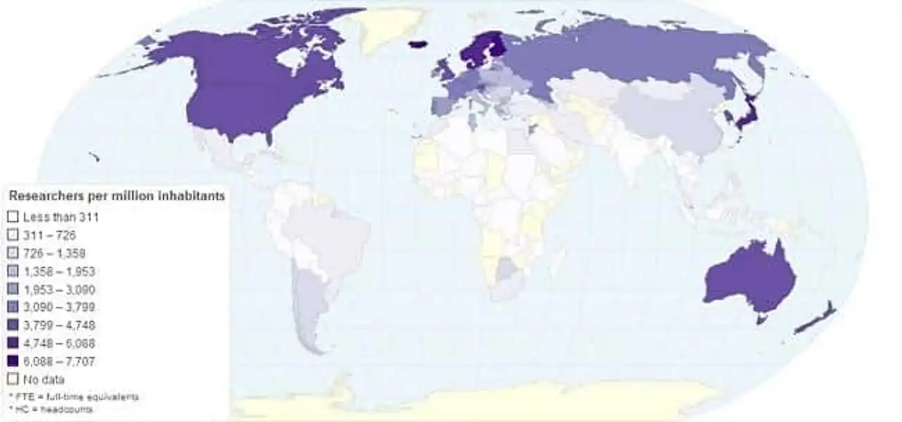 The Scandinavian countries, the United States, Japan, and Australia seem to have many researchers among their citizens.
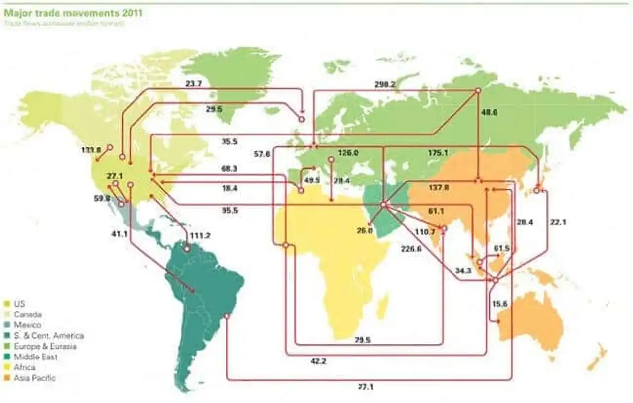
24. World map of oil exports and imports in 2011 in millions of tons
25. Map of 7,000 rivers and rivers feeding the Mississippi
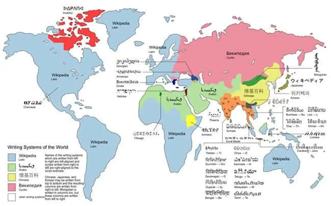
26. World map of different alphabets
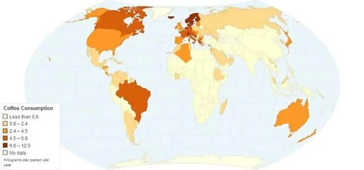
27. Annual coffee consumption card in kilograms per person
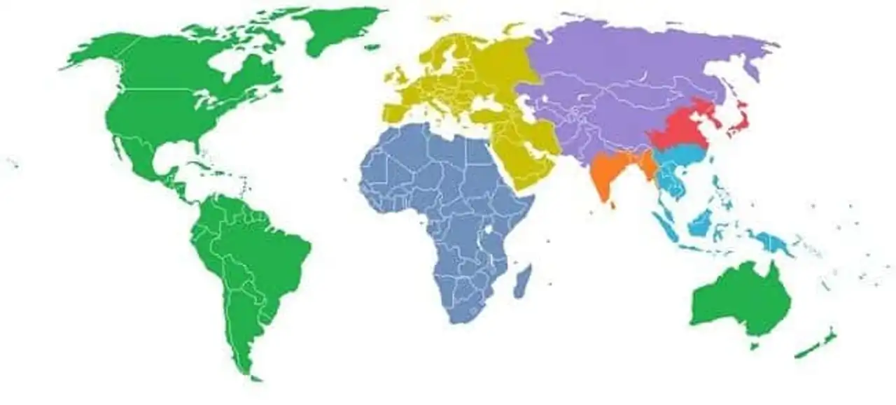
28. If the world was divided into seven regions each with 1 billion inhabitants
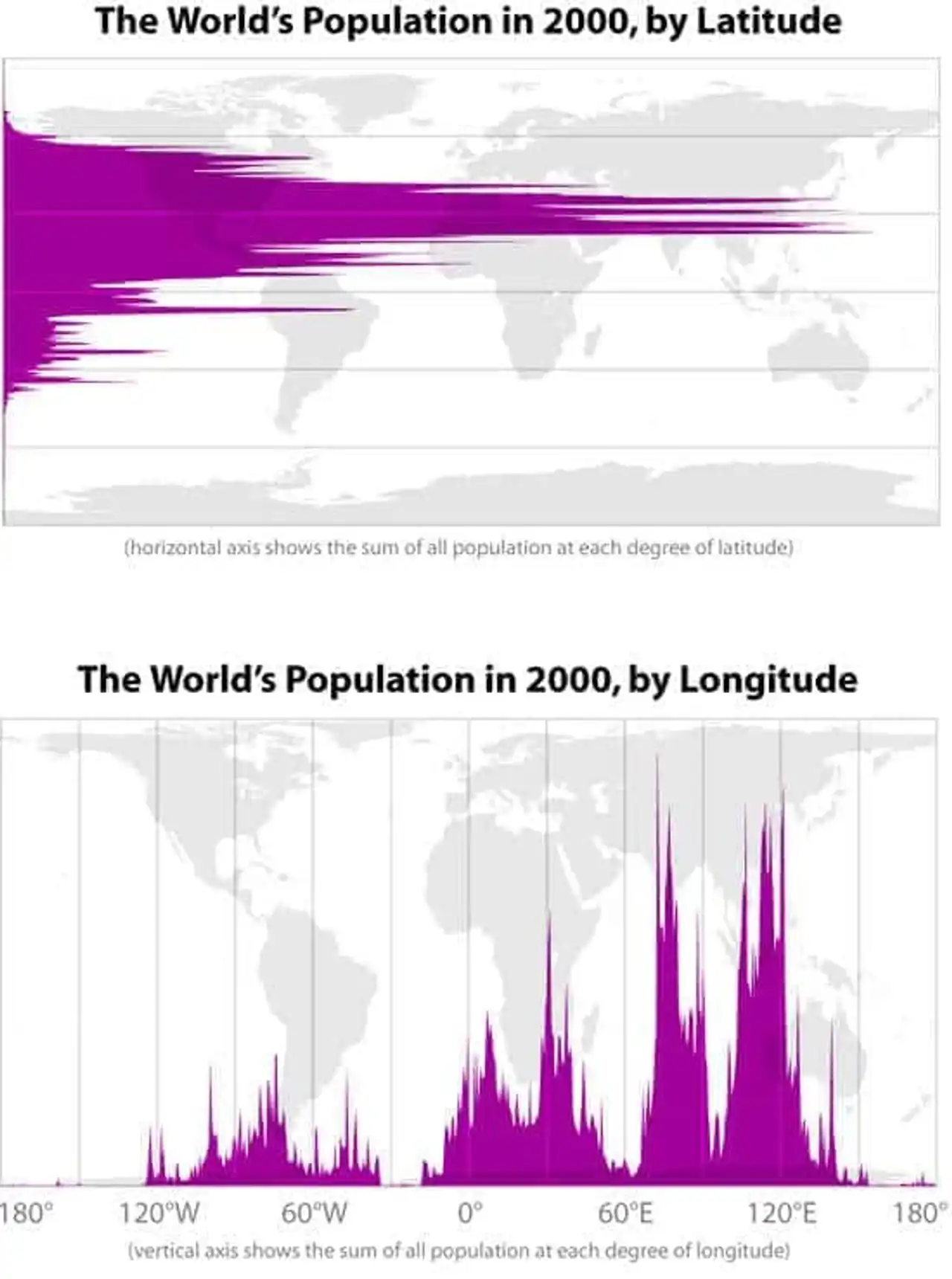
29. World population in latitude and longitude in 2000
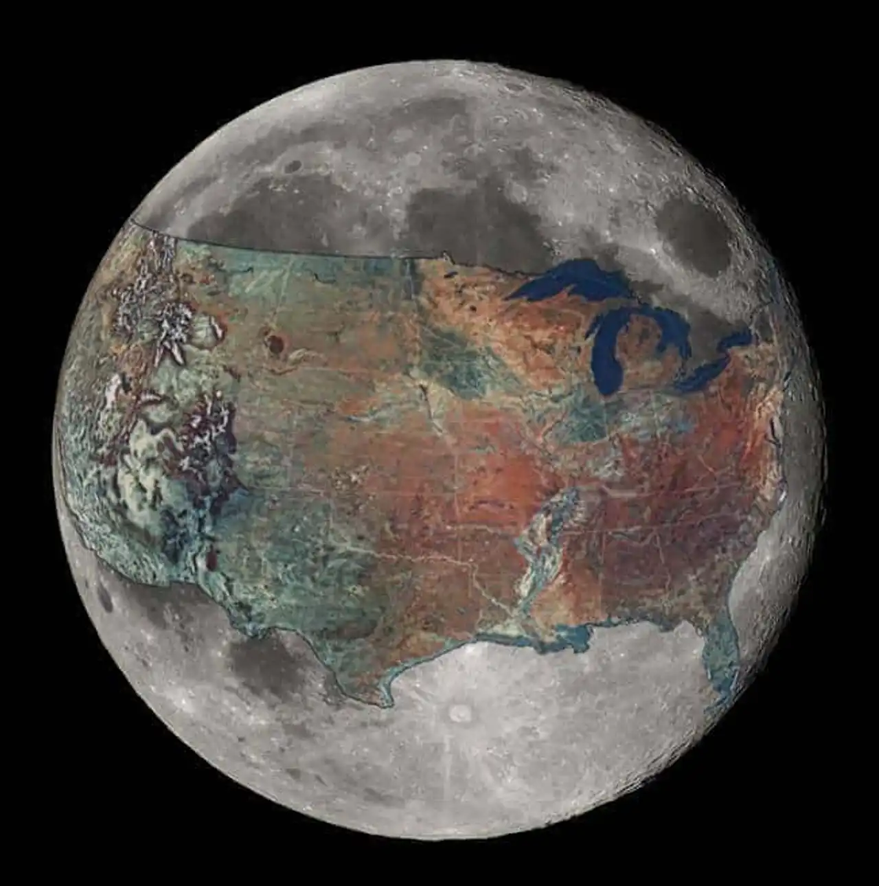
30. Map of the United States superimposed on the Moon
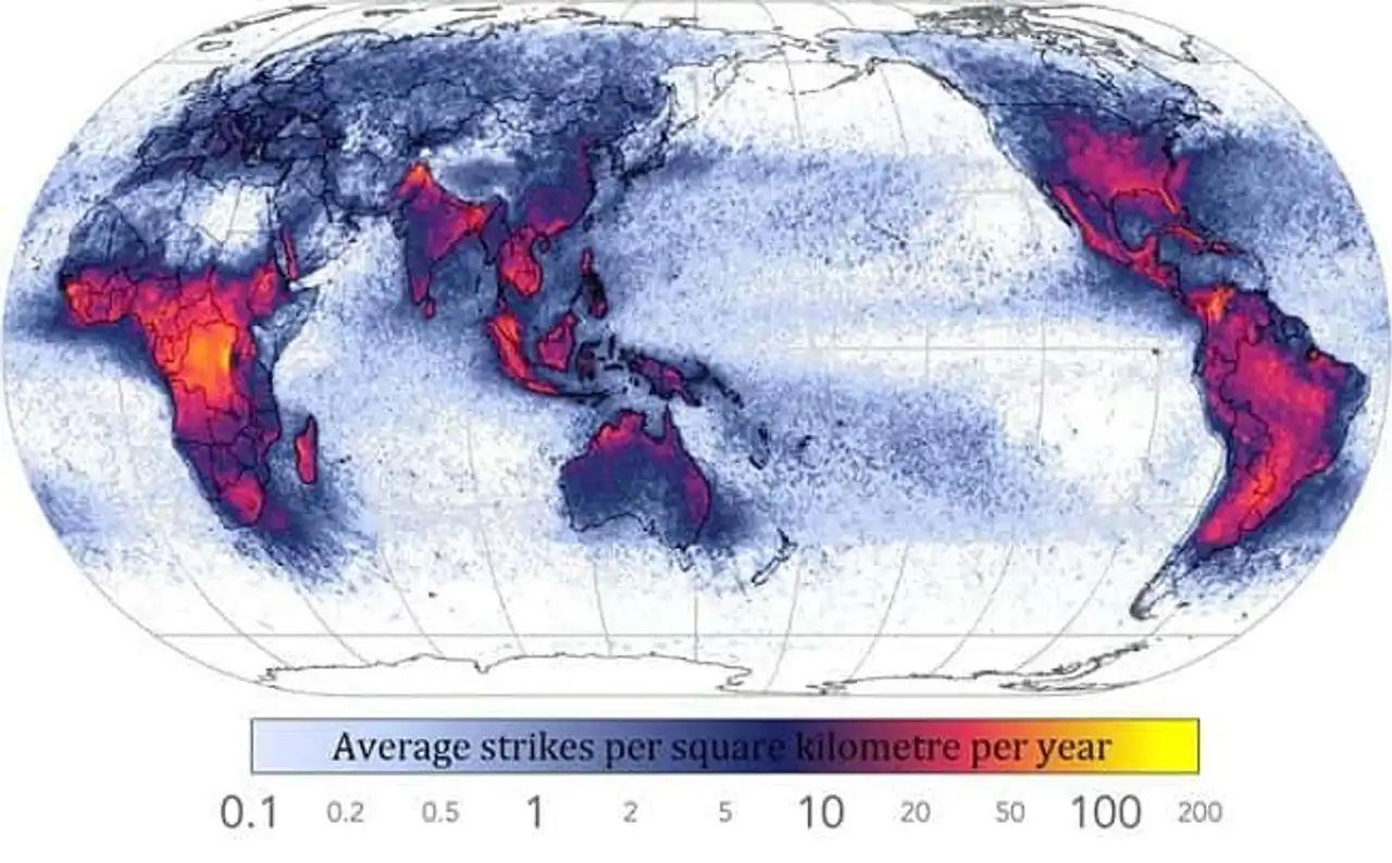
31. Frequency of lightning strikes around the world
32. Map of drinking and non- potable water in the world
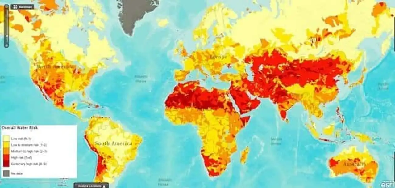
World Resources Institute
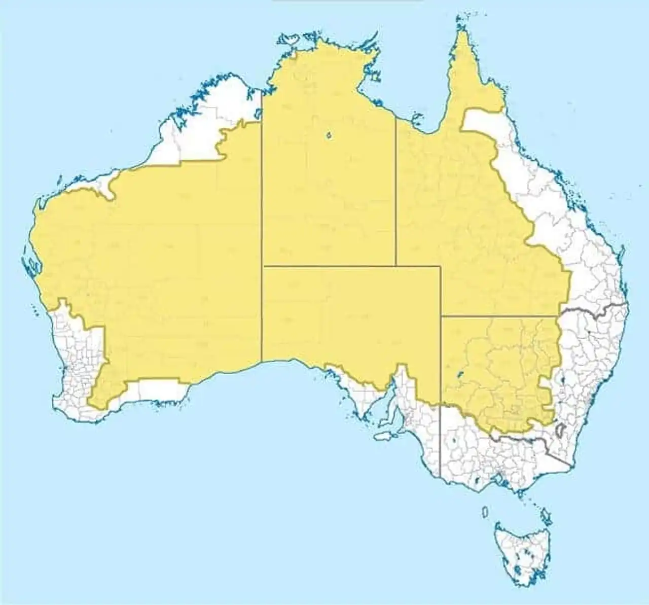
33. Only 2% of Australians live in the yellow part
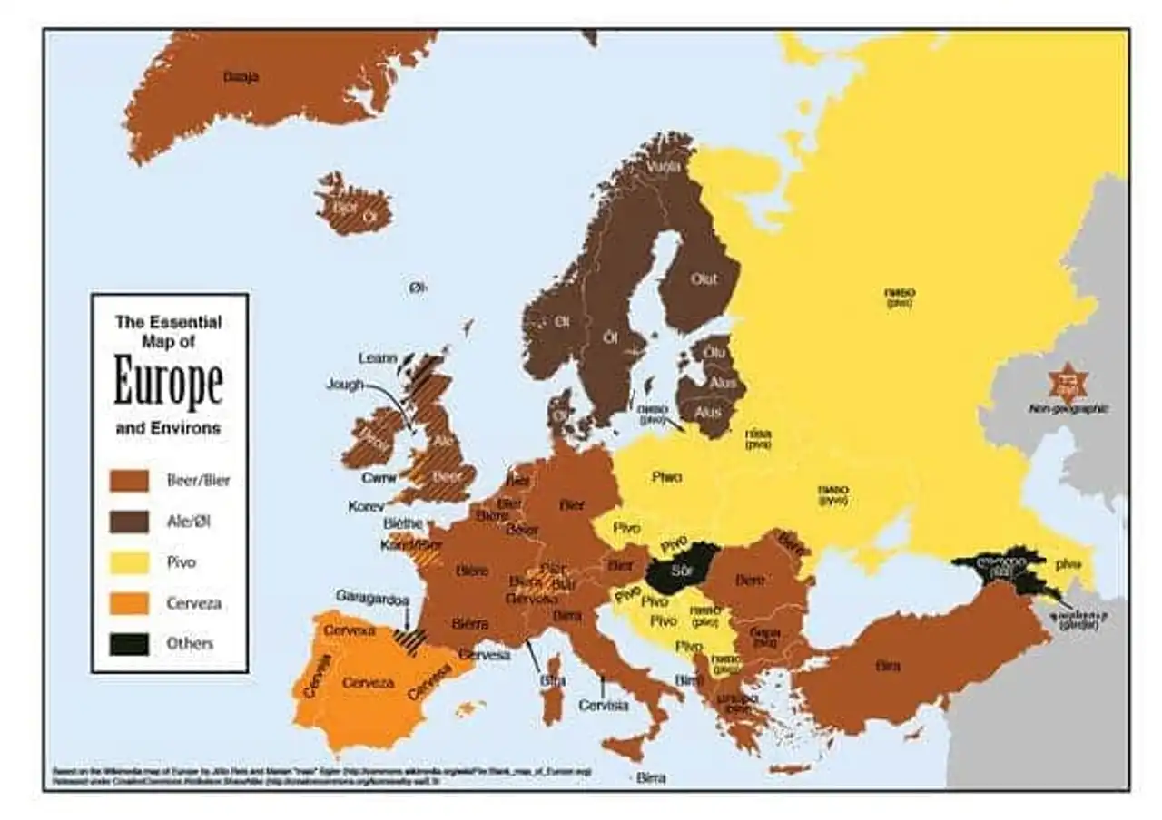
34. Map of translations of the word "beer" in Europe
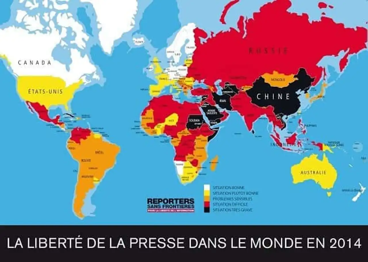
35. World Press Freedom Map in 2014
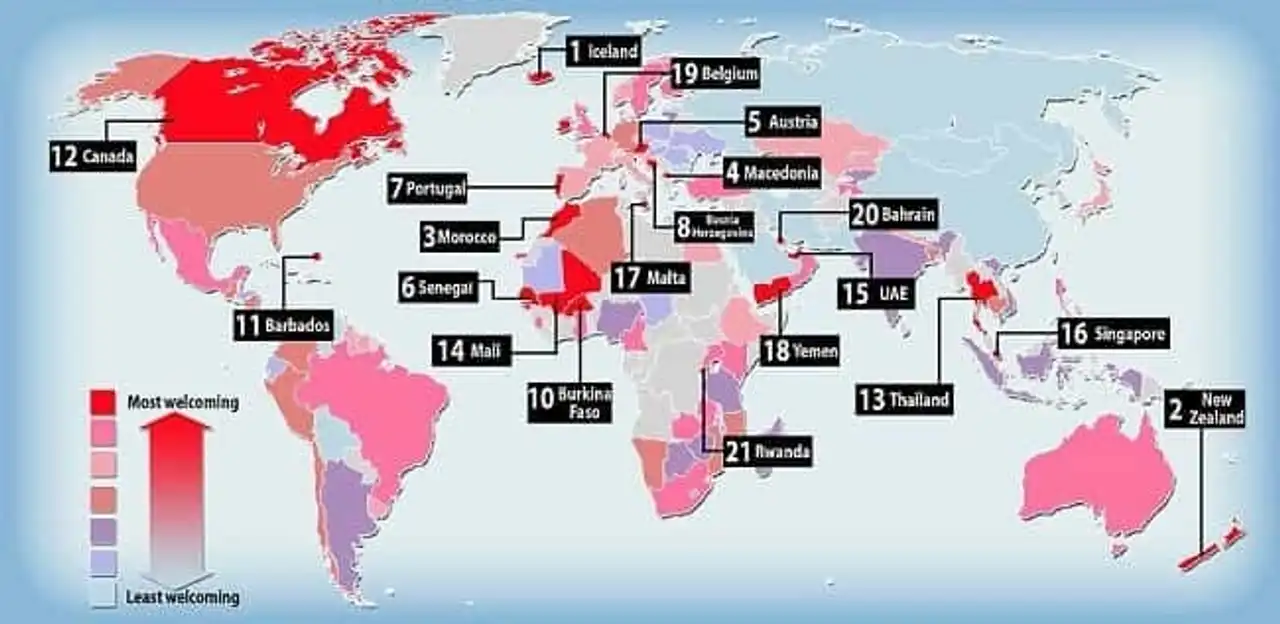
36. Map of the most welcoming (red) and inhospital countries (blue sky)
37. World map of the most used Internet browsers in 2014
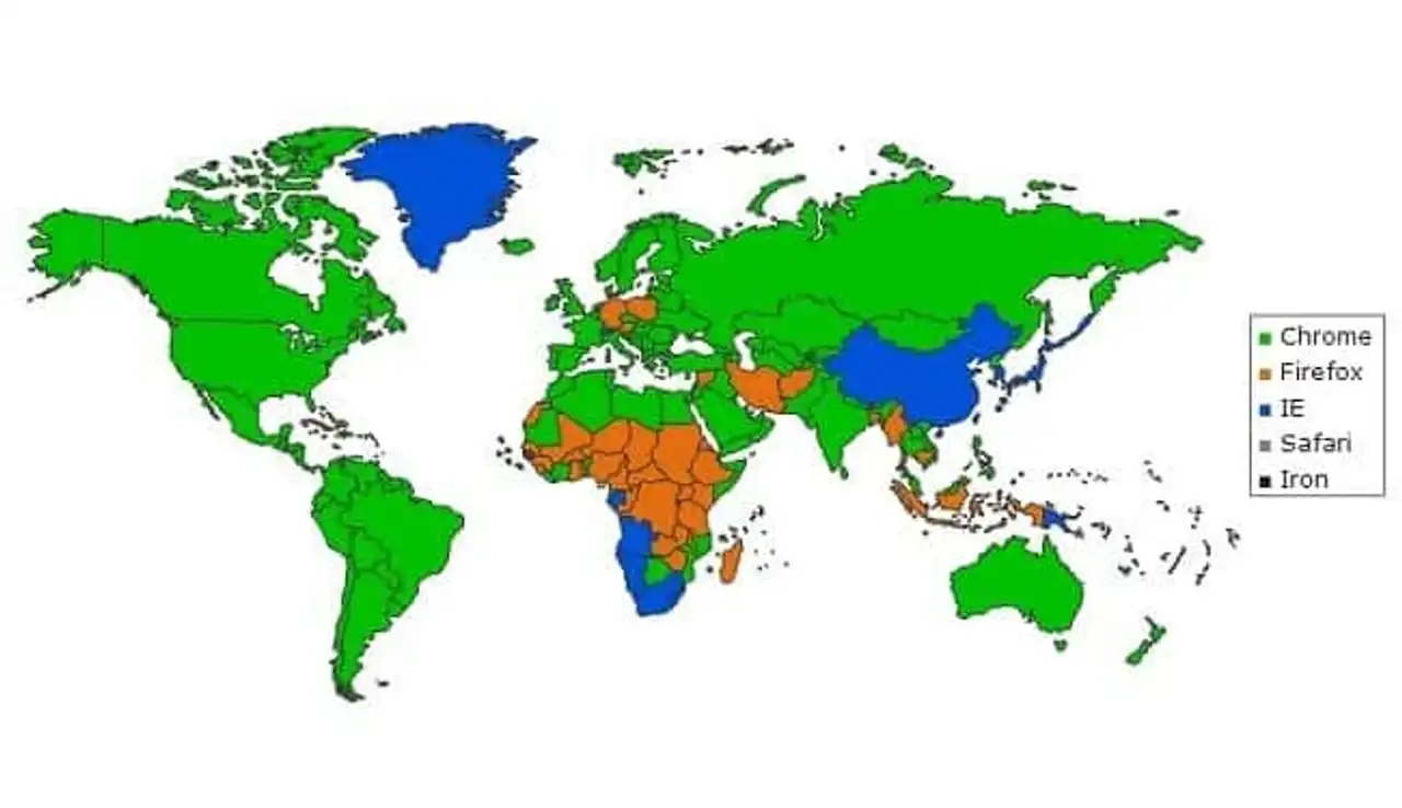
Stat Counter
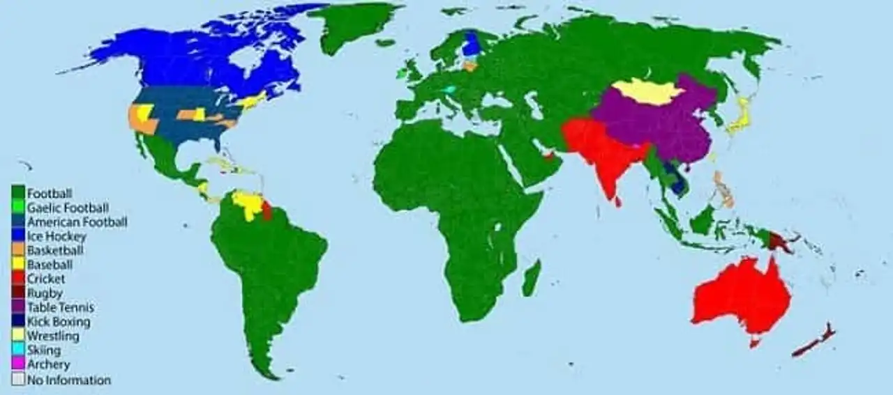
38. Most popular sports map in the world
39. Map of the prevalence of obesity in the world
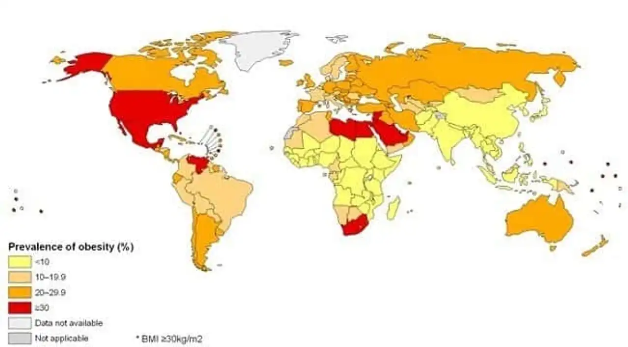
Harvard
40. World map of nuclear sites
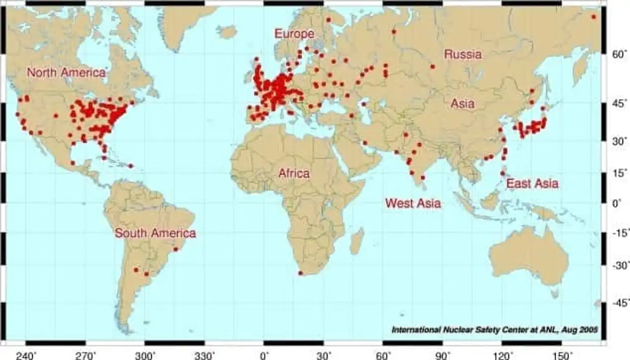
Each of these maps of the world is quite different from the simple planisphere we are shown on the school benches. At a glance, they reveal the complexity of our world and our society. Interesting, isn’t it?
These maps of the world make you react? Comment and share! Sources: Twisted Sifter, upsocl


Loading comments ...