Do you like the big air, the mountain, but also the sea? Then discover the hiking in Cape Verde through our selection of the best trails to explore during your stay.
Cape Verde is an archipelago of ten islands located approximately 650 kilometres off Senegal in the Atlantic Ocean. The country is divided into two series of islands.
First, the islands under the wind say “ Sotavento In the South: Brava, Fogo, Maio and Santiago on which is the capital Praia. And then the islands in the wind also called " Barlavento North: Boa Vista, Sal, São Nicolau, Santa Luzia, São Vicente and Santo Antão.
At the landscape level, Cape Verde will not disappoint you. Do you like the mountain? The peak of Fogo, the only volcano still active but also the highest point in the country and the tormented reliefs of the other islands offer you. Do you prefer the sea? Admire the beaches of black or blond sand and enjoy those where currents are not too strong to swim.
Fan of green nature? You will also take your eyes full of them: terrace crops, coconut trees, banana trees, eucalyptus and acacia forests... So breathe, we go on a hike to Cape Verde!
1. From the Ponta do Sol to Cruzinhas on the island of Santo Antão
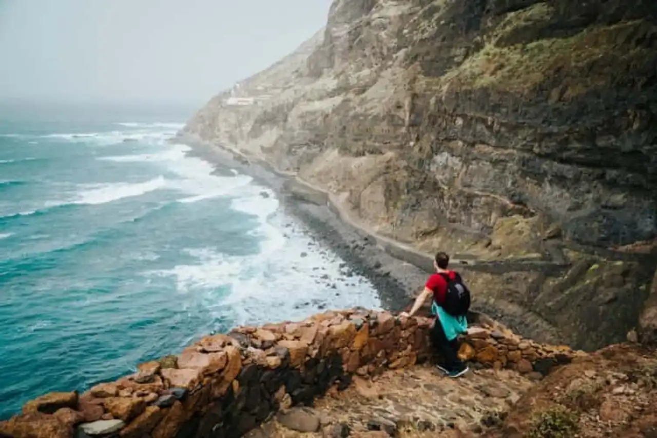
Photo credit: Shutterstock – Igor Tichonow
- Duration 6:33
- Denivelé 1,459 metres
- Difficulty : Difficult
- Distance 14.2 km
- See the hiking trail
This coastal path is one of the most popular hikes in Cape Verde on the island of Santo Antão. Over 14 kilometers, it will allow you to discover the full extent of the country’s landscapes. Thus, you will first take a small paved road to the pretty village of Fontainhas.
Then you will follow the terraced cultures on a mules trail with an incredible view of the ocean. You will then arrive at the river ribeira do Corvo and the village of Forminguinhas. You will finally arrive in the village of Cruzinha after crossing a few valleys again.
A very nice hike in Cape Verde between sea and mountain to explore a wide variety of landscapes.
2. From the Ponta do Sol to Chã de Igreja by the coast on the island of Santo Antão
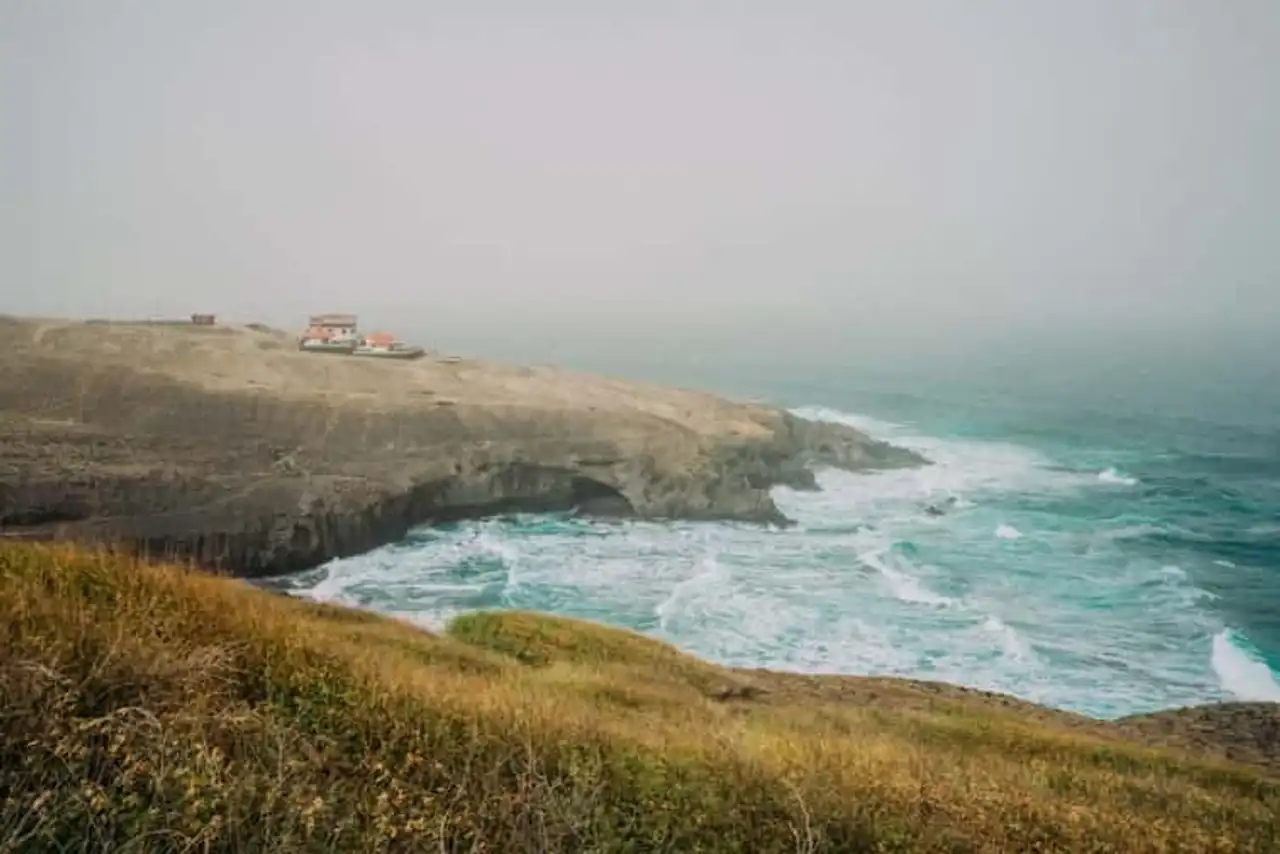
Photo credit: Shutterstock – Igor Tichonow
- Duration 7:10
- Denivelé 1,567 metres
- Difficulty : Difficult
- Distance 16.6 km
- See the hiking trail
Do you want to hike in hard Cape Verde? This is certainly also one of the most beautiful in the country. Over 15 kilometers, this coastal path will offer you an uninterrupted view of the ocean below.
As in the hike n°1 above, you will follow the path from Ponta do Sol to Cruzinhas. But instead of stopping there, you will continue in the Garça valley. You will follow the Ribeira da Garça to the charming village of Chã de Igreja. The effort is intense, but it is worth it!
3. From Sao Pedro to the Farol of Dona Amelia on the island of Sao Vincente
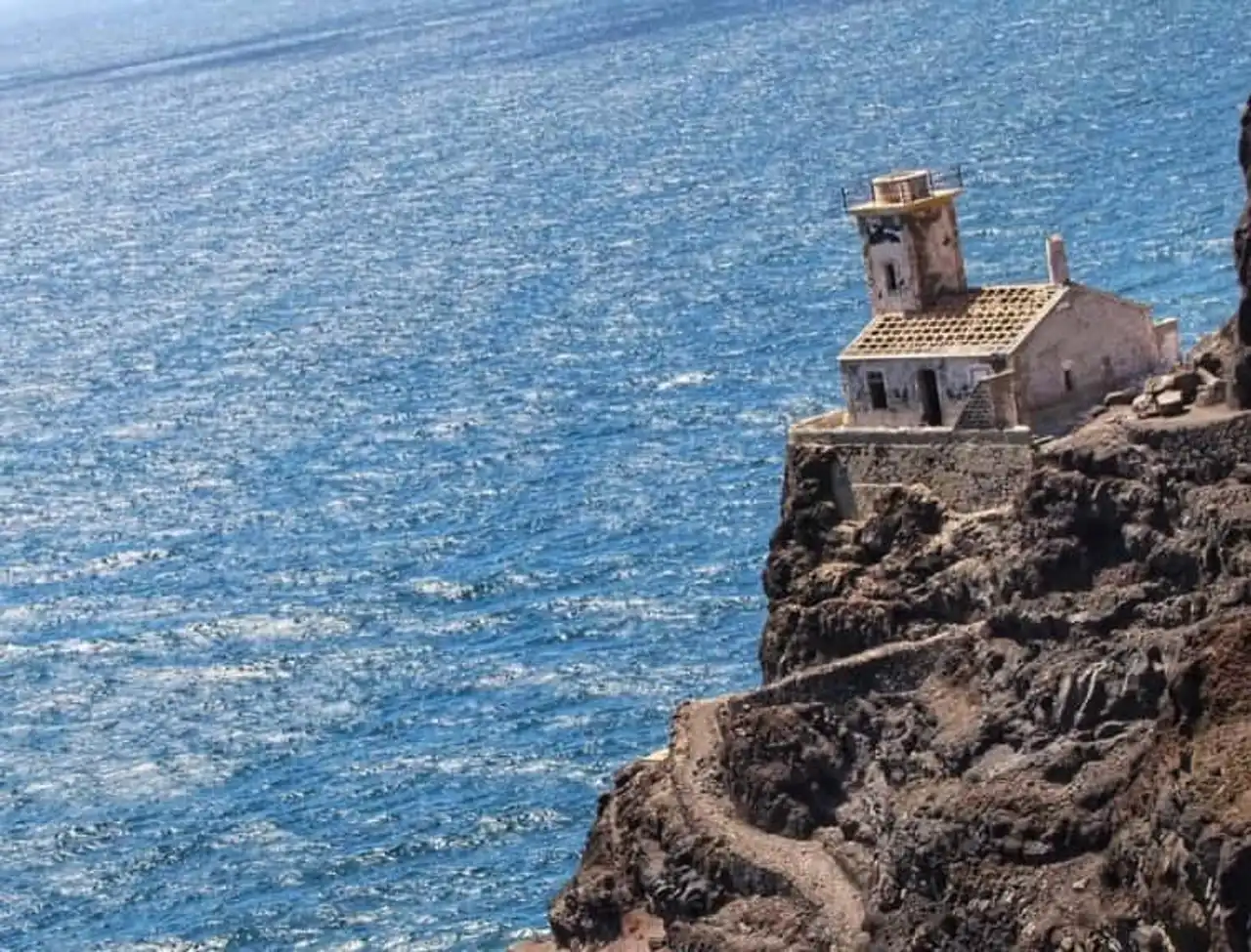
Photo credit: Instagram -santiagodevalpuesta
- Duration 1h29
- Denivelé 202 metres
- Difficulty Easy
- Distance 6.0 km
- See the hiking trail
If you’re looking to go hiking in Cape Verde very easy, here’s the one you need. This small circuit that runs back and forth will allow you to dripping your legs with a beautiful view of the ocean.
To begin with, you will follow the white sandy beach before climbing the road on the cliff side that will lead you to the Dona Amelia lighthouse. For about 6 kilometers, you will walk the cliff and you can admire the ocean below. You will then arrive at the lighthouse that it is possible to visit.
4. From Tarrafal to Monte Trigo by the coast on the island of Santo Antão
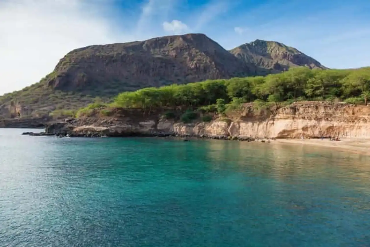
Photo credit: Shutterstock – Samuel Borges Photography
- Duration 5h16
- Denivelé 922 meters
- Difficulty : Difficult
- Distance 13,0 km
- See the hiking trail
Attention, this hike in Cape Verde is reserved for lovers of thighs that pull and knees that heat because it is quite difficult. It will take you from the black sandy beach of Tarrafal to Monte Trigo, 11 km further. The difficulty of this hike is not in its itinerary. You will follow the paved path from end to end and you cannot be mistaken. On the other hand, the trail is very steep. Over the course you will see the view change to embrace the grandeur of the volcanic landscapes of the island of Santo Antão.
For the return, if you agree with a fisherman in Tarrafal, he will pick you up at the agreed time and bring you back by the sea at the scheduled time. With a little luck, you might be able to cross whales!
5. From Chã das Caldeiras to Mosteiros on the island of Fogo
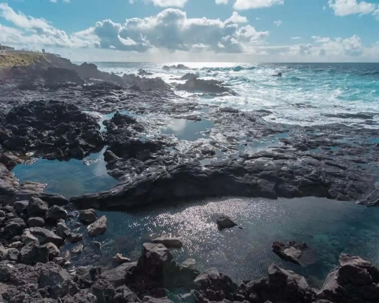
Photo credit: Instagram – checkoutsam
- Duration : 3h10
- Denivelé 77 metres
- Difficulty : Difficult
- Distance 12.4 km
- See the hiking trail
This 11-kilometre hike in Cape Verde will allow you to explore the volcanic landscapes of the country's only active volcano. First of all, you will walk for about an hour at the bottom of the caldeira, a typical depression of the surrounding volcanoes. The path is flat enough. When you are at the edge of the caldeira, enjoy the panorama on the surroundings. And then things get a little bit of a little bit. As you enter the eucalyptus and acacia forest, you will begin to descend.
This is the reason why this journey is in the most difficult of hiking in Cape Verde. Indeed, the descent is long and lean and you will muscle the thighs for sure! On the other hand, the shaded forest landscape is worth it. However, be careful by location, the trail may be slippery. Don't hurt yourself!
6. Up to the top of Morro de Areia hill on the island of Boa Vista
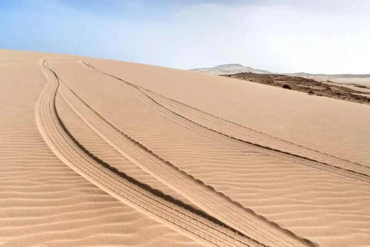
Photo credit: Shutterstock – Rangzen
- Duration : 3h46
- Denivelé : 297 meters
- Difficulty Average
- Distance 15.1 km
- See the hiking trail
If you are looking for a family-friendly hike in Cape Verde, this route is for you. This small circuit of about 7 kilometers will allow you to walk a part of the natural reserve of Morro de Areia.
Starting from Chave beach, you will follow the coast for a while before crossing the dunes. You will then reach the top of this hill about 170 m high.
Enjoy the view of the surrounding area: ocean, white sand and preserved nature. You may also have the chance to spot protected species such as turtles or a red beaked phaeton, a marine bird.
7. Climb at the top of the Fogo Pico volcano on the island of Fogo
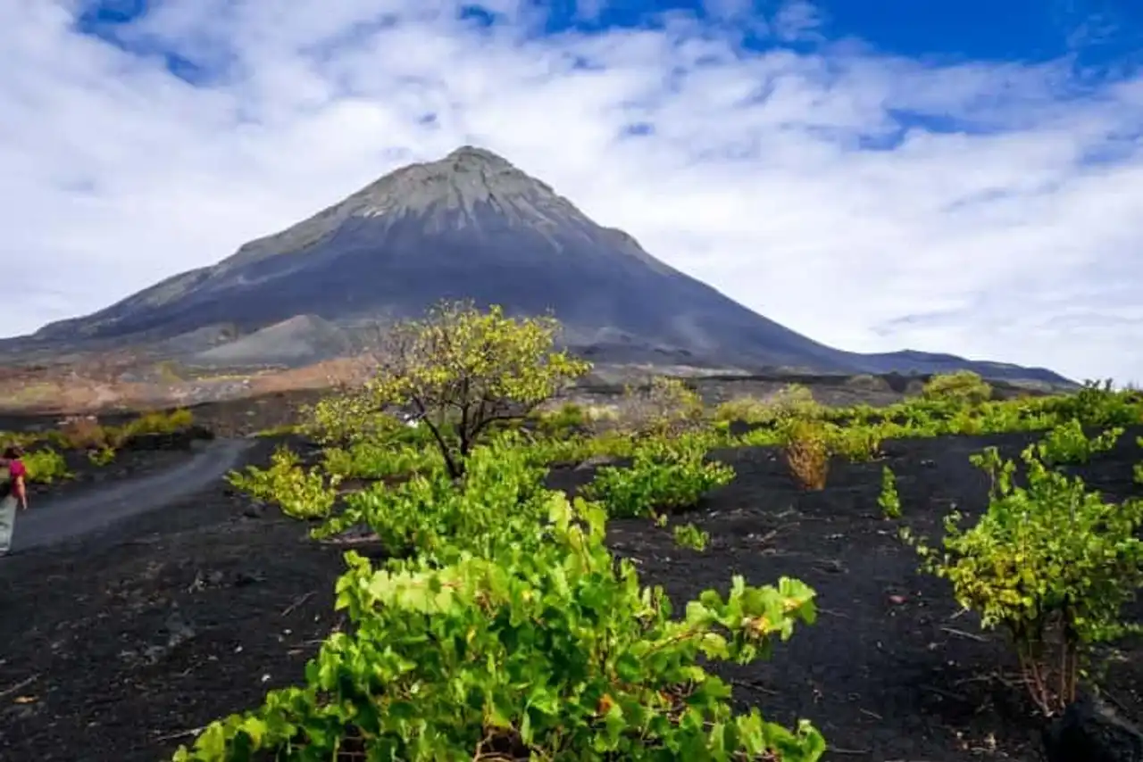
Photo credit: Shutterstock – Daboost
- Duration 4h
- Denivelé 1 087 metres
- Difficulty : Difficult
- Distance 8.2 km
- See the hiking trail
Attention, it is mandatory to take a guide to carry out this journey in good security!
Incontournable from the hikes to Cape Verde, the climb of the Pico de Fogo crater will remain an unforgettable memory for you. This route will make you cross fields of lava, areas of black sand and lush vegetation that grows on fertile volcanic soils. A sometimes lunar landscape, sometimes apocalyptic but yet so impressive!
Hiking can be a little difficult at times because of the nature of the terrain, but it is accessible even to beginners. And the view from the top of the volcano is breathtaking!
8. In the Xoxo valley on the island of Santo Antao
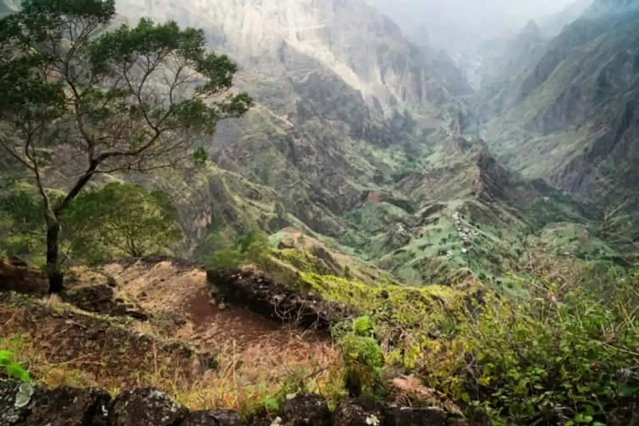
Photo credit: Shutterstock – Igor Tichonow
- Duration : 4h05
- Denivelé 1 222 metres
- Difficulty : Difficult
- Distance 8.4 km
- See the hiking trail
Are you looking for the most beautiful hikes in Cape Verde? Choose the Xoxo valley. Less frequent than the Paul Valley ( Vale do Paul ), it is at least as heavenly. You will cross banana crops, impressive rocky peaks and lush tropical vegetation. From Xoxo you will pass through the villages of Lombo do Pico, Rabo Curto and Losna. The highlight of the walk is the view Faja de cima at almost 1000 meters altitude. You will have an impressive view of the magnificent surroundings: forest, mountain, terraces and, in the distance, the ocean.
This hike in Cape Verde presents a big gap but is not so difficult that it is because stairs are arranged between the terraces per moment. That being so, you can still have enough water and protect yourself from the sun!





Loading comments ...