
Aix-les-Bains is known to be one of the most enjoyable cities to live in France, it is also one of the nicest to walk! Between Lake Bourget and the Regional Natural Park of the Bauges Mountain, the beautiful hikes in Aix-les-Bains are not rare...
In the heart of the Savoie and the Alps Mountains, Aix-les-Bains is a thermal city that attracts for its “well-being” dimension: between the calm waters of the lake and the revitalizing air of the mountain, there is indeed what to recharge the batteries. For a complete fitness, here is a simple advice: go to Aix-les-Bains!
All the benefits of the city are discovered when you walk on the trails around Lake Bourget, or between the summits of the Massif des Bauges . Breathtaking landscapes, which offer hikers from the end of the spring, when the snow releases the trails, and in the middle of the summer, to experience the mountain “out season”: you will not regret it...
Even if we are at altitudes, the hikes in Aix-les-Bains are for everyone: nice family-friendly walks with the ascents of more corsed summits, there are for all tastes and levels!
1. La Grotte des Fées depuis Brison-Saint-Innocent
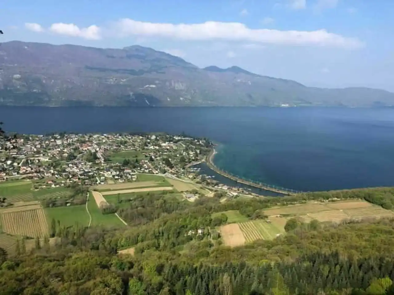
Photo credit: Alltrails
- Duration : about 1h
- Distance 4.8 km
- Denivelé : 315 m
- Difficulty Easy
- See the hiking trail
La Grotte des Fées, here's a name that makes Aix-les-Bains want to go back with the whole family! This falls well, because the cave in question is accessible on foot from Brison-Saint-Innocent, by a path certainly without great difficulty, even with the children, but still offering its little denial...
Once you arrive at the Cave des Fées, take the time to admire the breathtaking view of Lake Bourget below. Mix with a torch lamp to explore the cave more easily. Then the trail forms a beautiful loop that gradually descends to your starting point, in the shade of trees, for a pleasant walk even in the summer.
2. Lace of the Cat
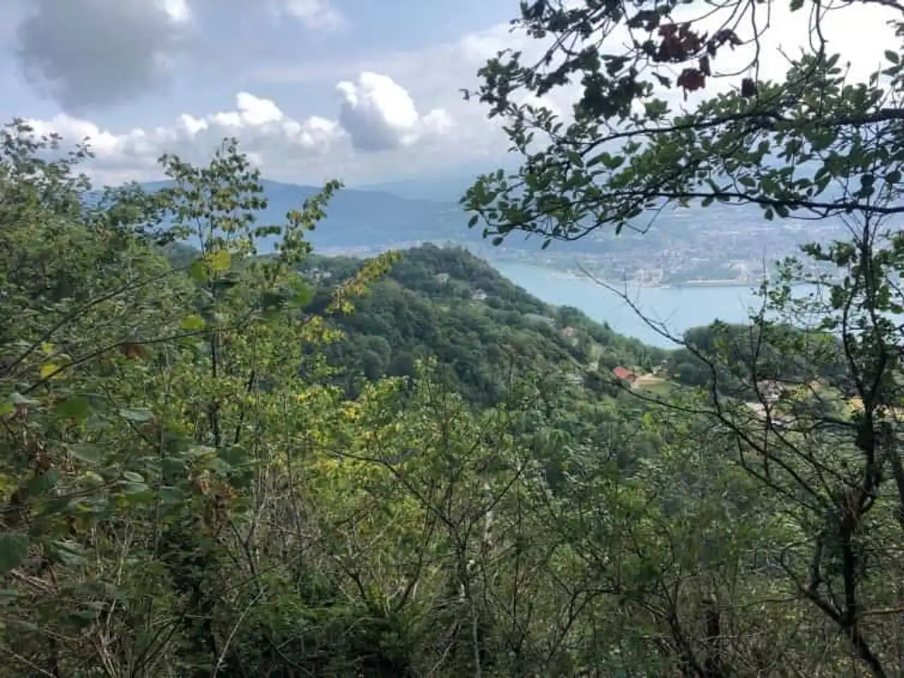
Photo credit: Alltrails
- Duration : about 3h
- Distance 6.8 km
- Denivelé 678 m
- Difficulty : Difficult
- See the hiking trail
We change the bank to get to the Bourdeau side, with a hike to Aix-les-Bains that climbs. We suspected that in the Alps, we were going to meet some serious problems! The route begins at the Col du Chat, at 638 m above sea level, and climbs immediately towards the Roc de Cornillon: do not confuse the path with the via ferrata!
Ascension continues with a ridge path that overlooks the Lake of the Bourget, Aix-les-Bains, Chambéry and the Bauges massif... The view even carries to the Belledonne massif and the Mont-Blanc ! Once you arrive at the top of the Dent du Chat (1,389 m), you can turn back, or continue climbing through the path of the Black Molard. Careful, you'll have to be able to come back...
3. The cross of Meyrieux
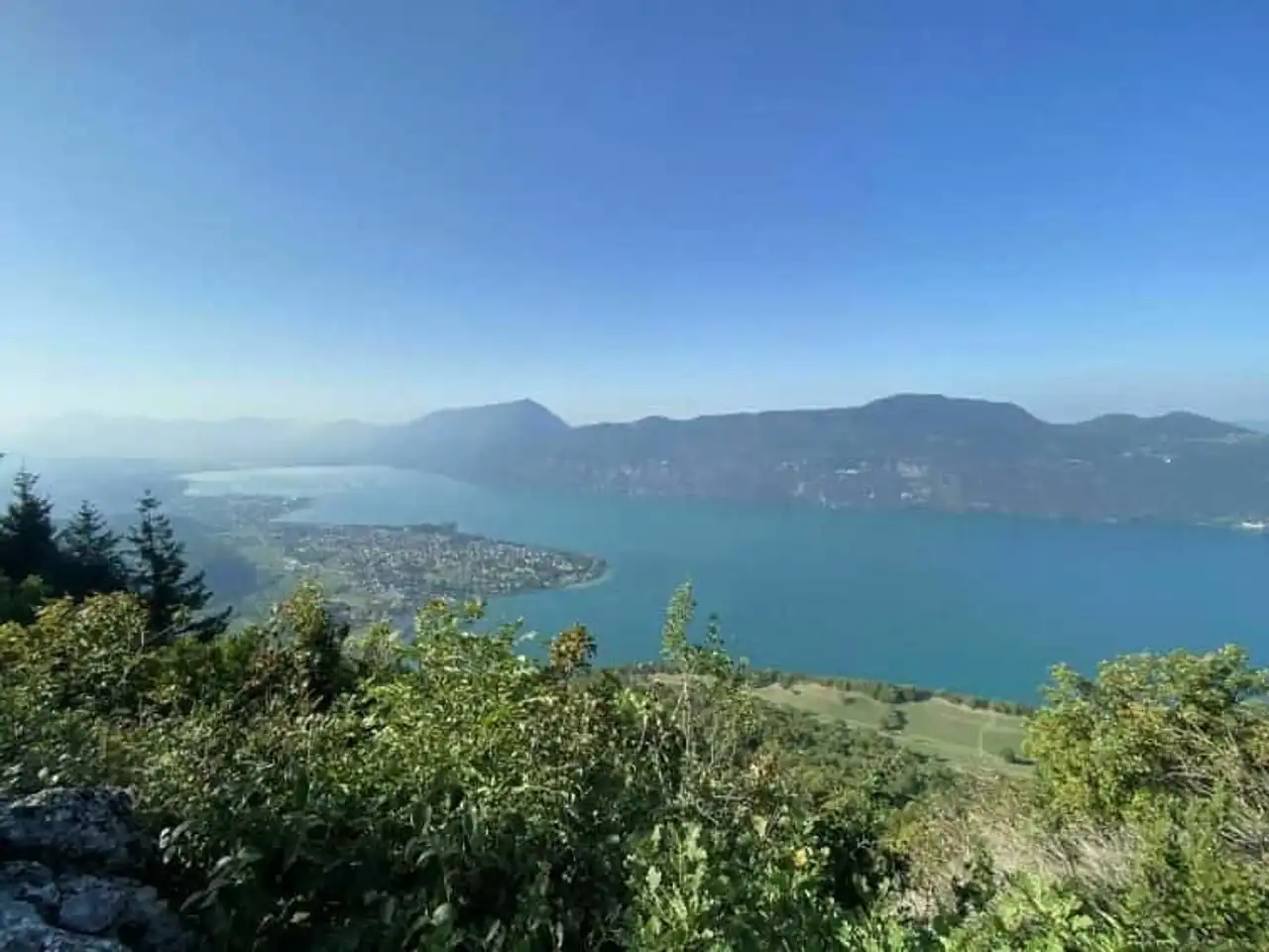
Photo credit: Alltrails
- Duration : about 3h15
- Distance 12.1 km
- Denivelé 533 m
- Difficulty Average
- See the hiking trail
A beautiful hike in Aix-les-Bains for its multiple views, the first step of this walk will be the view of the Chambotte. From the top of a steep slope, the view opens onto Lake Bourget and La Dent du Chat, right across the street. The trail then leads to the emblematic Cross of Meyrieux, at 843 m, to descend under the cliffs of the Chambotte.
Most of the route takes place in the forest, in the shade of trees. But if you start in the middle of the summer, still plan water to complete this 12 km loop with some more technical passages... Also make sure you have the right walking shoes.
4. The view of the Revard
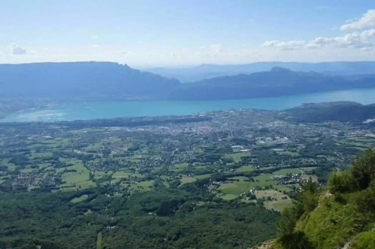
Photo credit: Alltrails
- Duration : about 1h
- Distance 4 km
- Denivelé 198 m
- Difficulty Average
- See the hiking trail
The view of the Revard is one of the most popular spots for the panorama it offers on Aix-les-Bains and Lake Bourget: a breathtaking view!
Several routes exist around Revard. Here we start from the old train station in Cremail, curiosity of the corner, for a beautiful walk mainly forested and accessible to all walkers, forming a large loop around the ridges of the Revard.
Allow a good half day out. A variety of hikes in Aix-les-Bains reserved for the most courageous, the ascent of the Revard starts at the Mouxy train station, to reach the viewpoint after more than 1,200 m of positive denim!
5. The lake path of Bourget
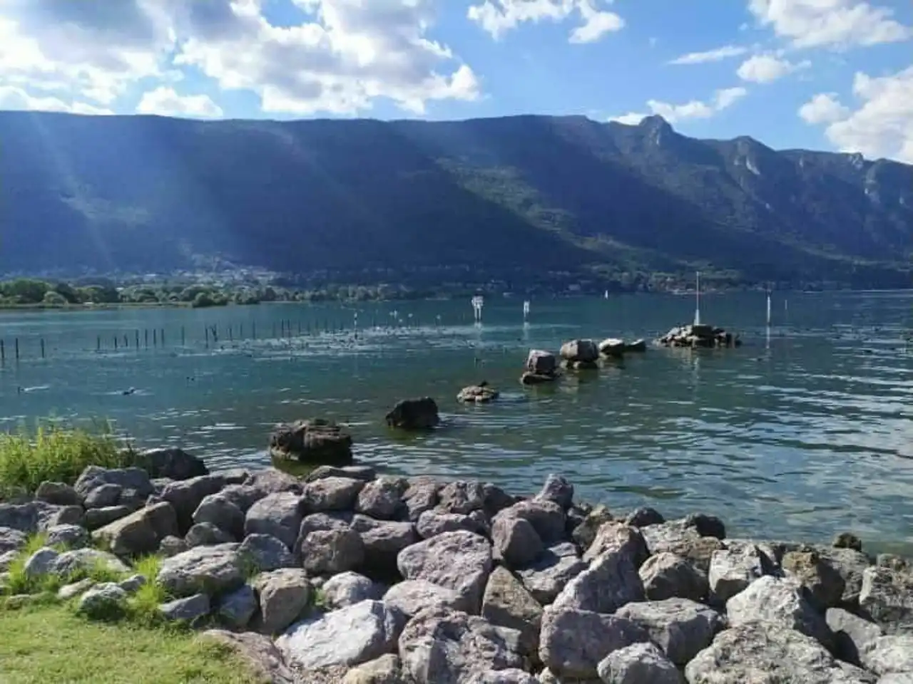
Photo credit: Alltrails
- Duration : about 2h30
- Distance 11.9 km
- Denivelé : 245 m
- Difficulty Easy
- See the hiking trail
This time, it is no longer a hike in Aix-les-Bains where you climb and you descend through the mountains. Indeed, the lake path is completely flat, and quietly follows the banks of Lake Bourget from the city centre. A ride-level hike, but it still allows you to take a few kilometers on foot to go back to Terre-Nue, further south.
A walk in all seasons, but think about taking your bathing business in the beautiful days. Indeed, several beaches pass the lake path and allow you to swim in the quiet waters of Lake Bourget!


Loading comments ...