
Here are the most beautiful hikes of Lanzarote, the "Black Pearl" of the Atlantic.
Lanzarote is a Spanish island that is part of the Canary Islands Archipelago. Located in the Atlantic Ocean, off the African coast, it is extremely recent from a geological point of view. Indeed, it emerged following a volcanic eruption. Also, she has to remain wild and preserved from mass tourism.
Known as a biosphere reserve by Unesco, this island has lunar landscapes and beautiful white sand beaches... or black. To enjoy them at best, what better than to discover them on foot? Wanderlix has concocted a selection of the most beautiful hikes in Lanzarote. Come on, let's go!
1. La Caldera Blanca
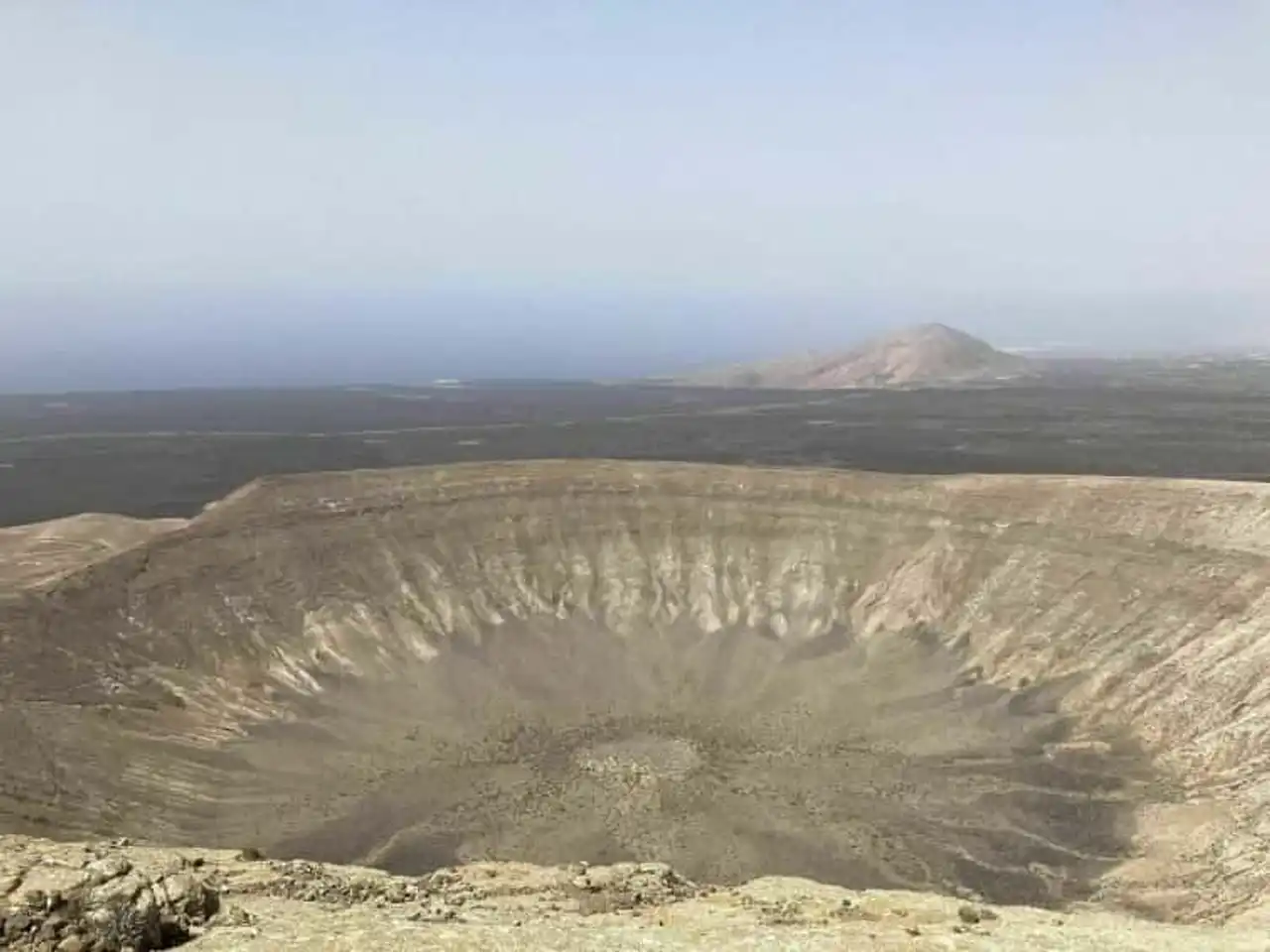
Photo credit: Alltrails
- Duration 2:15.
- Distance 9 km
- Denivelé 502 m
- Difficulty Average
- See the hiking trail
Among the most beautiful hikes in Lanzarote, the Caldera Blanca trail is uncontourable. Close to the city of Tinajo, it runs along the whole crater of the Caldereta which measures about 300 meters in diameter.
Your journey continues to the spectacular Caldera Blanca volcano. Today turned off, it was formed in a single volcanic eruption. Its crater is the largest of the islands: 1,200 meters!
The surrounding landscapes recall those of Timanfaya Park. Vertiginous, windy and rocky, the path promises nice sensations. Good shoes are mandatory to progress safely.
2. La Playa del Paso
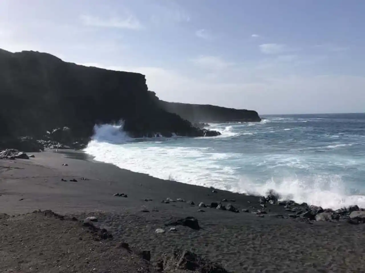
Photo credit: Alltrails
- Duration : about 2 hours
- Distance 9 km
- Denivelé 179 m
- Difficulty Easy
- See the hiking trail
One of the best hikes in Lanzarote begins in the small fishing village of El Golfo. The trail faces the Atlantic Ocean before reaching the Playa del Paso. Its black sand of volcanic origin is a wonder of nature.
You will have the opportunity to climb the Caldera de Montaña Quemada while contemplating the waves violently hit the cliffs of the lava. The trail is rather flat but, as everywhere on the island, covered with acerated lava pebbles. You will have understood: forget the sandals!
3. Pico Redondo and Los Ajches
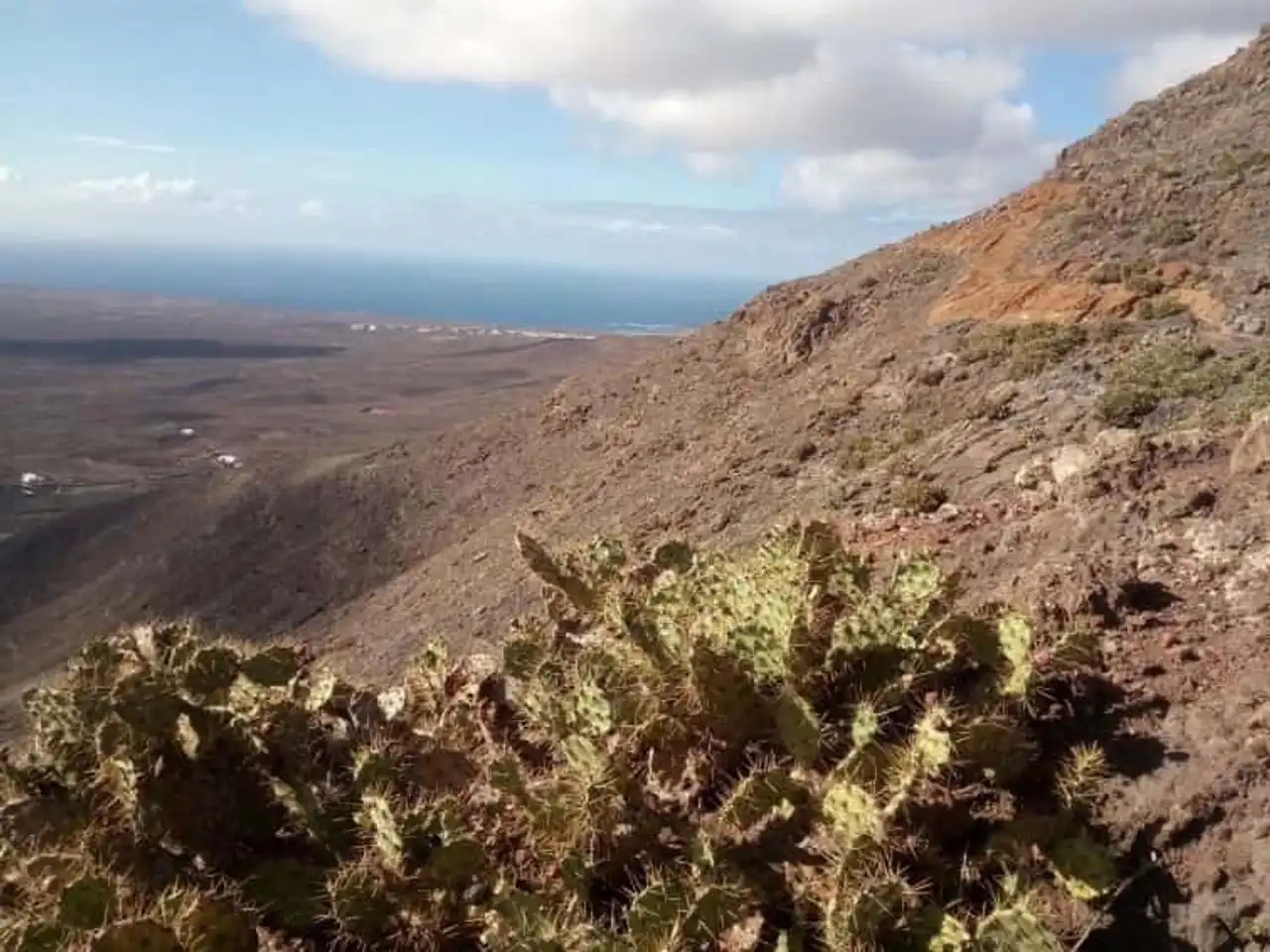
Photo credit: Alltrails
- Duration : about 3h30
- Distance 13.7 km
- Denivelé 636 m
- Difficulty Average
- See the hiking trail
This route is located in the heart of the south-eastern region of the island. This hike in Lanzarote aims to reach the incredible natural monument of Los Ajaches. This volcanic formation covers almost all the south of Lanzarote and offers unique landscapes in the world.
This site also includes archaeological and prehistoric vestiges of first order. From the church of the village of Femes, you will cross the Higuera valley and start the tower of Pico Redondo. This trail gives the impression of walking on the Moon. But the herds of goats will remind you that this is not really the case!
4. Monte Corona
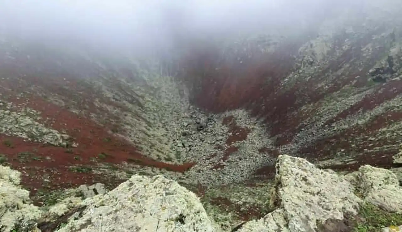
Photo credit: Alltrails
- Duration : about 1h
- Distance : 3.4 km
- Denivelé 145 m
- Difficulty Average
- See the hiking trail
The climb of the Monte Corona is an unmissable excursion close to the municipality of Haría. After you parked your vehicle near the church on the road to San Francisco Javier, you will start the journey.
It will lead you to the top of the volcano (eteint!) Monte Corona. It measures 600 meters high and offers a sublime view of its frozen magma innards. The colors are beautiful: from bright red to light grey...
In the distance, the vineyards and fields of lava extend, punctuated with wonders of nature. Look at the Mirador del Rio and the island of La Graciosa cut off the horizon!
We recommend you make this hike in Lanzarote with water and sun protection. In the summer there is little or no shadow on the journey!
5. La Montana Colorada
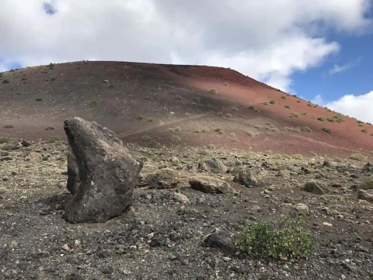
Photo credit: Alltrails
- Duration : less than 1h
- Distance 2.9 km
- Denivelé 48 m
- Difficulty Easy
- See the hiking trail
Montana Colorada is located along the LZ56 between the villages of Mancha Blanca and La Asomada. This volcano probably owes its name to multicolor shades that change depending on the brightness. This hike in Lanzarote takes the turn of this volcanic cone dating from the eruptions of Timanfaya.
Particularly well marked (and in several languages) the trail has explanatory panels on the environment. The terrain is flat and the course layout requires no special equipment. Families, you're welcome!
6. The Mirador de Montana Ganada
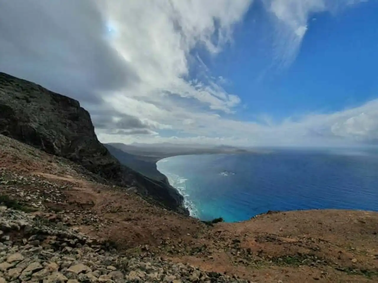
Photo credit:  Alltrails
- Duration : about 1h45
- Distance 6.6 km
- Denivelé : 167 m
- Difficulty Average
- See the hiking trail
This hike in Lanzarote starts in the municipality of Haría. It is one of the “white villages” of the north of the island of Lanzarote, in the heart of the Mille palm trees valley. A dirt road climbs to the Mirador de Montana Ganada, a viewpoint overlooking the Atlantic Ocean. Beautiful views of Caleta de Famara and the rural areas of the island are available.
This rather easy loop will be performed preferably in the direction of the needles of a watch. Train with slippery rocks and clay mud flacs when it rained! Finish with a discovery of the sumptuous city of Haría: the town is one of the most beautiful of the island.
7. La Montana de Tinaguache
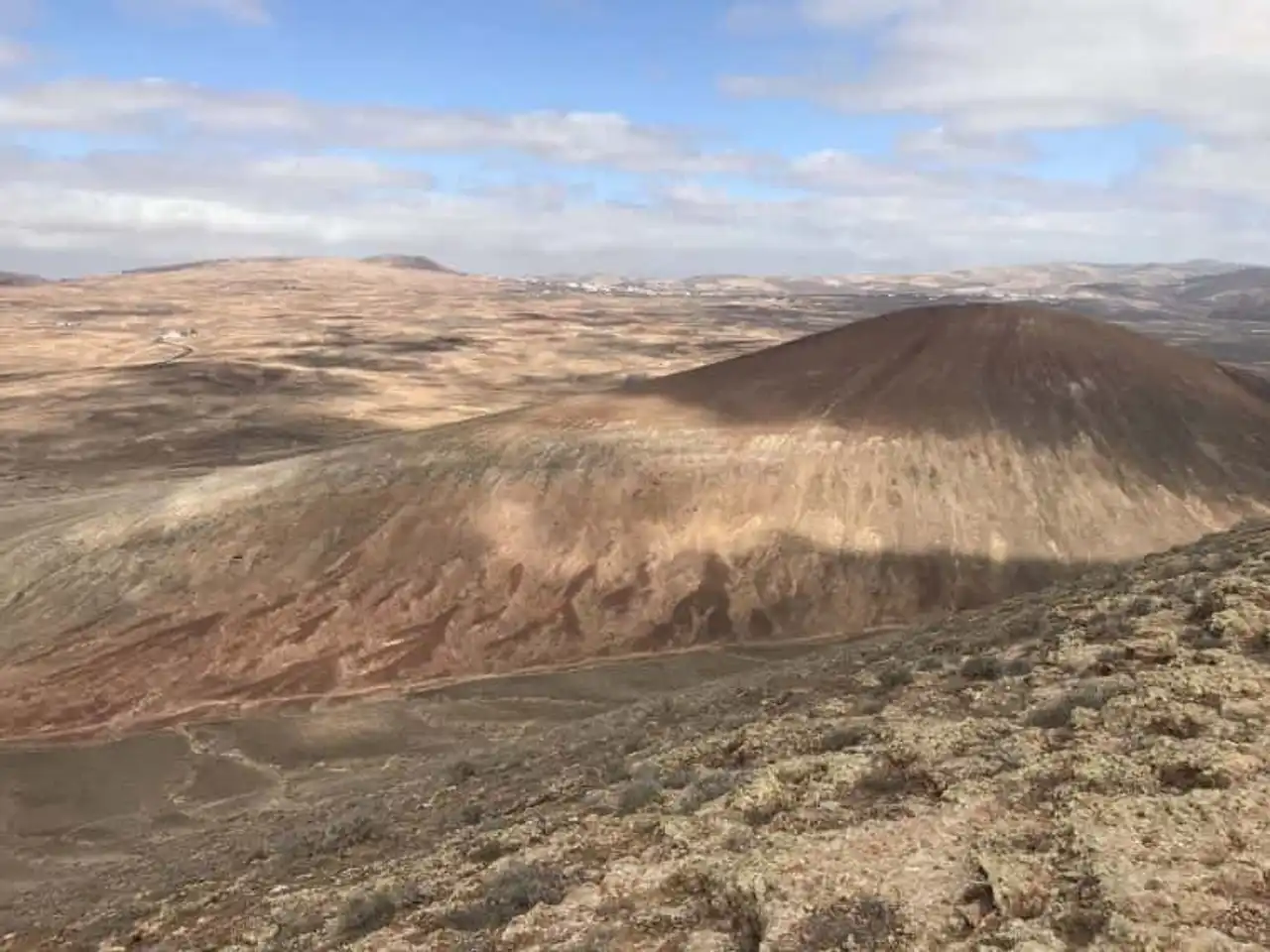
Photo credit: Alltrails
- Duration : about 1h15
- Distance 4.7 km
- Denivelé 221 m
- Difficulty Average
- See the hiking trail
A wild nature that we admire at the price of some efforts. Because the path is steep during this hike in Lanzarote!
The ascent of the Montana de Tinaguache (east side) requires good shoes and concrete calves. Once at the top, a superb view of the north volcanoes and the south ocean awaits you. We even see the island airport!
Your walk will lead you to an exceptional local flora adapted to the harsh climate and to the reddish volcanic land. Short but intense, this route is worth the detour of the richness of the crossed ecosystem.
8. La Caldera de Los Cuervos
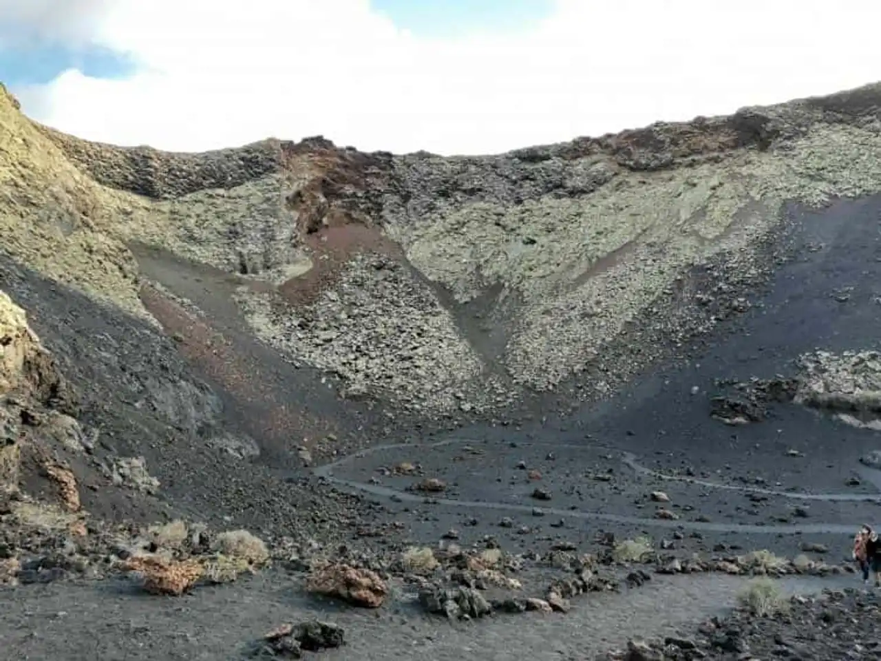
Photo credit: Alltrails
- Duration : about 1h
- Distance 4.2 km
- Denivelé : 83 m
- Difficulty Easy
- See the hiking trail
Finish our selection of the best hikes in Lanzarote with this special walk. It will allow you to penetrate the crater of a volcano!
Located in a unique setting, it faces the Black Mountain and the Red Mountain as well as the Timanfaya National Park. The crossing begins along a perfectly marked path around the crater. An opening allows you to enter and observe this surprising magmatic decor.
It should be noted that the area is protected and that it is forbidden to leave the managed path. Indeed, raptors elected to the slopes of the Caldera de Los Cuervos during their nesting period. You are exposed to a high fine if one of the (many) environmental protection agents surprise you off the road...
Very crowded, however, the route remains emblematic of the hikes to be made on the island. Do not hesitate to survey it during your visit to the Canary Islands!
- Discover our comprehensive guide (locations, activities, ...)


Loading comments ...