High-altitude valleys, high perched lakes, peaks and solids... the hike in Loudenvielle takes place in an authentic mountain setting, in the heart of a department that bears its name: the Hautes-Pyrénées.
From the beautiful days, when the snow melts and the mountain completely changes face, it is the hiking enthusiasts in Loudenvielle who take over the skiers, while the marked trails replace ski trails and ski lifts. It is the season of walking, with mountain routes large public or more sporty, at the choice.
Do not hesitate to force a little on the calves in Loudenvielle, because this small village on the edge of the artificial lake of Génos-Loudenvielle is also known for its thermal center where to take the water and recharge!
All around the Louron Valley where Loudenvielle is nestled, the walking routes are numerous: let’s note, for example, the passage of the mythical GR10, which crosses the Pyrenees from the Atlantic to the Mediterranean, reserved for hikers of great path!
Take shorter but not less sumptuous trails, with this selection of the most beautiful hikes in Loudenvielle.
1. To the Soula refuge
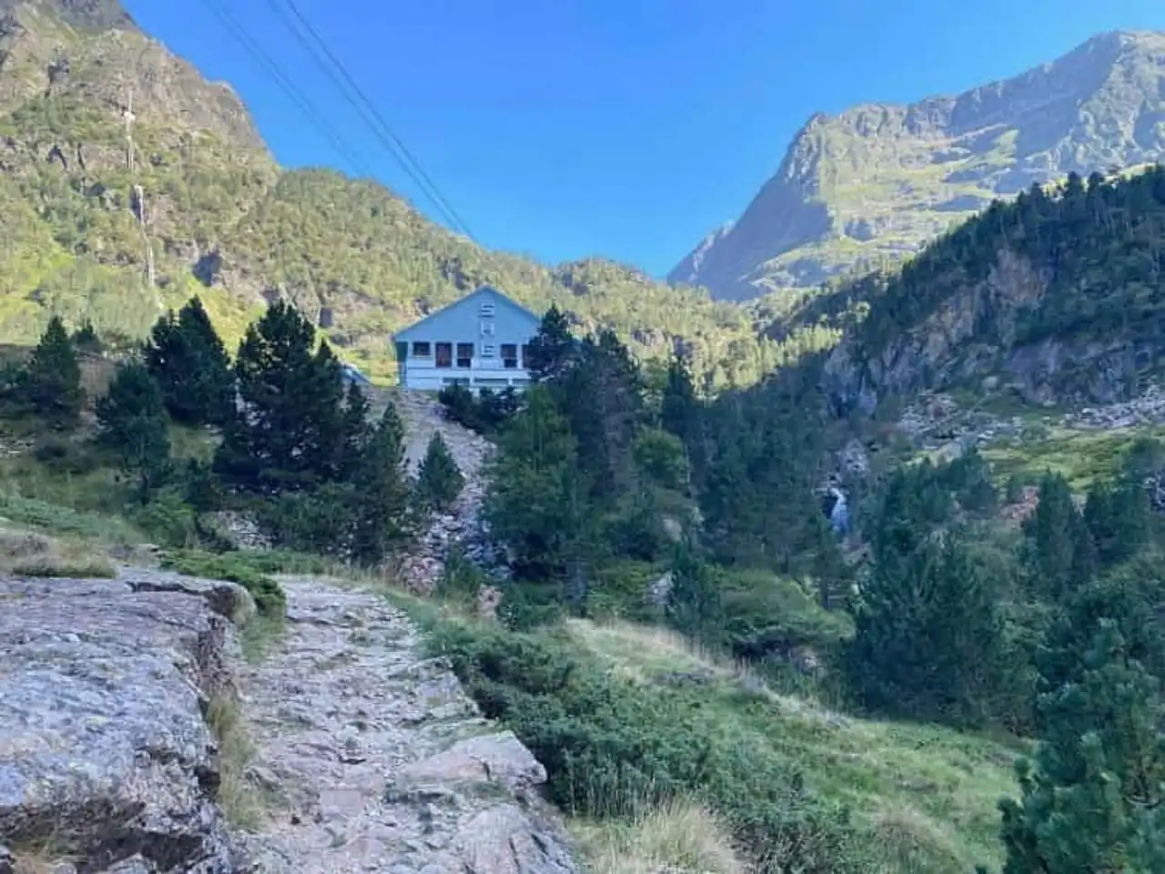
Photo credit: Alltrails
- Duration : about 3h
- Distance 9.8 km
- Denivelé 460 m
- Difficulty Average
- See the hiking trail
We start with a great classic of hiking in Loudenvielle: the refuge of the Soula. The route, well traced and marked from end to end, begins at the parking lot of the Pont de Prat: here begins a progressive ascent with a beautiful view of Loudenvielle and the Vallée du Louron. This hike is for the whole family, you even cross pedagogical panels from there!
The trail first crosses the forest before entering the gorges of Clarabide, a spectacular section, to finally reach the refuge of the Soula at the bottom of the valley. The opportunity to take a restorative break, to linger for a moment and why not eat a piece before descending on the same path.
2. Lake Caillauas
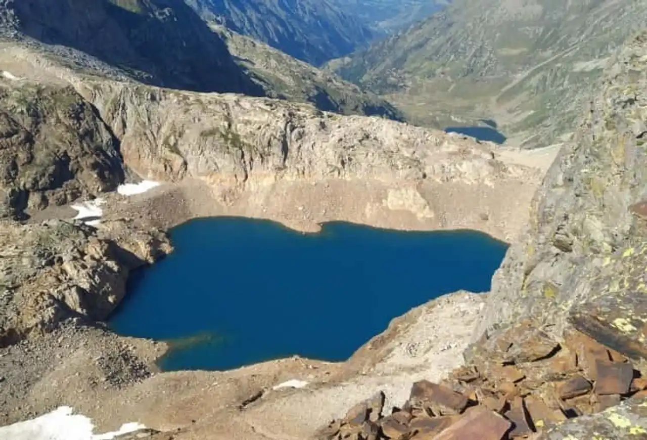
Photo credit: Alltrails
- Duration : about 6h
- Distance 16.3 km
- Denivelé 1 856 m
- Difficulty : Difficult
- See the hiking trail
Here is the version “for adults” of the previous hike to the refuge of the Soula. With this hike in Loudenvielle, you reach the refuge of the Soula by the usual trail, as explained above, for a quiet ascent.
It is then that things go hand in hand, with a much more technical path from the refuge, and 500 m of additional denim to reach the lake of Caillauas, in a superb setting of high mountain!
Leave early in the morning and enjoy well-equipped, and enjoy the refuge on the return for a salvatory break before returning to the trail.
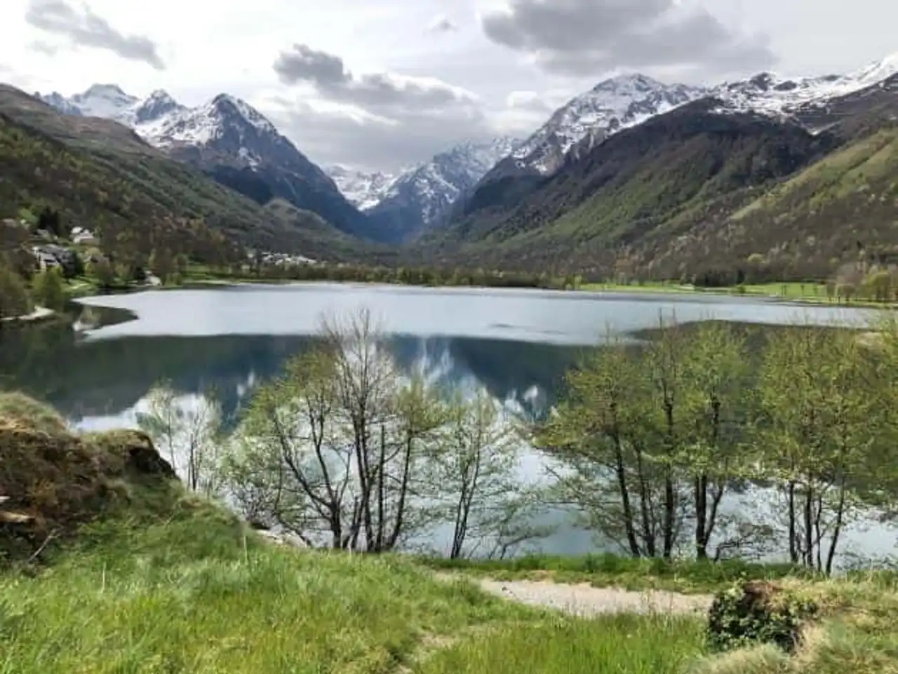
3. The tower of the lake of Génos-Loudenvielle
Photo credit: Alltrails
- Duration : about 1h
- Distance 2.6 km
- Denivelé 28 m
- Difficulty Easy
- See the hiking trail
After the big skies, here is a much more peaceful hike in Loudenvielle with the full tower of the lake of Génos-Loudenvielle: a very nice walk on the banks of this artificial lake with an area of 32 hectares, which passes under the ski lifts and several walkways!
Ideal in summer when the sun warms and the clear waters are there to refresh you, very nice also at the end of the day to untie the legs. Also, it is easy to extend the duration of the walk with a picnic break on the way, or on the playgrounds for children...
4. On the ridges between the valleys of Aure and Azet
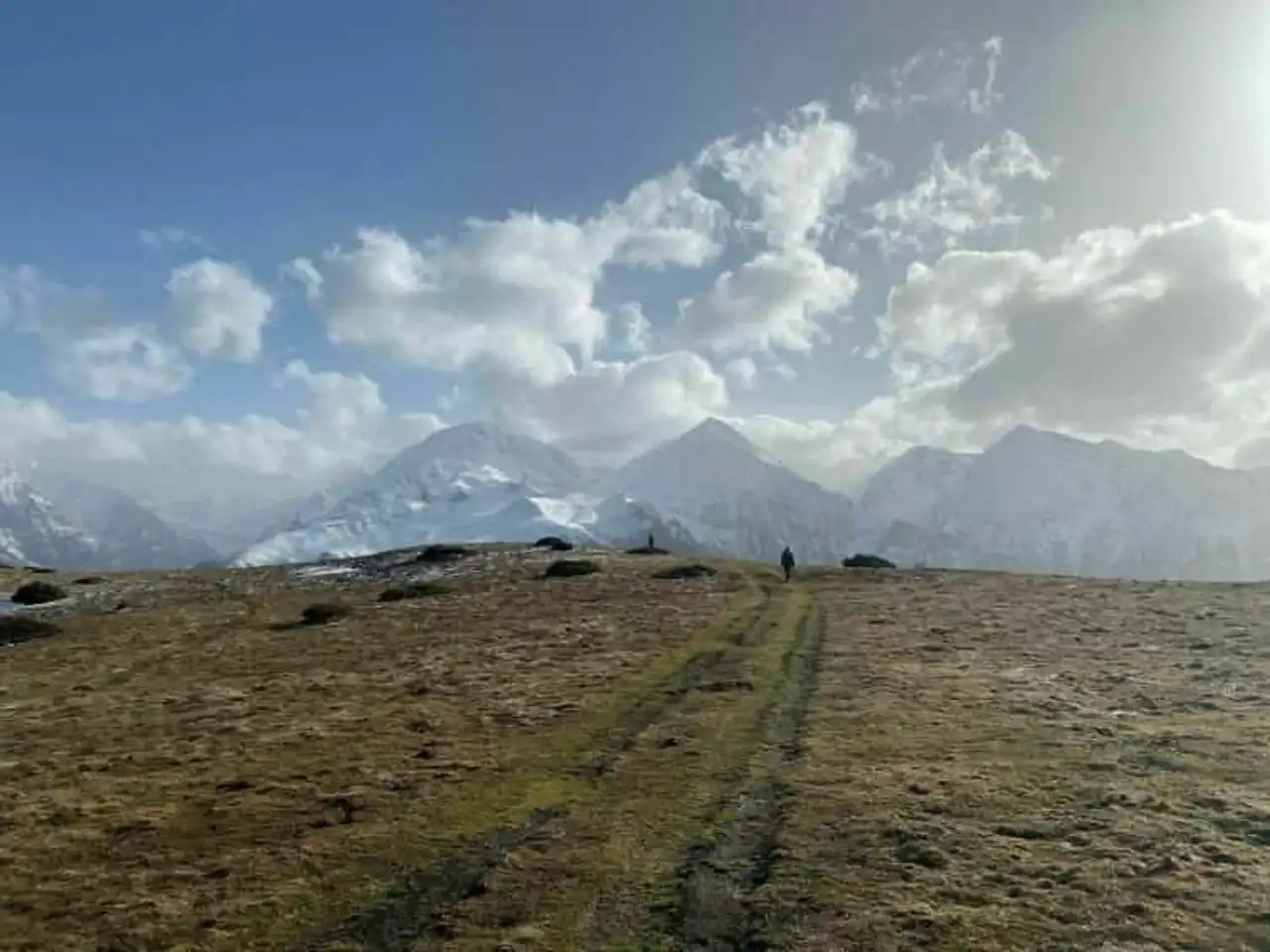
Photo credit: Alltrails
- Duration : about 3h
- Distance 10.1 km
- Denivelé : 394 m
- Difficulty Average
- See the hiking trail
Take the road that climbs towards the beautiful pass of Azet (1 580 m), the starting point of this hike in Loudenvielle which takes place in the foothills of the village. The itinerary can go back and forth by following grosso modo the ridge line between the Louron Valley and the Aure Valley, where Saint-Lary is located.
Along the way, you will enjoy beautiful views of the Hautes-Pyrénées, with a clear 360° view! A route without major difficulty to complete in return, even if variants are possible.
5. The summit of Puyaué
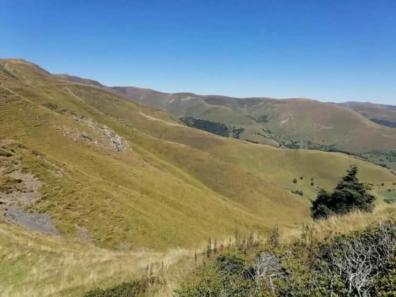
Photo credit: Alltrails
- Duration : about 3h
- Distance 10.6 km
- Denivelé 648 m
- Difficulty Average
- See the hiking trail
This hike in Loudenvielle is aimed primarily at lovers of beautiful mountain landscapes, which is often synonymous with a strong positive denial. With almost 800 m to climb (and to descend...), the sticks are rigour, and a minimum of training as well.
The hike begins at the pass of Peyresourde, leaves in zigzag to begin the slope then continues its ascent by a ridge path, from which exceptional views are offered throughout the region. The summit of Pouyaué, at 2,068 m, will be the signal of the return.
6. Lake Oo
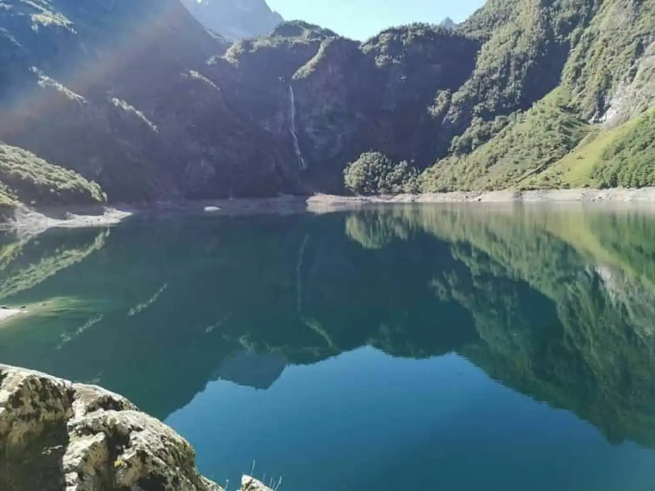
Photo credit: Alltrails
- Duration : about 2 hours
- Distance : 6.3 km
- Denivelé : 376 m
- Difficulty Average
- See the hiking trail
You will have to go to the nearby town, and even the nearby department, for this beautiful hike of Loudenvielle. Direction la Haute-Garonne and the village of Oo, 30 minutes’ drive from the Granges d’Astau. Here begins one of the most popular walking routes of this part of the Pyrenees, in the direction of Lake Oo and its magnificent waterfall: a grandiose landscape!
The hike climbs a little but without excess, on an easy and well shaded path overall, it remains accessible to all. Those who have more under the sole grow up to the Espingo Pass, steep and much more difficult, for the view of Espingo Lake before descending.


Loading comments ...