Are you planning your ski holidays? Here are the detailed maps and plans of the Grand-Bornand!
Winter holiday lovers? Grand-Bornand station is waiting for you! Nestled in the heart of the Massif des Aravis Annecy , Chamonix and Geneva , the commune of Grand-Bornand will charm you with its traditional mountain village atmosphere. Below you will find detailed maps and plans of the Grand-Bornand to help you when you arrive at the station. For each of the cards, you have the possibility to enlarge it. To download maps & plans, right click and "Save as".
Also:
Le Grand-Bornand Station: packages, courses, locations
Detailed map of the alpine ski slopes
Find on this map of Grand-Bornand all the details you need to know for alpine skiers! You can see all the tracks and their level of difficulty.
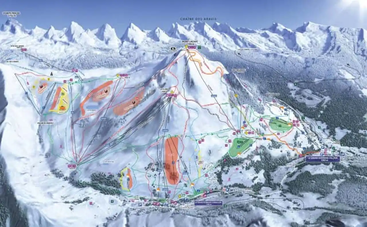
Photo credit: Official website
Detailed map of the Nordic ski slopes
For Nordic ski lovers, here is a detailed map that will be very useful for your stay in Grand-Bornand! In addition to finding strategic points, you can see the different routes and their starting point.
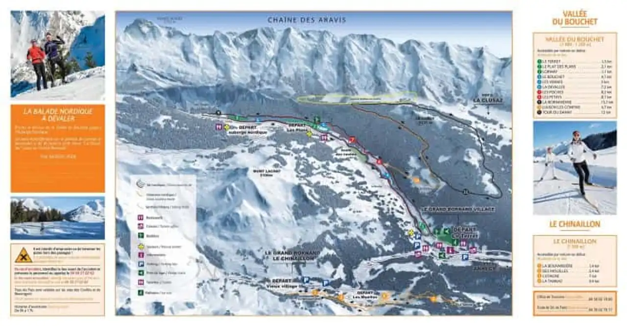
Photo credit: Official website
Grand-Bornand General Plan
The commune of Grand-Bornand extends over two altitudes. The Grand-Bornand Village is 1,000 metres away, in its typical savoyard atmosphere with its main square, church and small shops.
Six kilometers higher, we have Le Grand-Bornand Chinaillon, which stretches at 1,300 metres above sea level and is the main departure of the alpine ski slopes.
On this map you can view an overview of the two villages in the commune of Grand-Bornand.
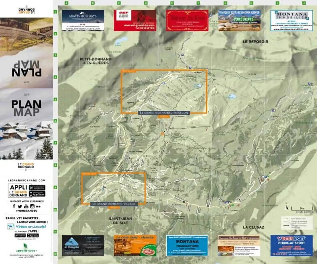
Photo credit: Official website
Zoom in on both villages
This detailed map of the Grand-Bornand is a zoom of the commune, which is divided into two villages and two different altitudes.
On the top map you will find Le Grand-Bornand Chinaillon, which, as explained in the previous part, is the highest and closest village to the slopes, located 1,300 meters above sea level.
Finally, on the map of the bottom, you can locate the Grand-Bornand village, which is six kilometers below the Grand-Bornand Chinaillon.
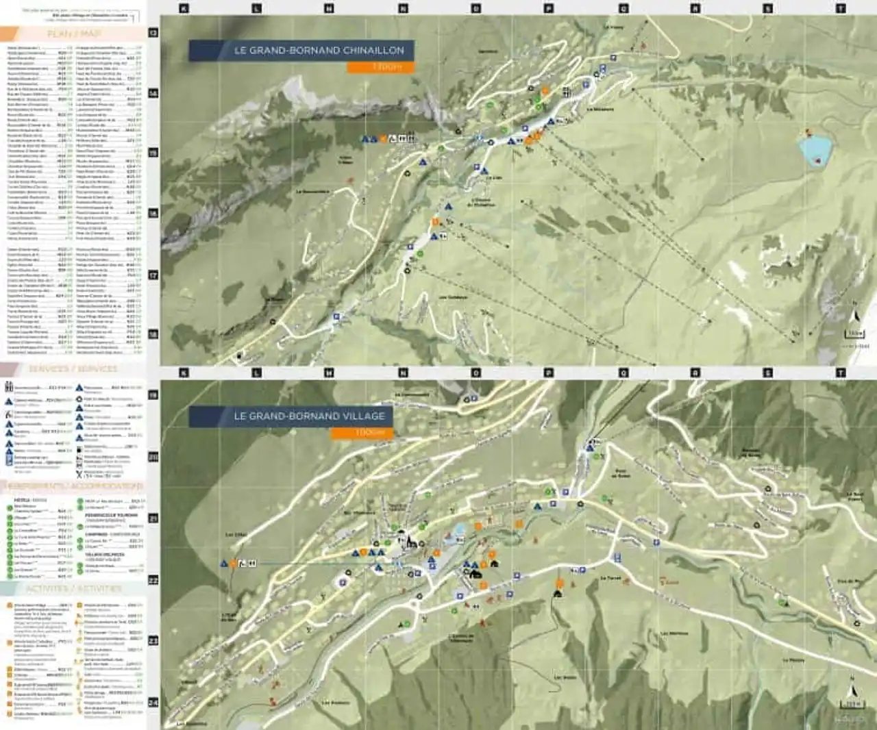
Photo credit: Official website
Detailed map restaurants
Find on this map the location of restaurants to organize your meals during your stay at the Grand-Bornand station.
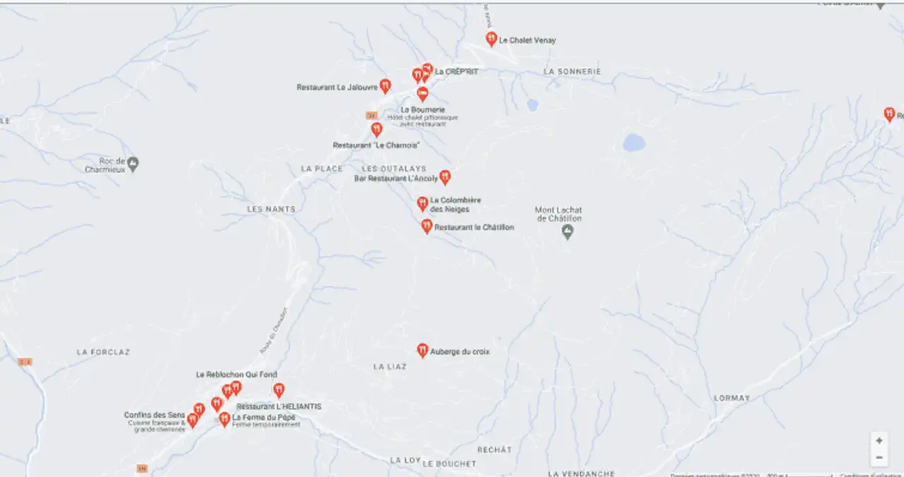
Photo credit: Google Maps
Grand-Bornand Access Plan
You want to spend your holiday in the Grand-Bornand and ask yourself how to get there? Several options are possible!
The plan below allows you to view the cities and roads that allow you to access the Grand-Bornand station.
By car
The Aravis massif is easily accessible. In winter, roads are well snowed. However, think about providing the right equipment for the season (snow snow or snow chains).
- A40 (White Highway): exit No. 16 Bonneville, direction Aravis station at 20 km;
- A41 exit Annecy Nord direction Thônes / Stations des Aravis at 30 km.
By train
- TGV from most major cities;
- Annecy SNCF train station at 30km.
By plane
- Geneva International Airport 50 km;
- Lyon Airport – Saint Exupéry 150 km.
For your flight tickets, do not hesitate to consult the offers on a flight comparison like Skyscanner .
Whether you're on a plane or on a train, no panic! Taxis or shuttles will take you to the Grand-Bornand ski resort.
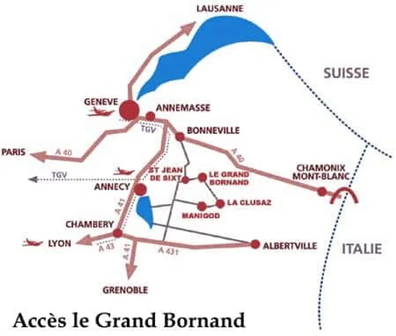
Photo credit: Ski-Planet
Detailed map of the car parks
Find on this detailed map the car park locations located in the two villages of the commune of Grand-Bornand, a total of 12.
The village of Grand-Bornand offers 7 parking spaces (Cf detailed map from the bottom):
- Parking of the bus station;
- Parking of cable cars;
- Farm parking of nature;
- Parking in Tardevant;
- Parking Space Grand-Bo;
- Parking in Villavit;
- Ice parking.
The Grand-Bornand Chinaillon, the second part of the town, counts 4 parking spaces:
- Outalays parking;
- Parking of the Floria;
- Parking of the mill;
- Clut parking.
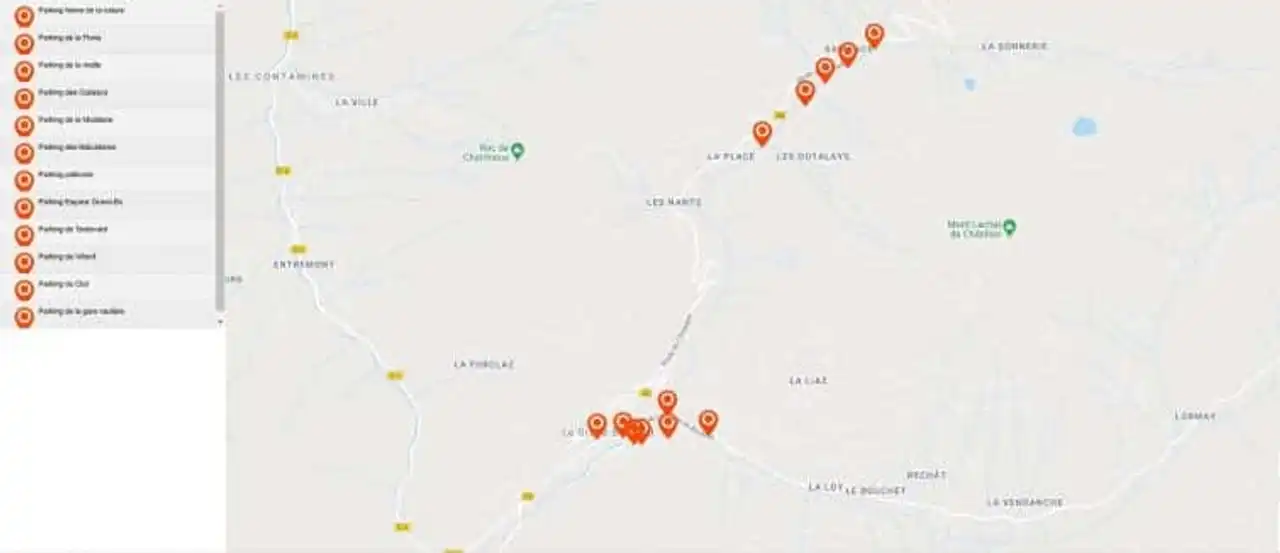
Photo credit: Official website
Thanks to all these detailed maps, you are now ready to go to the Grand-Bornand station!



Loading comments ...